The face of miscommunication
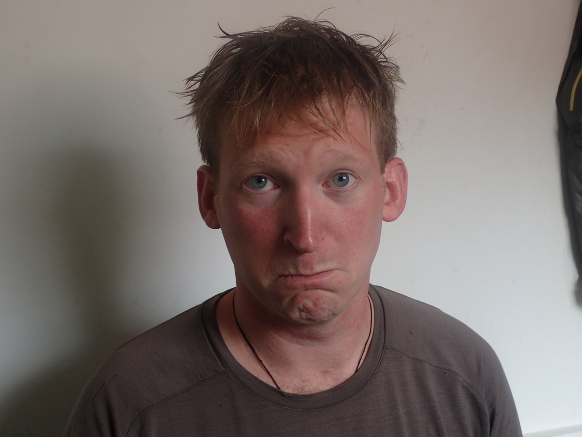
There was a misunderstanding over how much to take off. Hey ho, it’ll grow back. Teach me to have only basic Spanish ;)
There was a misunderstanding over how much to take off. Hey ho, it’ll grow back. Teach me to have only basic Spanish ;)
One of the main excursions from Cuzco is to visit Machu Picchu. Machu Picchu was hidden for many moons, and then “rediscovered” by an American historian (Hiram Bingham) in 1911 who asked some locals did they know where Incan ruins were..
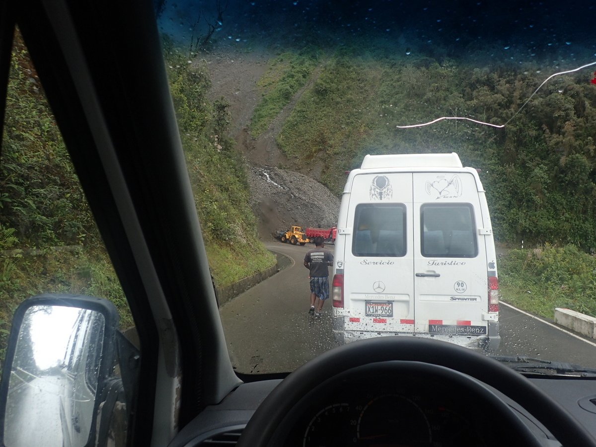
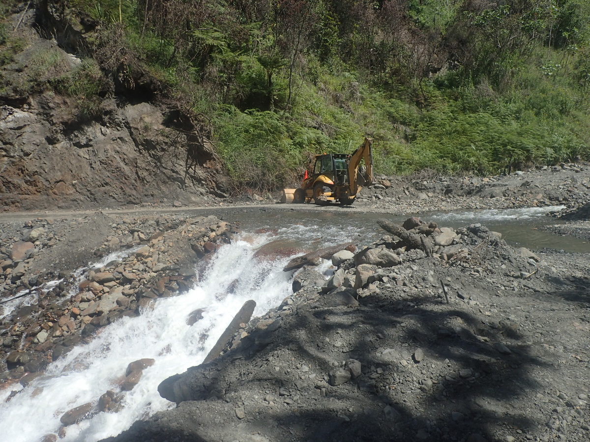
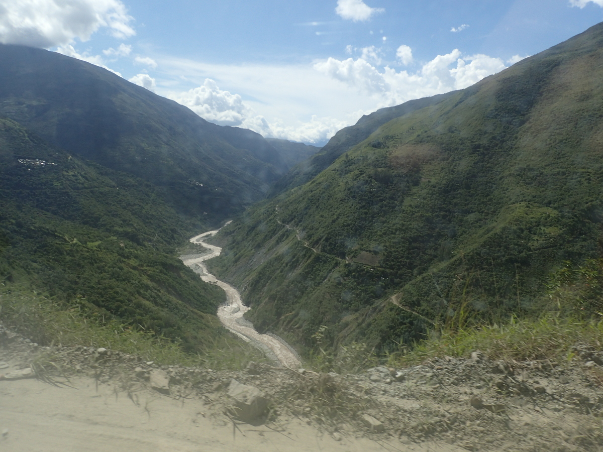
Anyway, we opted not to do the Inca trail. It’s quite expensive at $600 USD pp (you have to do it guided), though I’m sure it’s an awesome trip. So we took the bus from Cuzco to Hydroelectrica (you’ll never guess what’s there). That bus trip was, apart from the descent on the Pampa Linda track, the scariest thing I’ve done on this trip! It’s a seriously narrow road in places, with some rather large drop-offs into nothingness.


From Hydroelectrica we walked to Aguas Caliente. There is a train which runs, but it’s a pretty nice 2 hour fast walk through the jungle. I quite liked Aguas Caliente I must say, despite the many tourists. Our hostel was clean, being in lowish season there was lots of competition for dinner, so we settled for the happy hour & cheap pizza option (nyom).

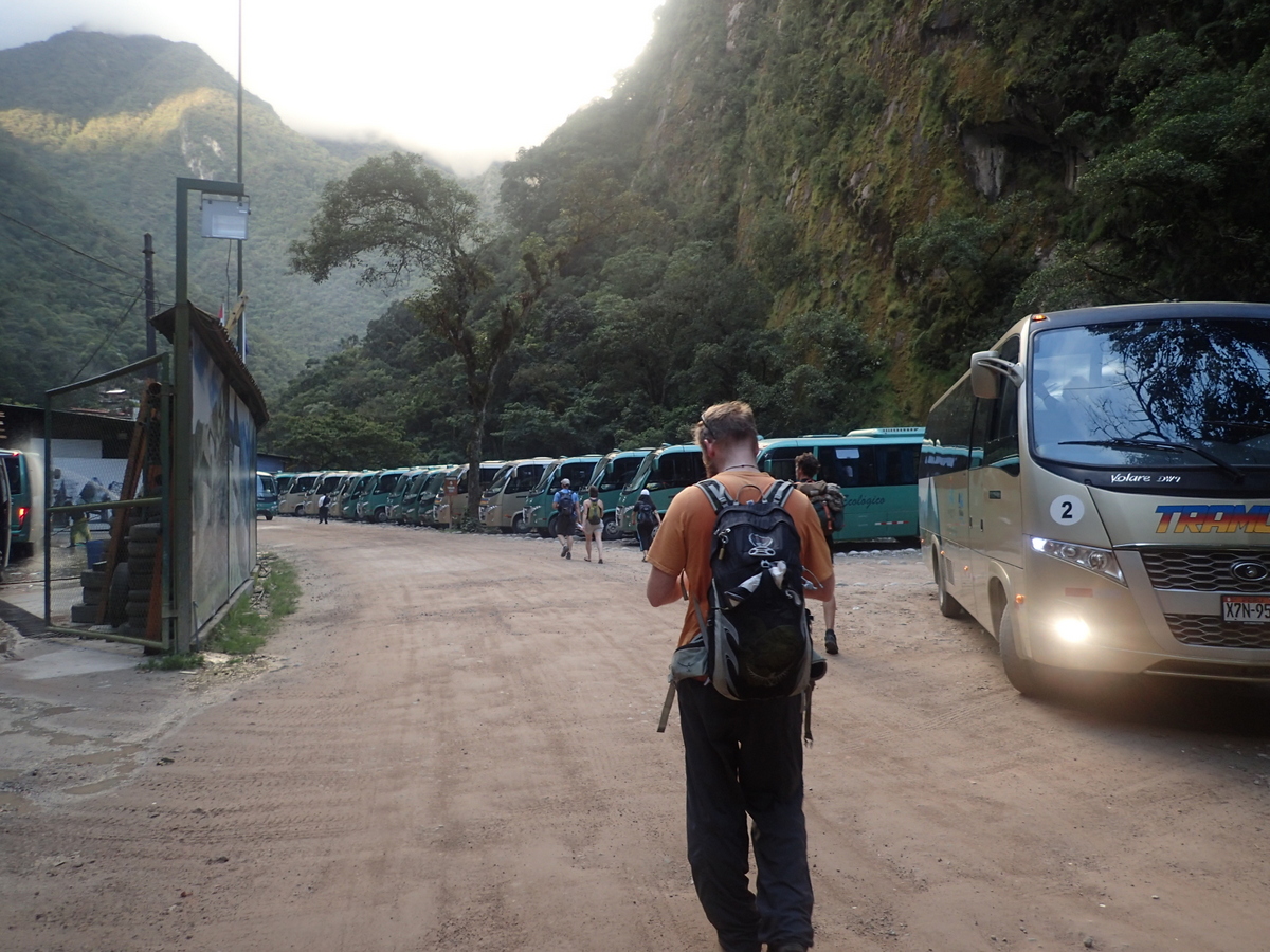

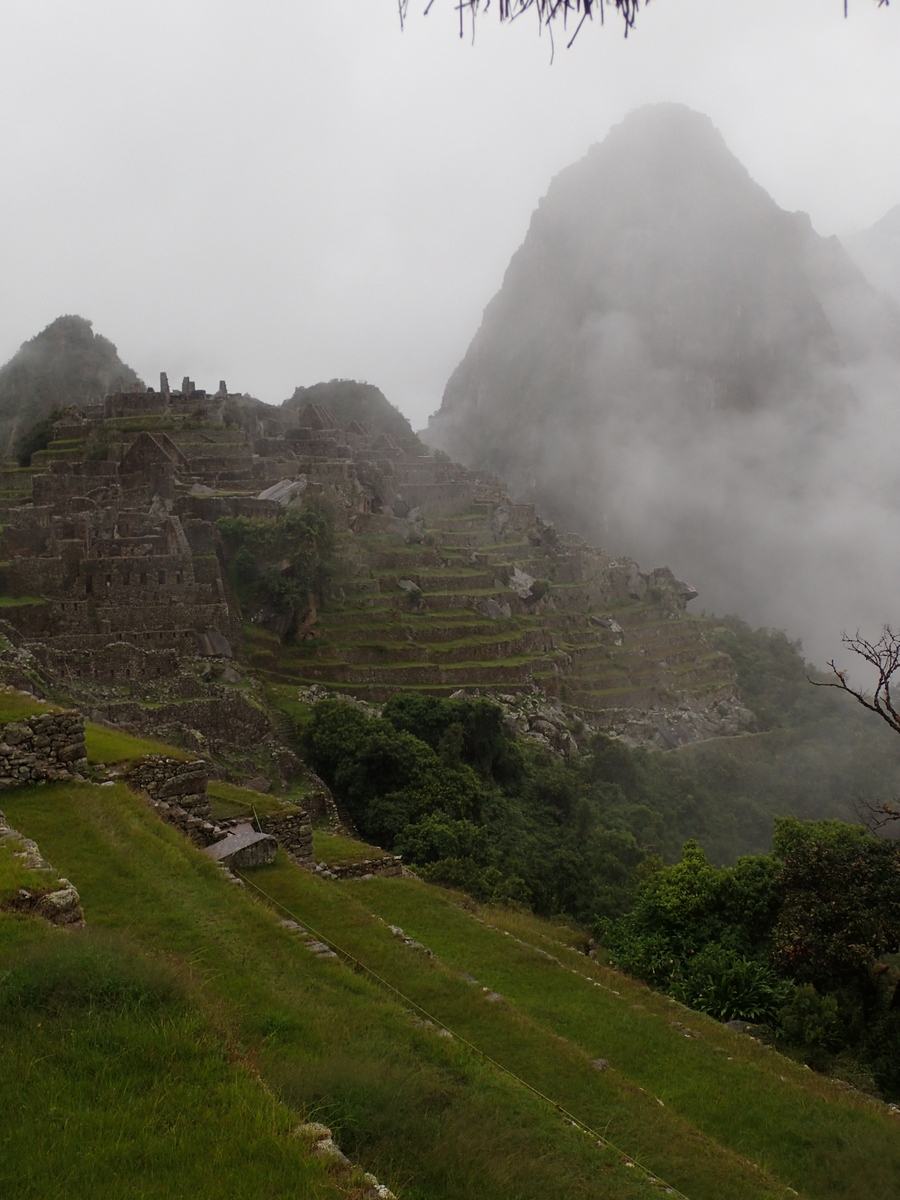
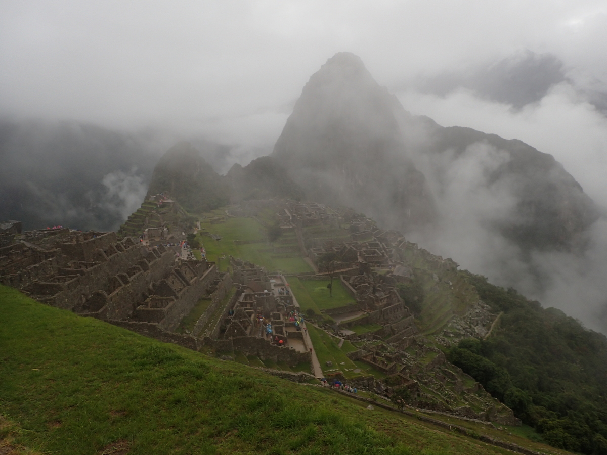
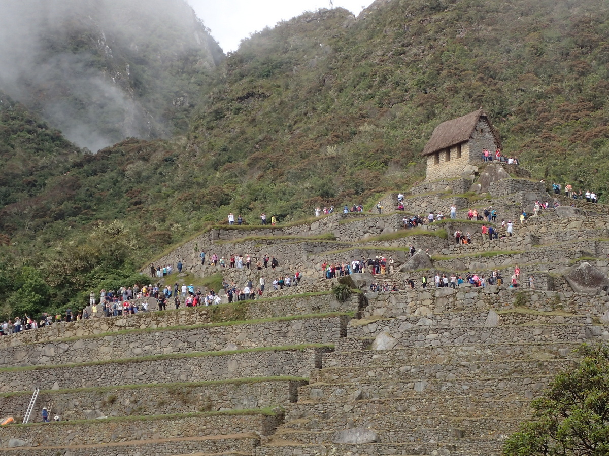
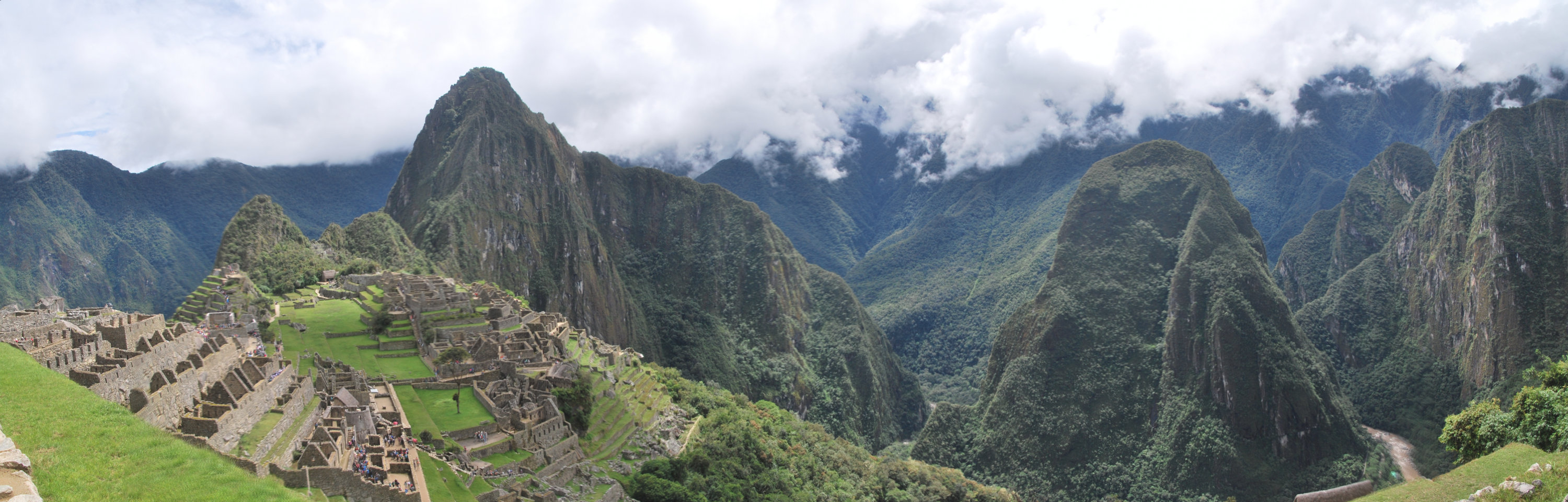
The next day we were up early (5am) to walk up to Machu Picchu. There are busses, but we like the exercise ;) It’s a good climb and took us about an hour I think. The weather was a little wet and overcast, however, it meant that there weren’t too many tourists in the photos.

I did like the “Inca bridge” – looks like quite an effective defence.

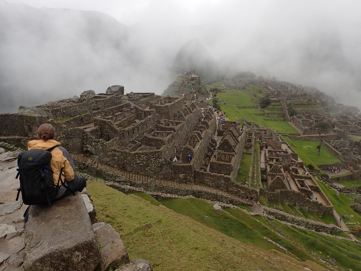
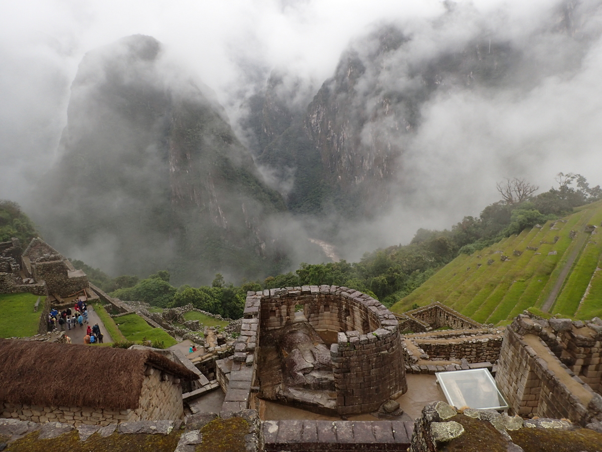
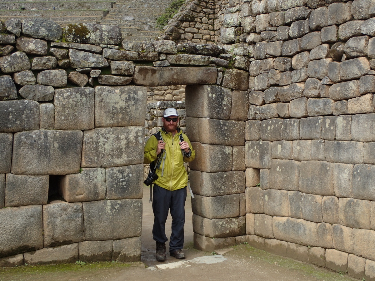
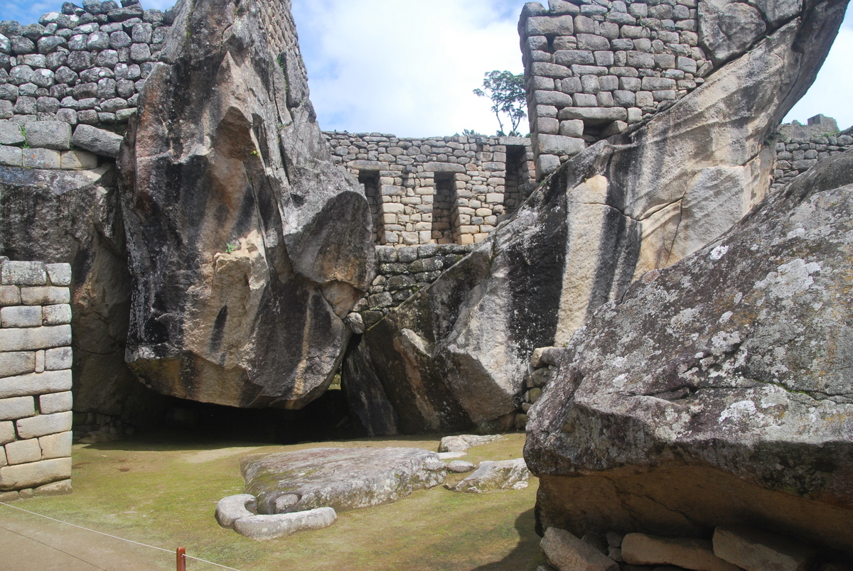
So, Machu Picchu… I did wish I had longer to enjoy it (though the 5 hours we had was just about enough), but, I dunno, it seemed to me that most of the buildings there were restorations rather than originals. There were only a few places where you could see the original impressive stonework, well, unless they were using mortar at Machu Micchu. I’d love to know how original it all was. Maybe it’s very accurate, I’ll have to read the Wikipedia entry again ;) . It seemed to me that you saw more original buildings / artifacts at Sachsuaman in Cuzco. Indeed, Machu Picchu may join a list of “UNESCO sites in danger of losing their status” ..
The sun did come out later on in the morning (hurrah!), so it was a pleasant walk back to Hydroelectrica. We saw 3 road traffic accidents on the way back to Cuzco, one looked quite serious. The drivers really are quite mental here. I was definitely pleased to be back to the hostel in one piece. You’re advised (and we generally do) travel during daylight hours, unfortunately the trip back from Machu Picchu pretty much has to happen during night hours, at least at this time of year.
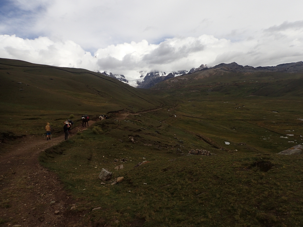
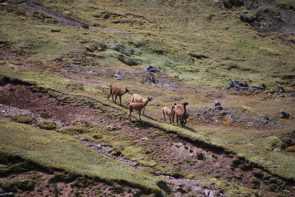
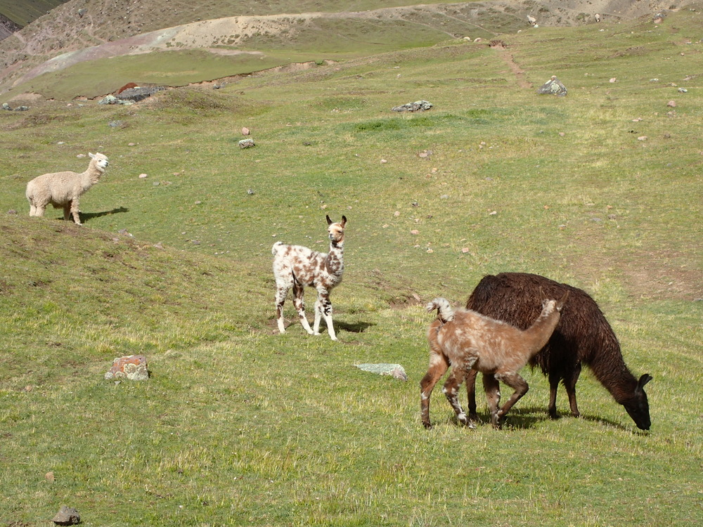
On our friends Tim & Yvonne’s advice, we headed off to hike the Ausungate circuit. It’s a lesser known (though becoming more so) hike, around the Ausungate massif, a few hours from Cuzco. It’s at altitude, most of the way you’re at ~4,500m, the passes are at 5,000 – 5,200m. We were fairly acclimatised from being in Bolivia but still found it hard going for the first few days.
We went to the excellent South American Explorers club in Cuzco for information. There, the very helpful Matt gave us lots of information and we were able to buy a 1:100,000 map there. Not really enough to navigate off, but useful all the same. We also booked a guide for the first couple of days. That was an interesting process. The guides expect to cook with you so you’re expected to provide their food (all very nice and communal). Maaike and I only have a couple of pots and an MSR so we weren’t really setup for that. We negotiated just for the guide and horses. All we really wanted was a horse to take our bags for the first couple of days to altitude.
When we arrived to Tinke (get the bus from here), and found Crispin, there were 5 other French people there. Whether there was misscommunication or what I’m not sure, but the (lovely) French group had taken up a fully guided trip and so the horses were taking their bags. In the event we all made it work, and I’m honestly not sure if there’d been miscommunication so that Crispin thought we just wanted the guiding services and not the bags. Crispin himself is a very experienced guide, and I’d be quite happy to recommend him.


Up to Upis (4,400m), took about 4 hours from Tinke. Remember, you’re coming from Cuzco(3,400m) so it really is a height change. Tim mentioned that their rule of thumb for height gain is 300-500m per day, however, that is probably at more of a base than just 3,400m. Anyway, suffice to say, you’ll feel the altitude and we were damn glad we had a horse taking our bags for the first couple of days.


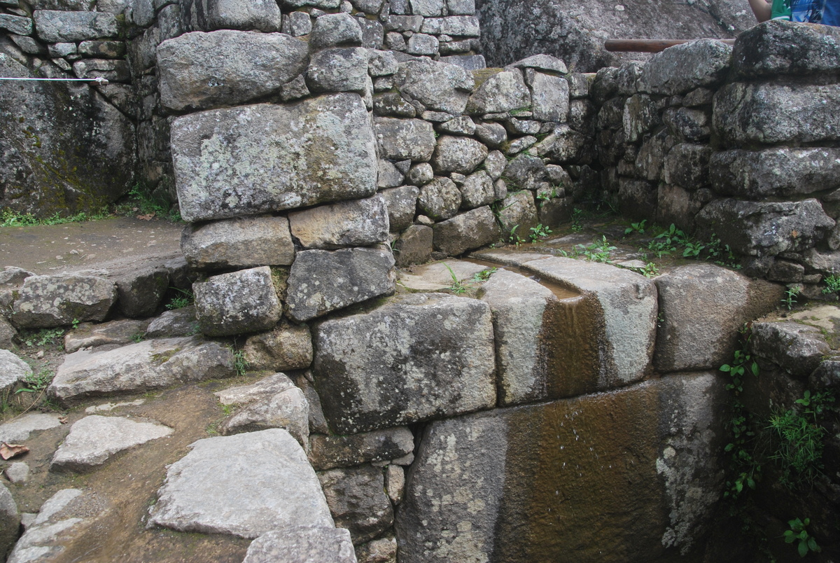
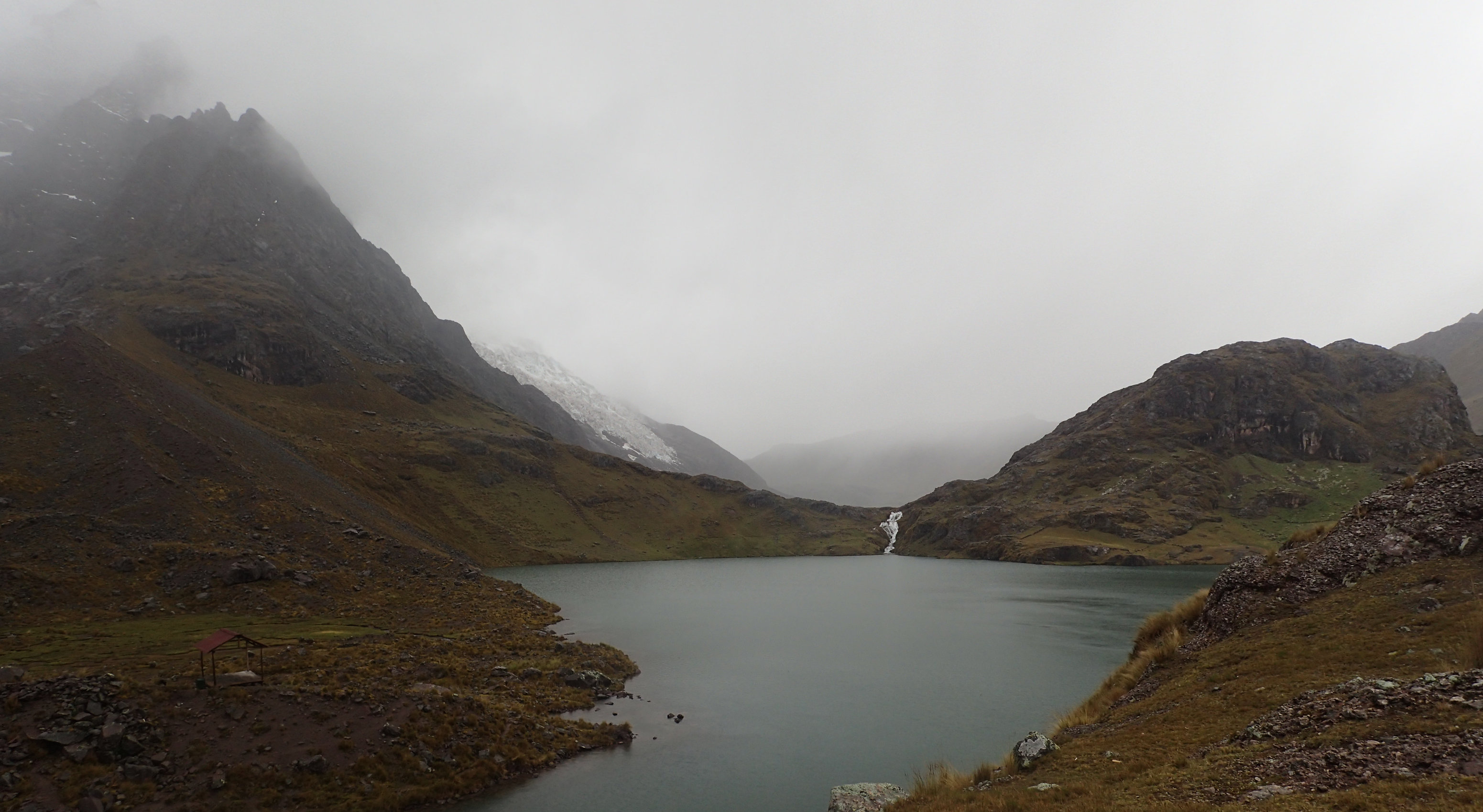
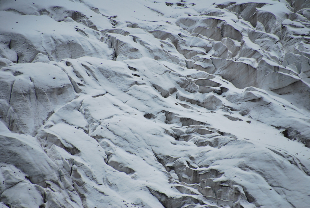
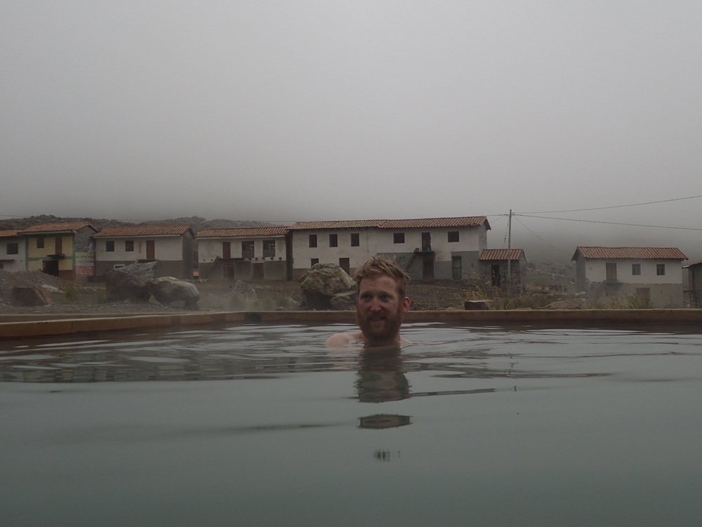
There are natural hotsprings at Upis, and they’ve constructed some basic baths there… perfect for a nice soak after the walk up – thanks to Thomas Jaubert for the picture :)

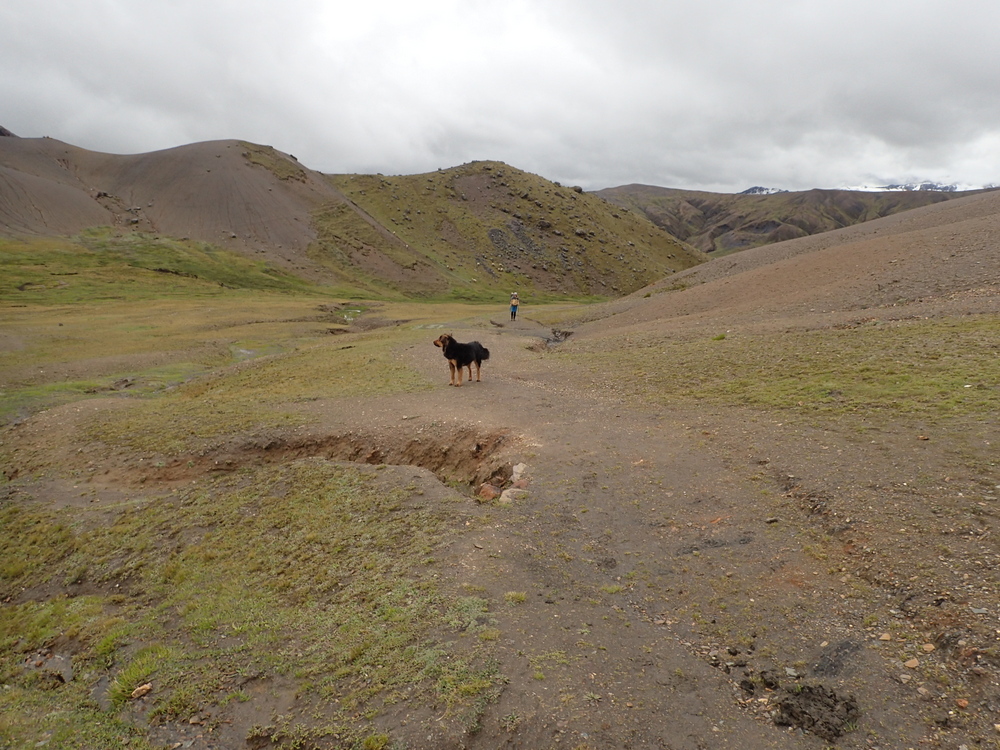
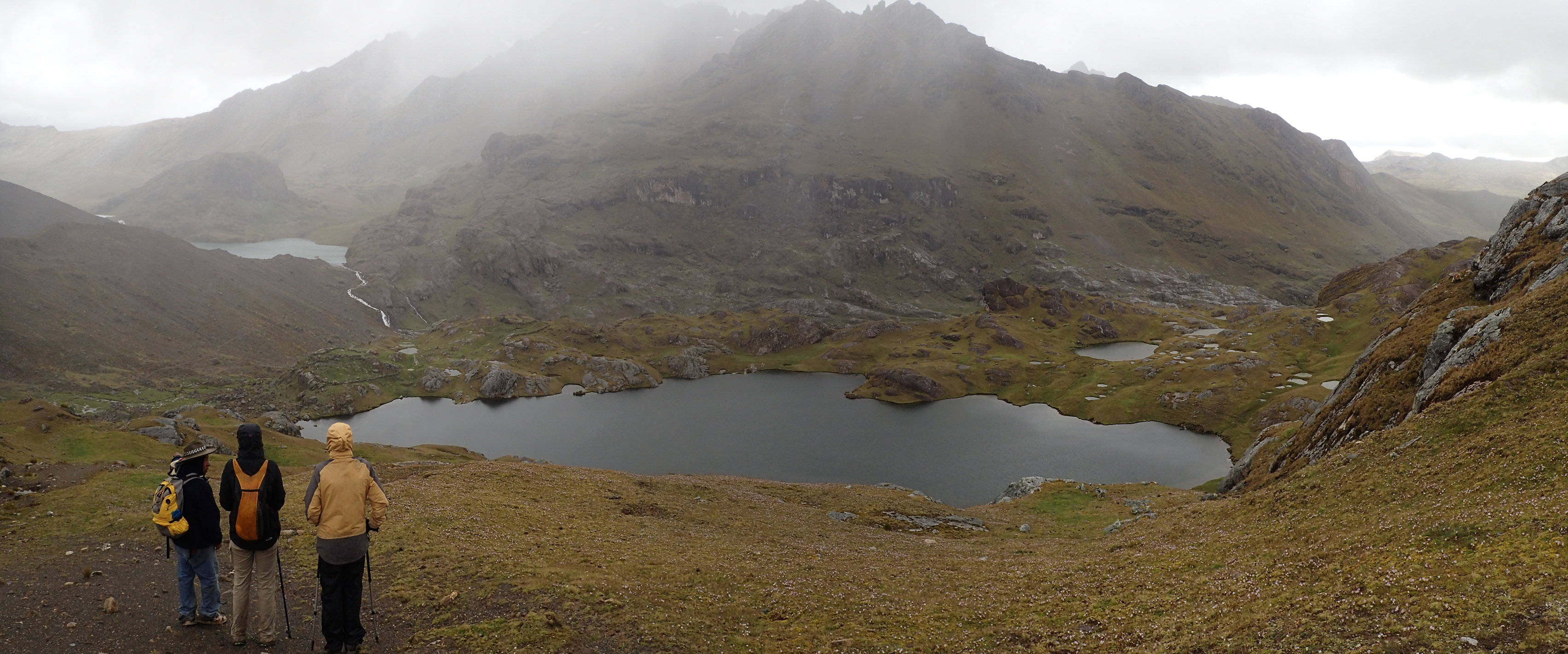
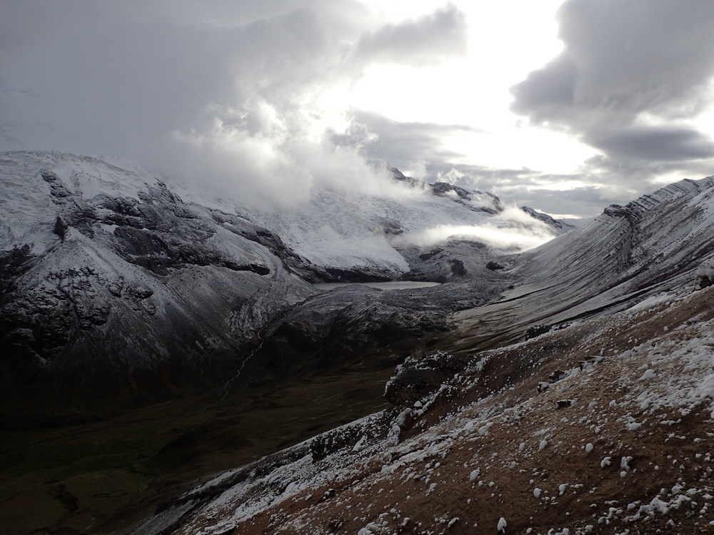
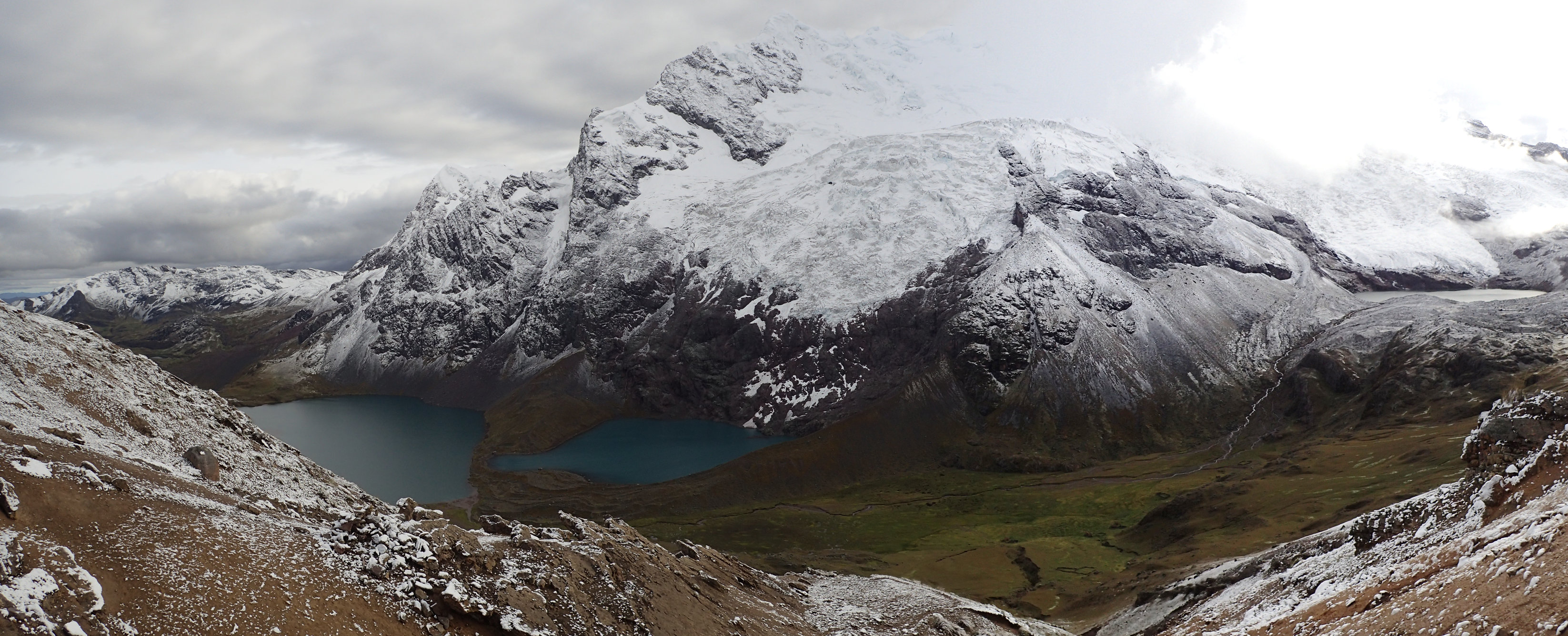
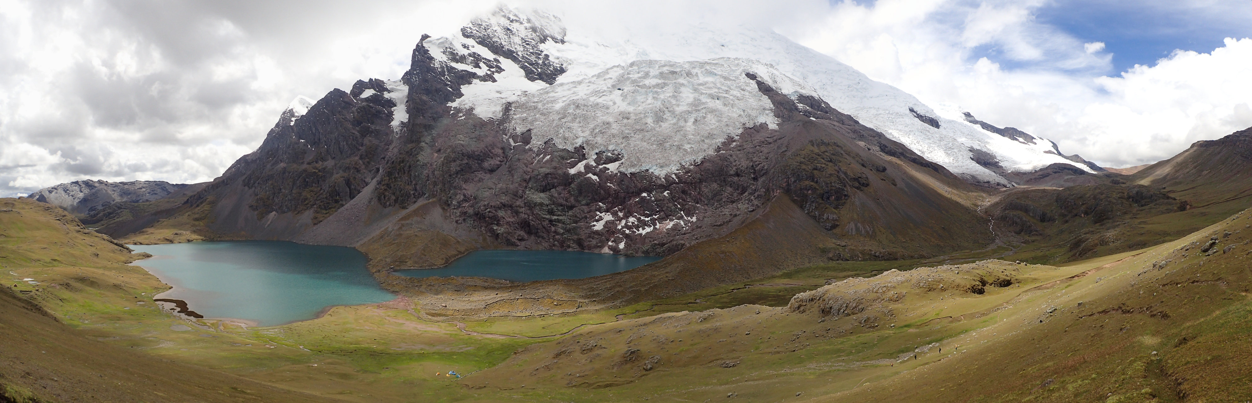
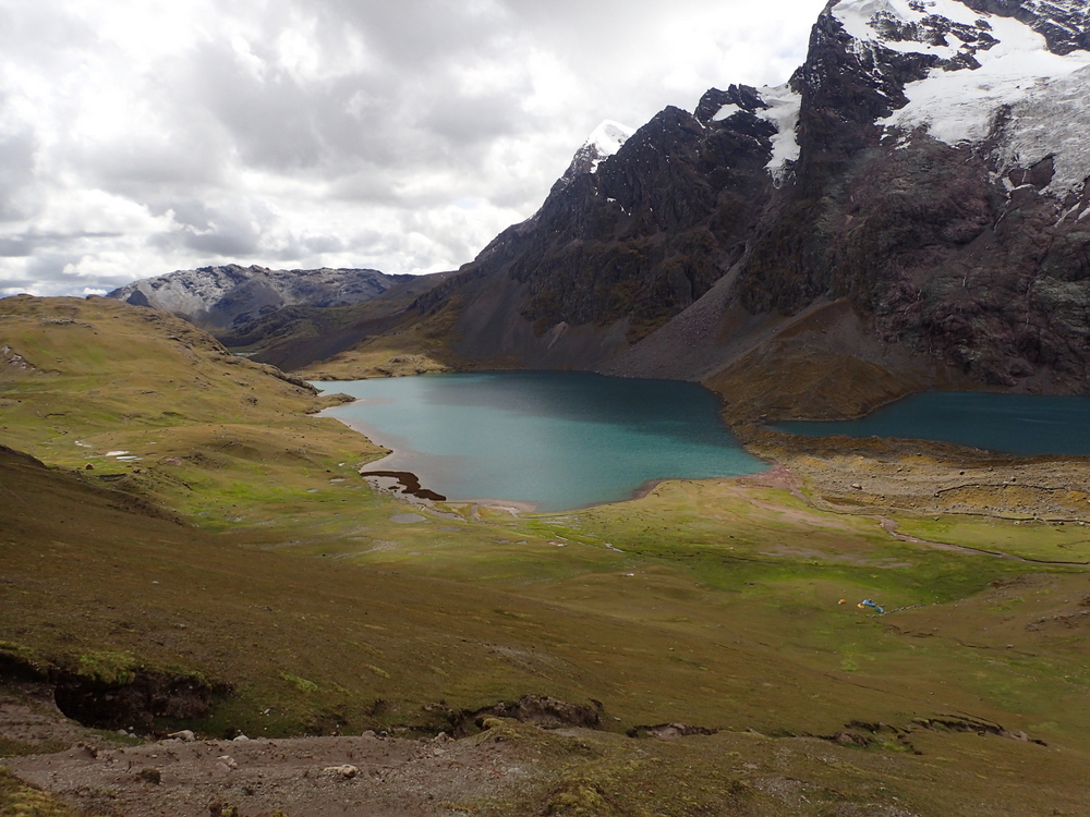
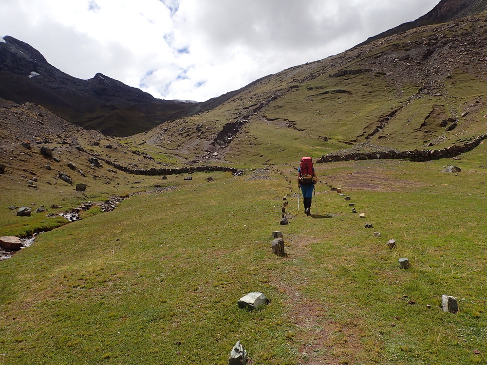
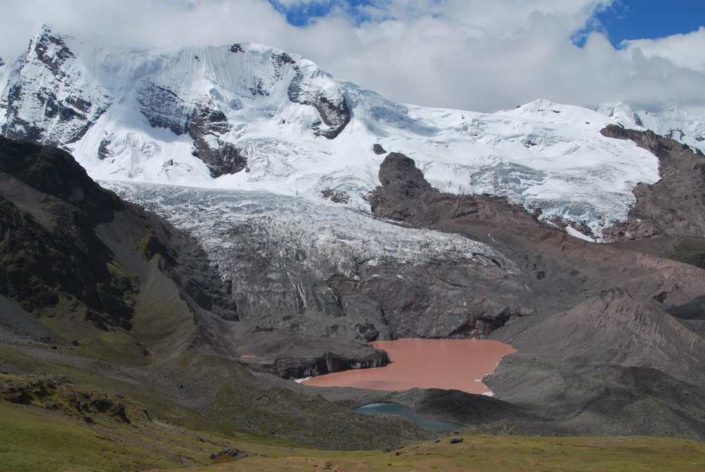
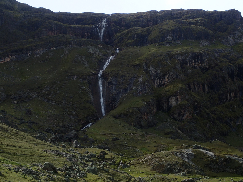
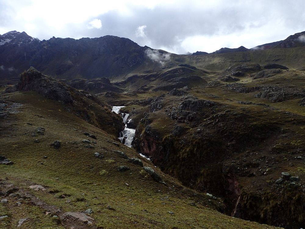
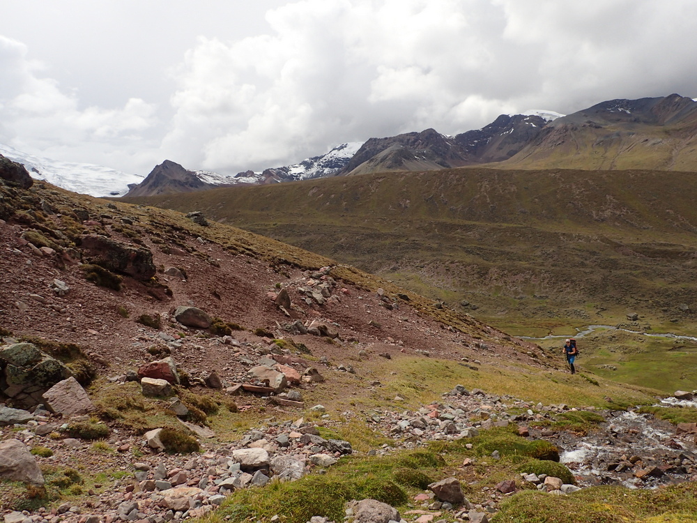
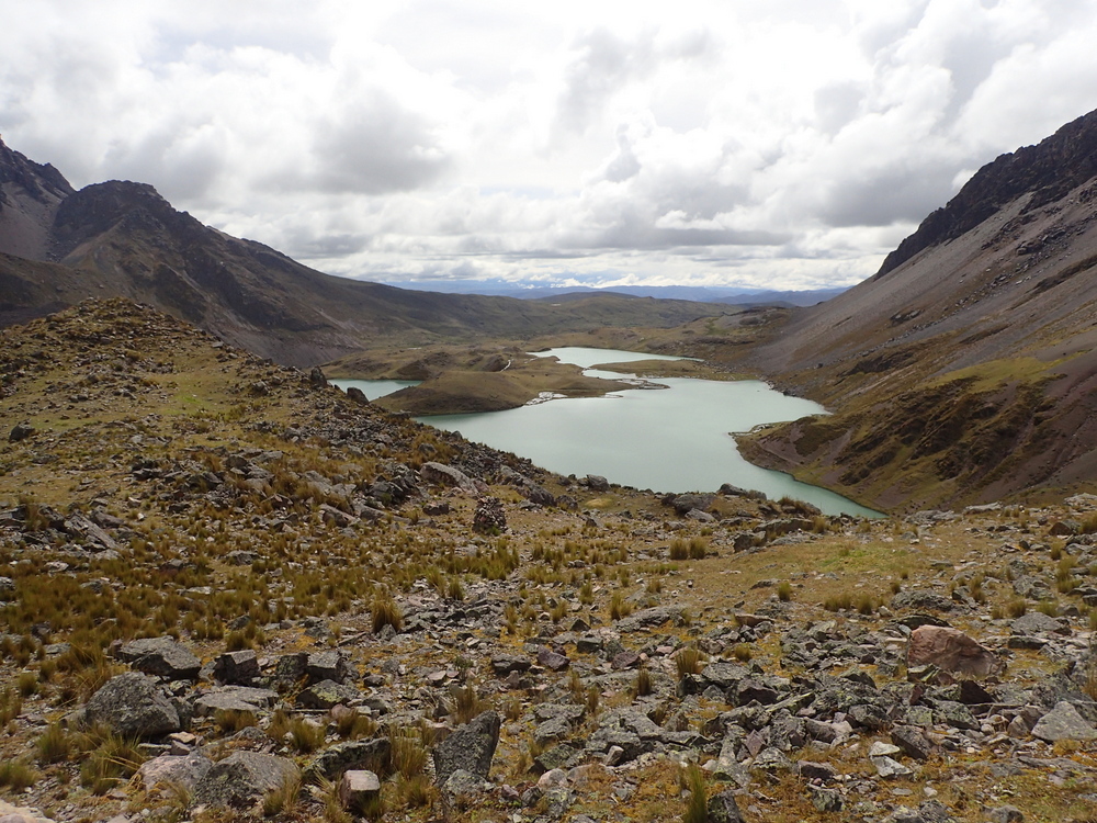
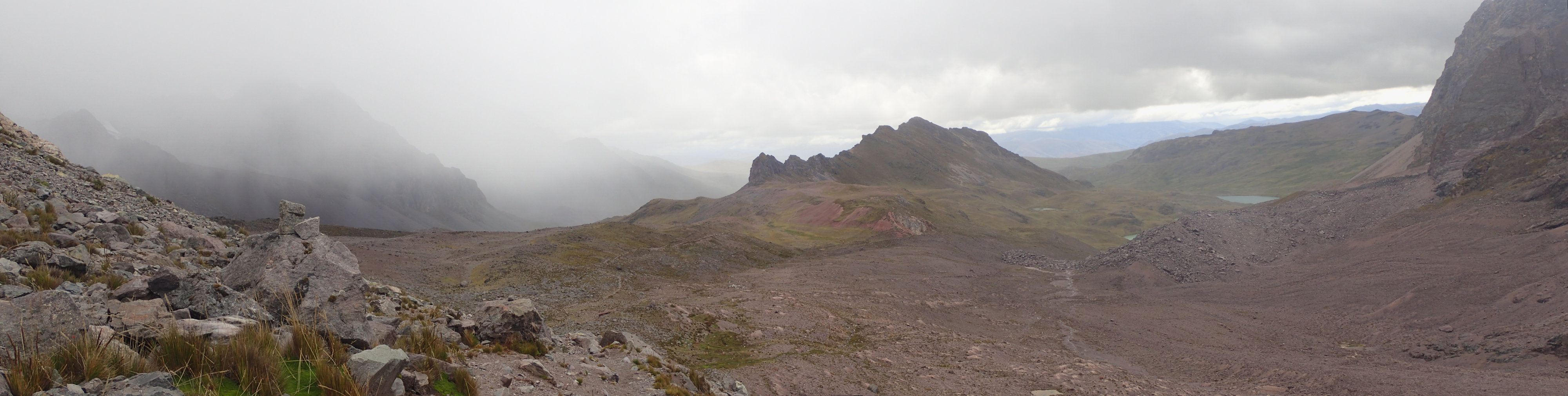
On to Laguna Puma Ccocha. I opted to carry my rucksack, partly because I’d understood that it was necessary as Crispin had picked up tents etc. at Upis, and partly to test to see how hard I would find it. Actually turned out to be OK really. Mixed overcast weather. It should have been OK this time of year, but I think the odd weather is due to El Niño? It was still a very scenic day, it just would have been nicer with sunshine. Well, nicer for pictures, but it makes the hiking harder if you’re dying under a hot sun. It was about 6 hours walk. (Campsite: S13.81687° W71.26810°)
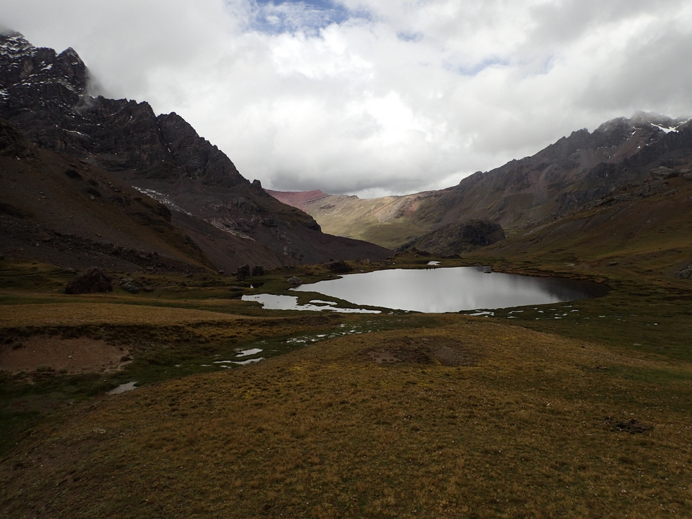
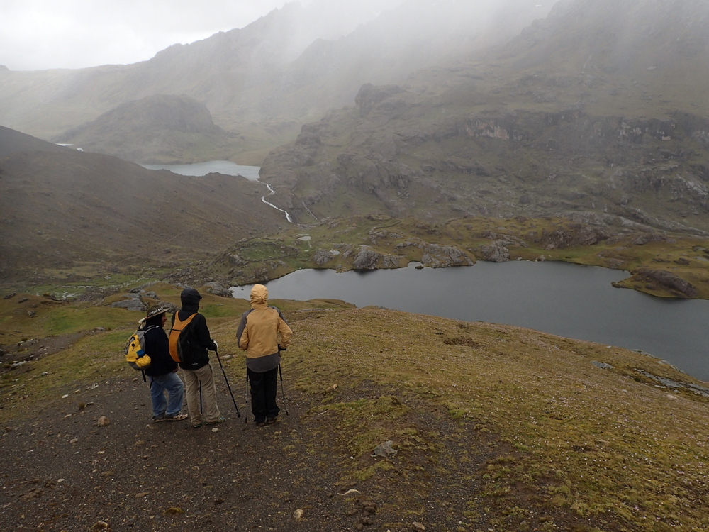

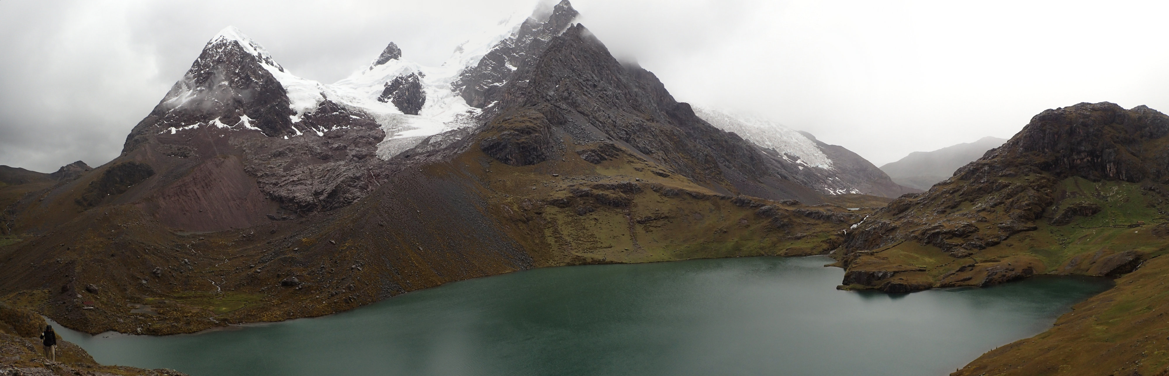
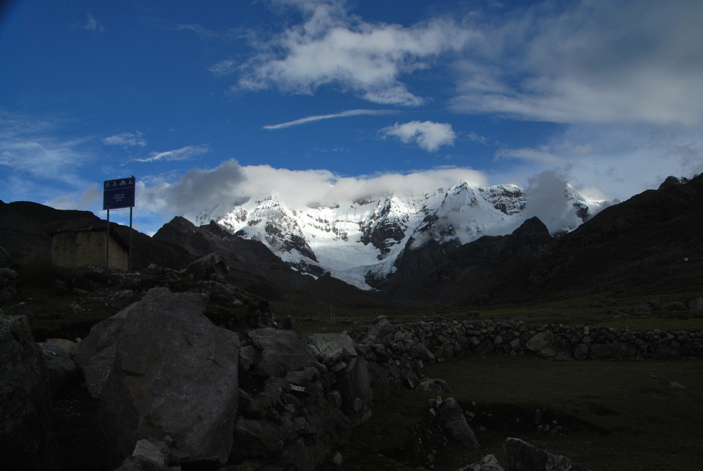
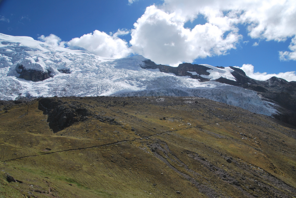
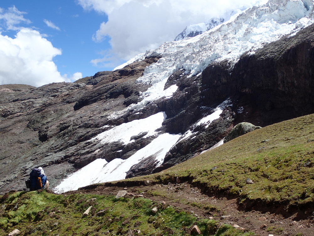
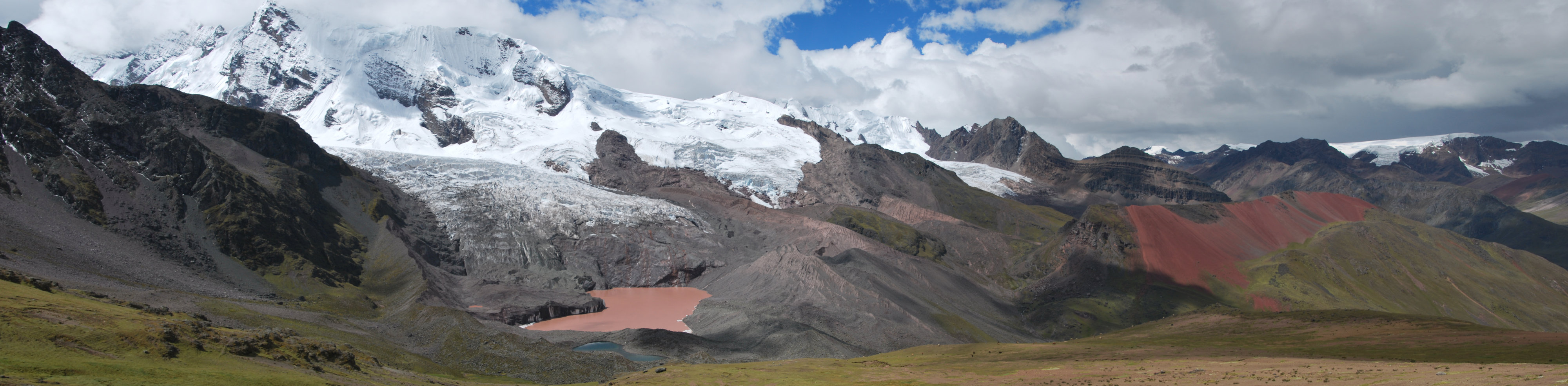
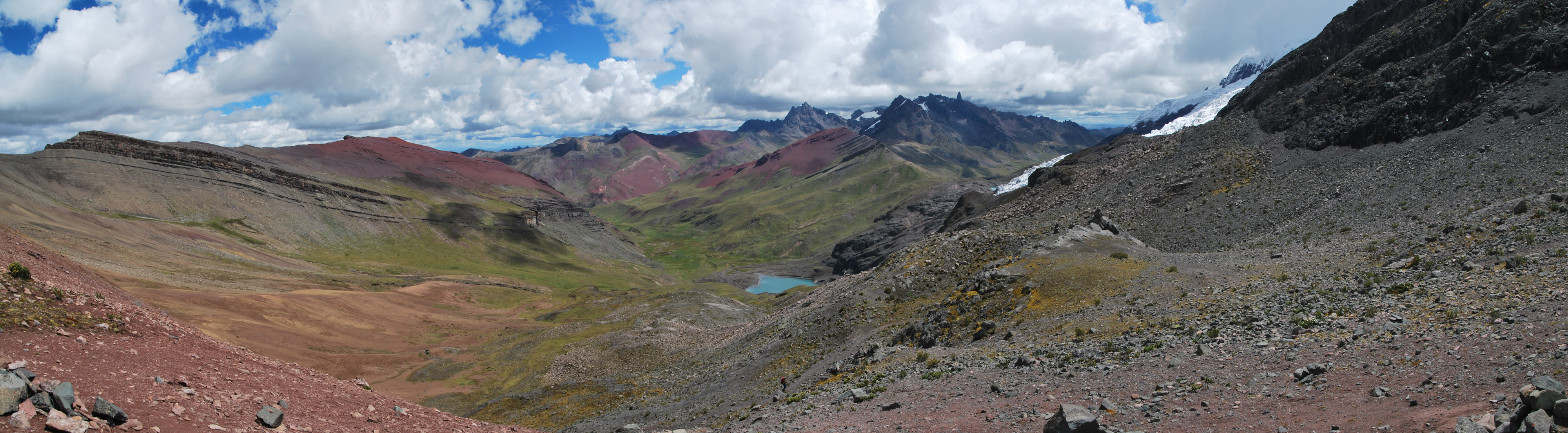
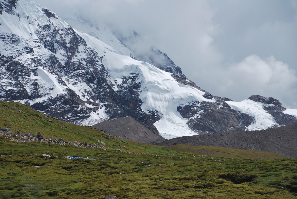
Originally we had thought that Crispin would just point us in the direction of the fabled “Rainbow mountain”, but the French were going there too, so we ended up having a guided tour and not needing the GPS track to Rainbow Mountain. It was a heck of a day though, up at 4am. Lashing rain, back to bed until 6. Up, everything covered in a thin layer of snow, but no longer raining. Then up to 5,000m straight from the campsite, then down into a valley, then up again to 5,100 ish where we saw a view to the rainbow mountain.
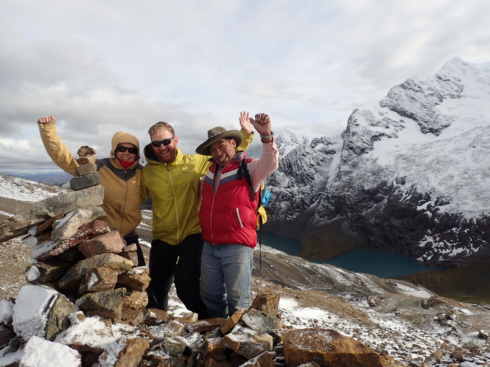
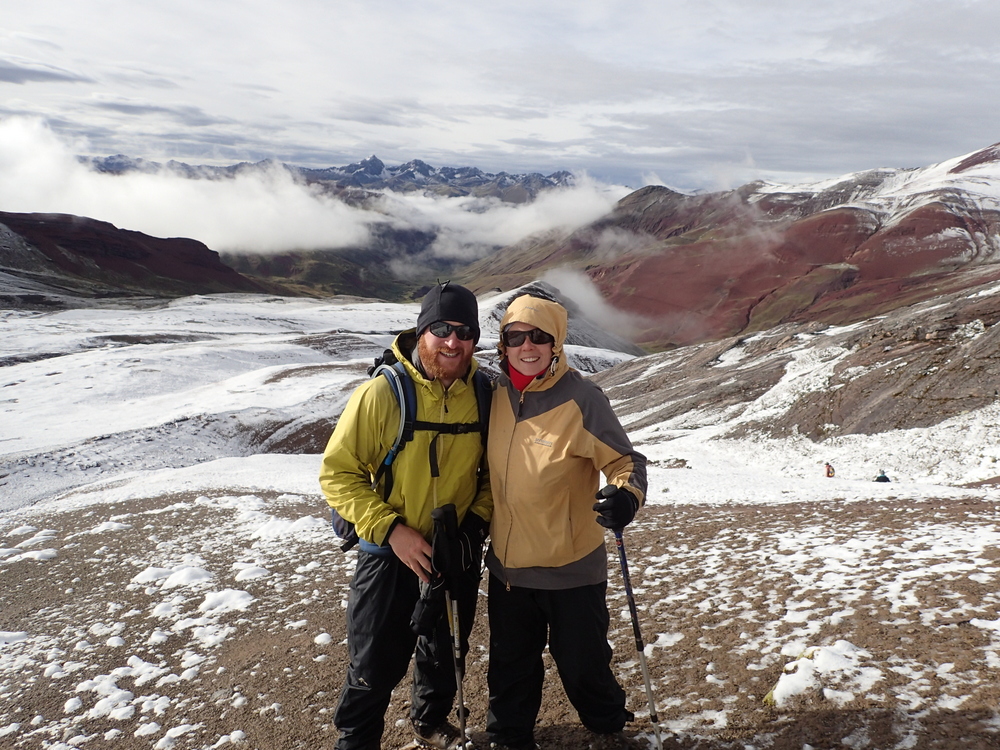
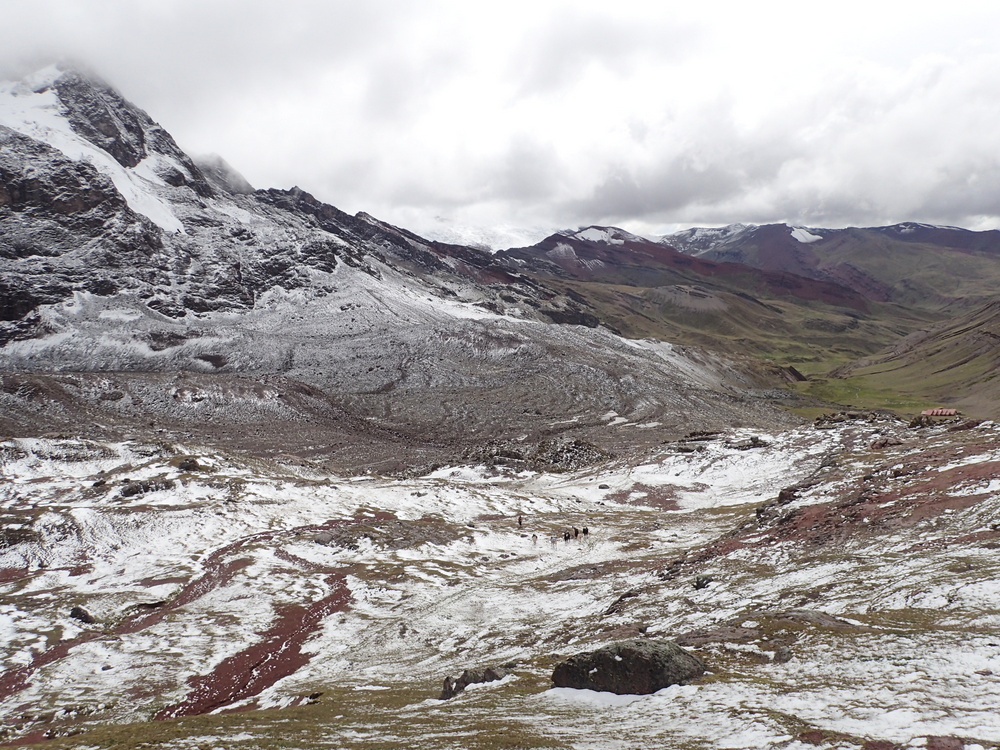
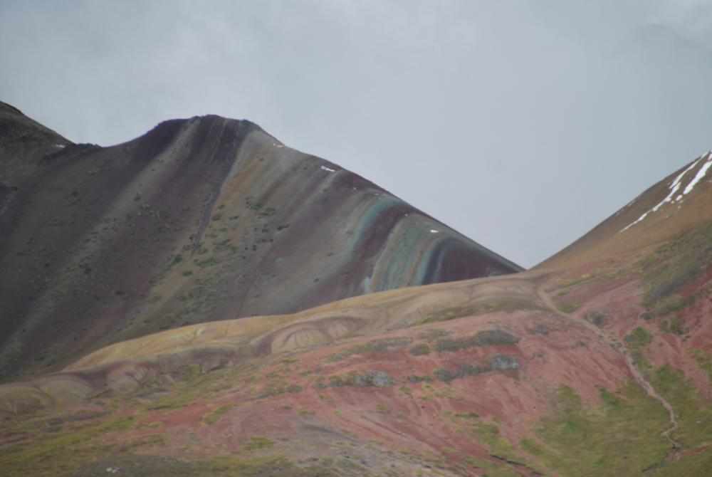
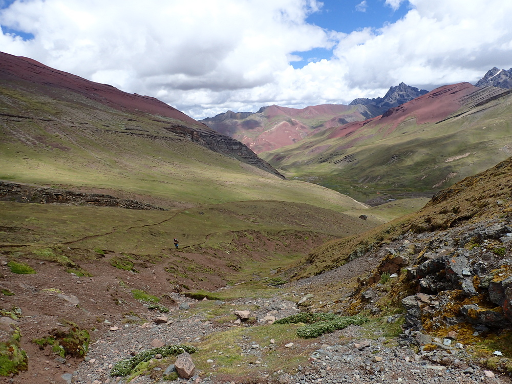
It would have been another 2-3 hours return. Maaike and I could have done it, as we were staying at our campsite at Puma Ccocha, but the French were heading back to Tinke. That said, I think we were all happy to just have a view and go, as we were knackered! Honestly, the rainbow mountain was a little bit of a disappointment on the cloudy day, the walk there was just as stunning in its own way. Perhaps with sun it would have been different. Check out Eric Hanson’s pictures here.
By the time we got back, most of the snow had melted away. Then the French friends left, and we were all alone in our little tent.
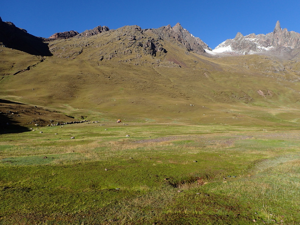


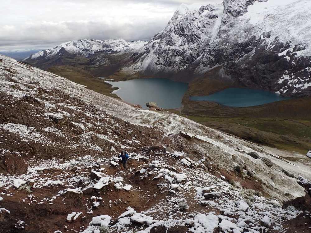
Stunning day, sun for most of it. Up at 6am as per usual and walking for 8 hours ish.


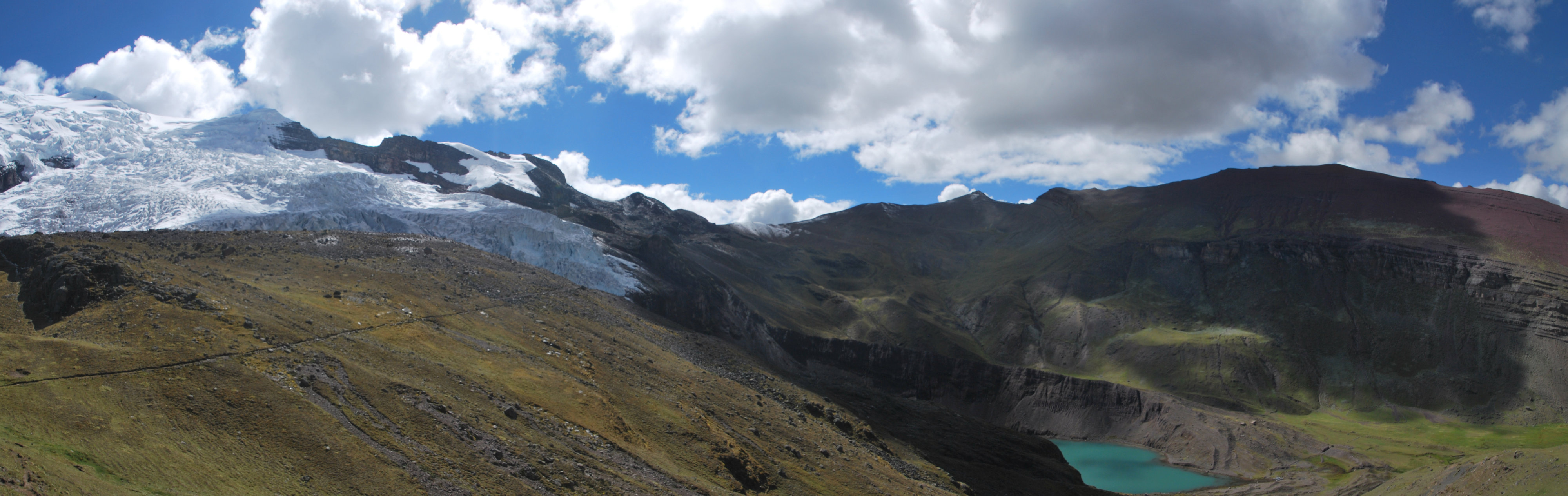
We’d been looking for a campsite for a while, but ended up just picking a beautiful looking spot (S13.81902° W71.18520°). As it turned out, there was some quite spiky grass there which was quite happy to go through the groundsheet. Ended up putting down our packliners as added protection.

Seemed to work, the thermarests didn’t deflate.. Good timing on dinner, just finished before the heavens opened.
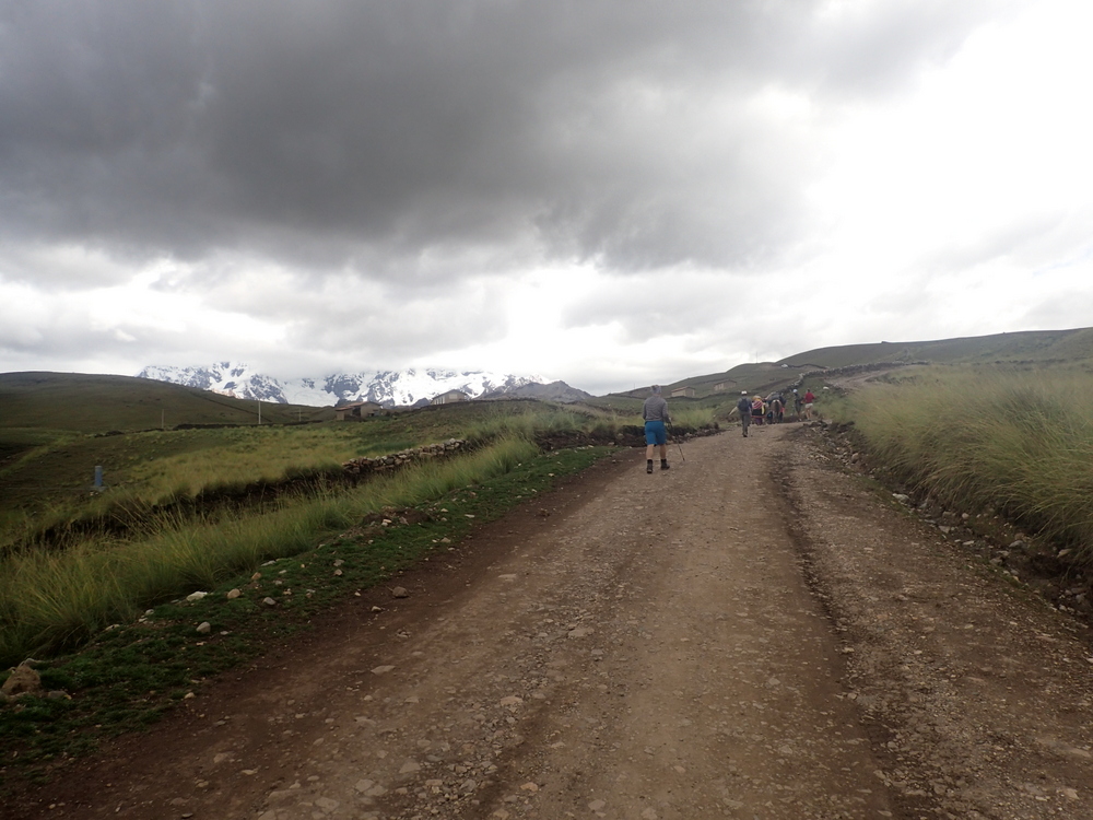
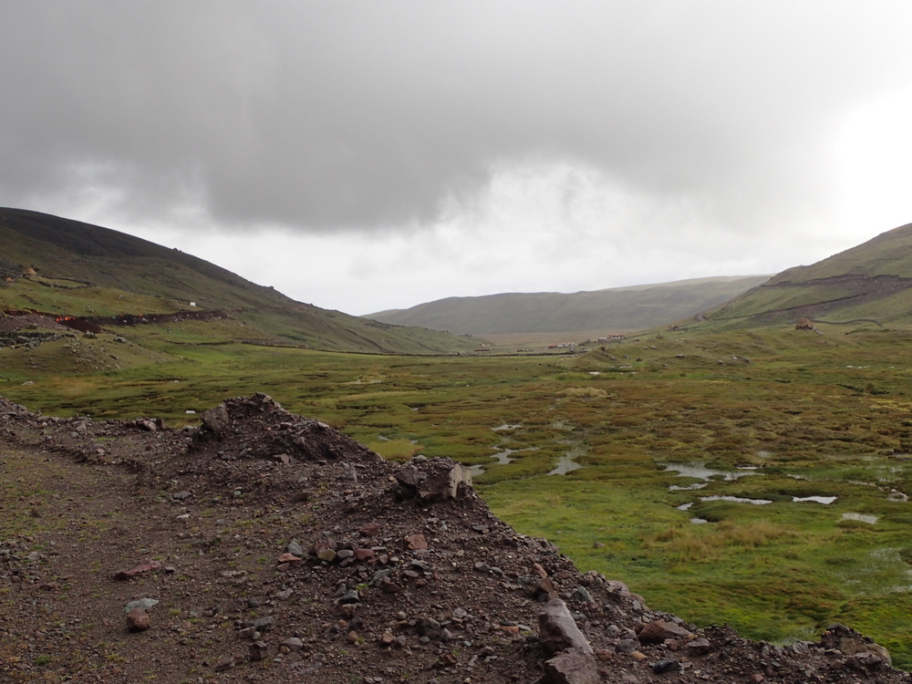
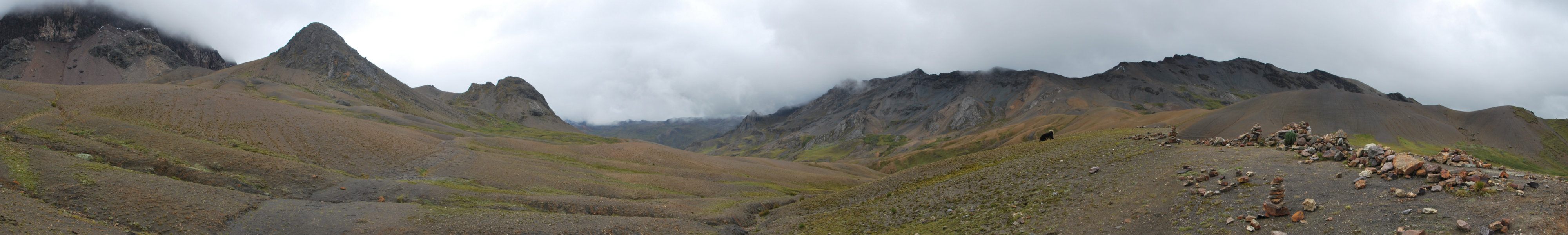
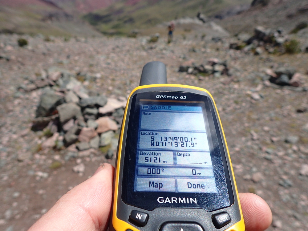
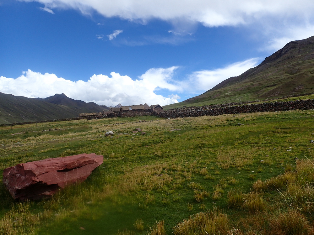
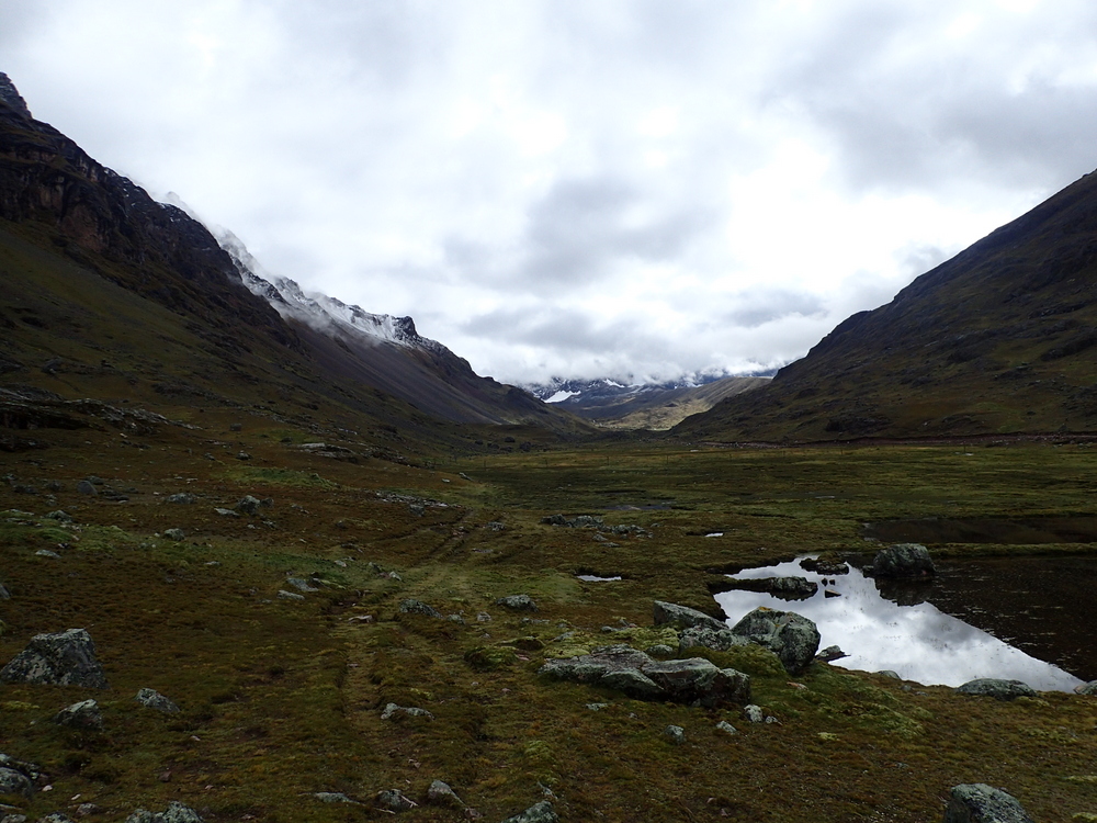
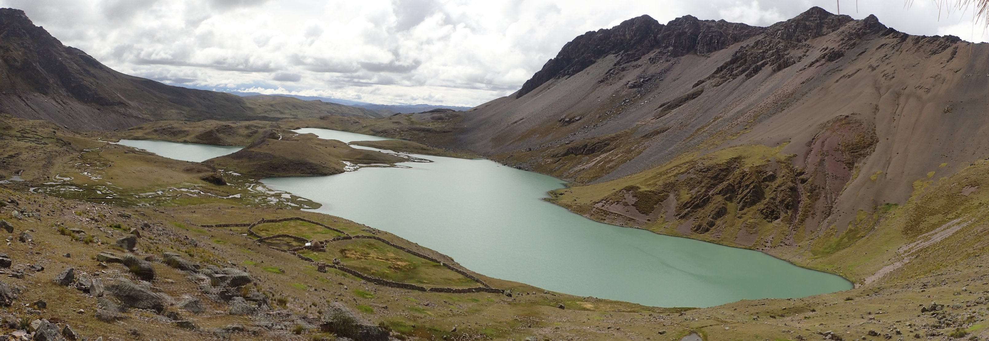
To Pacchanta (S13.71824° W71.24246°). Longest distance today, 22km or so, but once you were up to the pass (Campa) it was pretty much downhill all the way. We did lose the track at a couple of points. It’s misleading as there were lots of tracks, some very well formed, so we assumed we were on the right path. We weren’t worried as the terrain isn’t difficult (just high) and we did have the GPS, still, if you’re relying on map+compass, make sure your navigation skills are decent (ours are decent, if a little rusty).
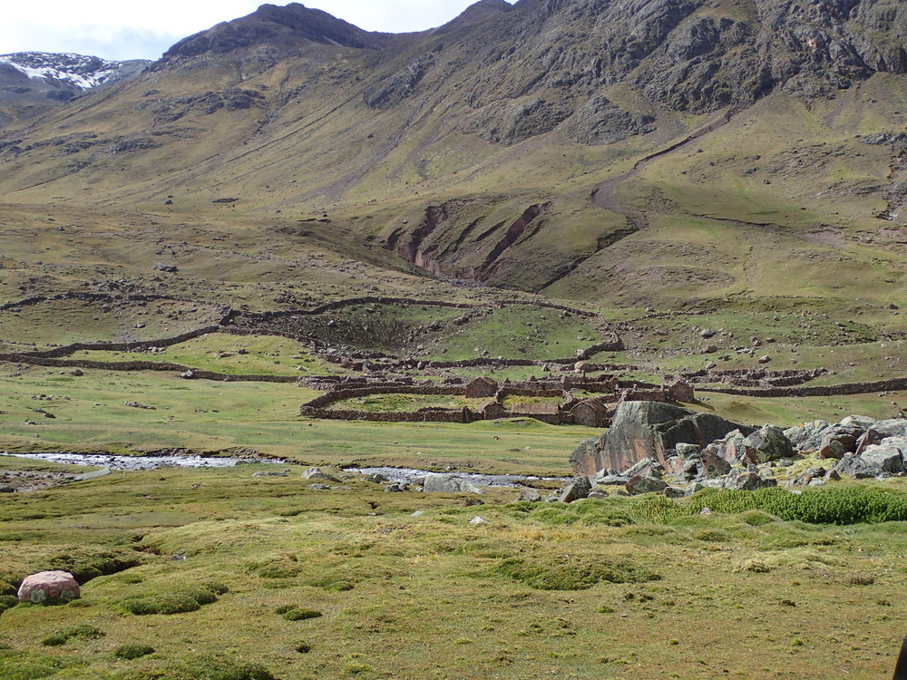


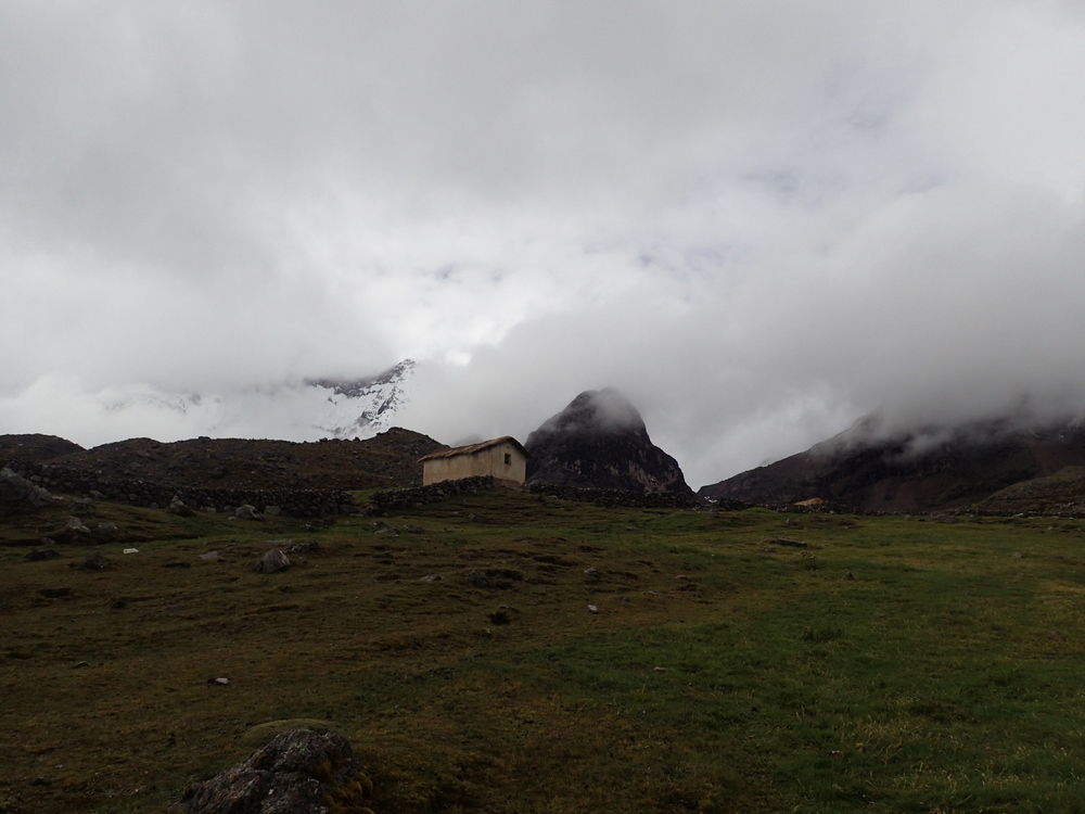
As you can see from this picture below, officially off track, but quite definitely on a decent track (which did end up going where we wanted it to).
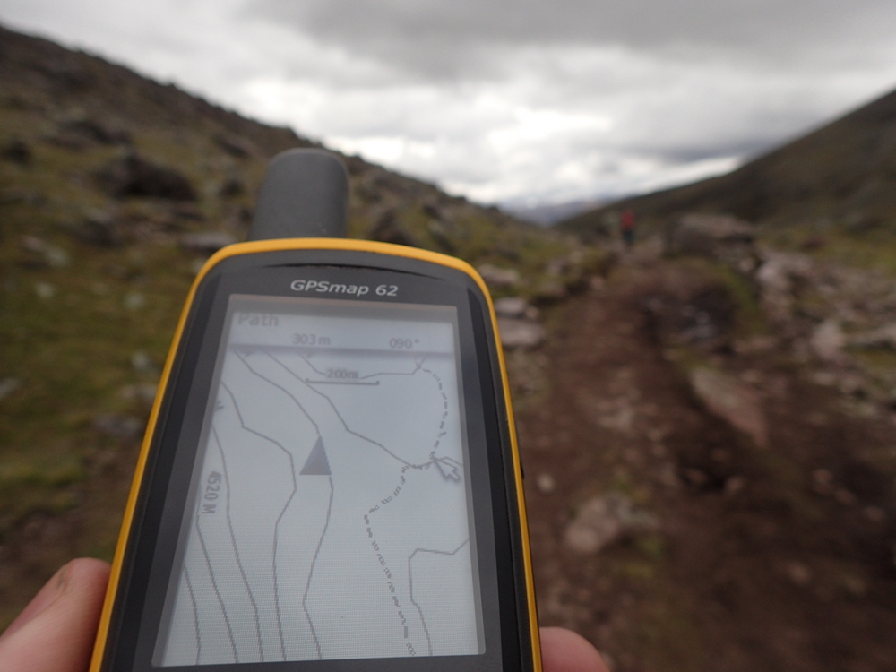
There is a wikiloc GPS track of the Ausungate circuit. I dunno, having a GPS makes it pretty straightforward. The track is mostly obvious, but there are lots of places where there are multiple options so it is easy enough to go wrong too.
Anyway, long enough day. Great hotsprings at Pacchanta – way nicer than Upis. Maaike gave in and let us get a hostel rather than camping for the last night. Even had a beer.
Just a few hours walk out to Tinke and then the bus home again. All in all a good walk, not technical really but hard work because of the altitude.
p.s. this is being published on a Wi-Fi enabled bus in Colombia. Nuts eh?
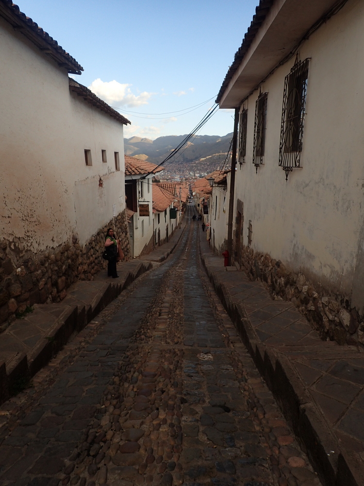
I like Cusco, or is is Cuzco. Interesting, spell check says the former is incorrect, whilst Wikipedia says the latter. Who knows what’s true any more?
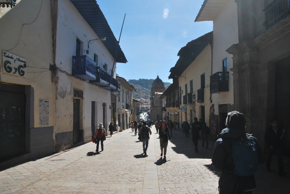

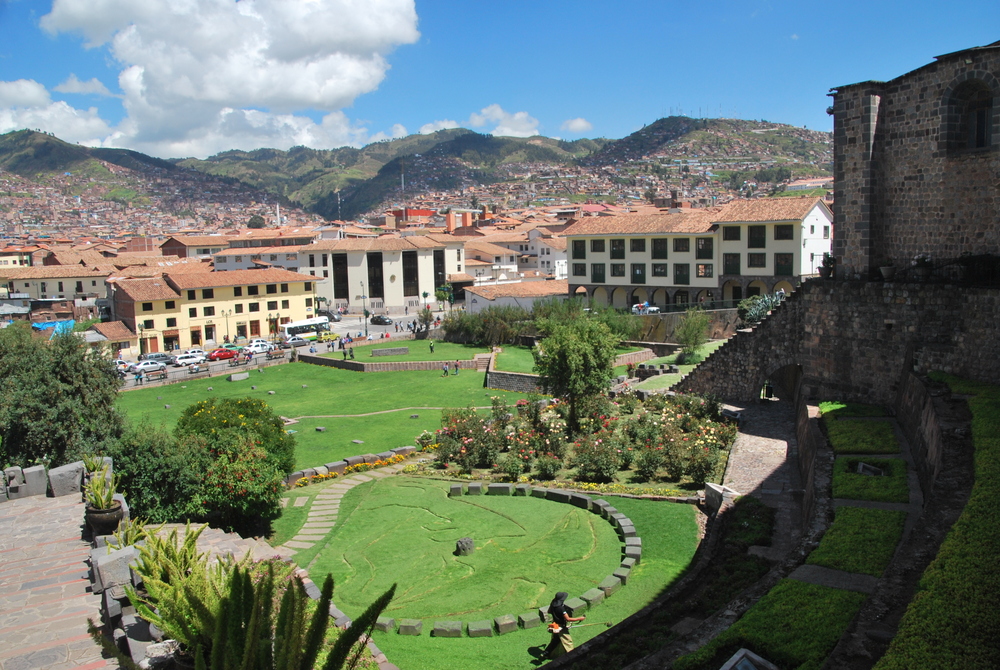
Anyway, it’s a great place to spend a few days (weeks if you have them) exploring the Incan sites that are all around here. One of the first sites I visited was Santa Domingo, the Dominican cathedral, which was built on top of the Palace of the Sun. Maaike, who has been in Cuzco before and already visited, opted out of this one. The cathedrals & museums aren’t cheap to visit.
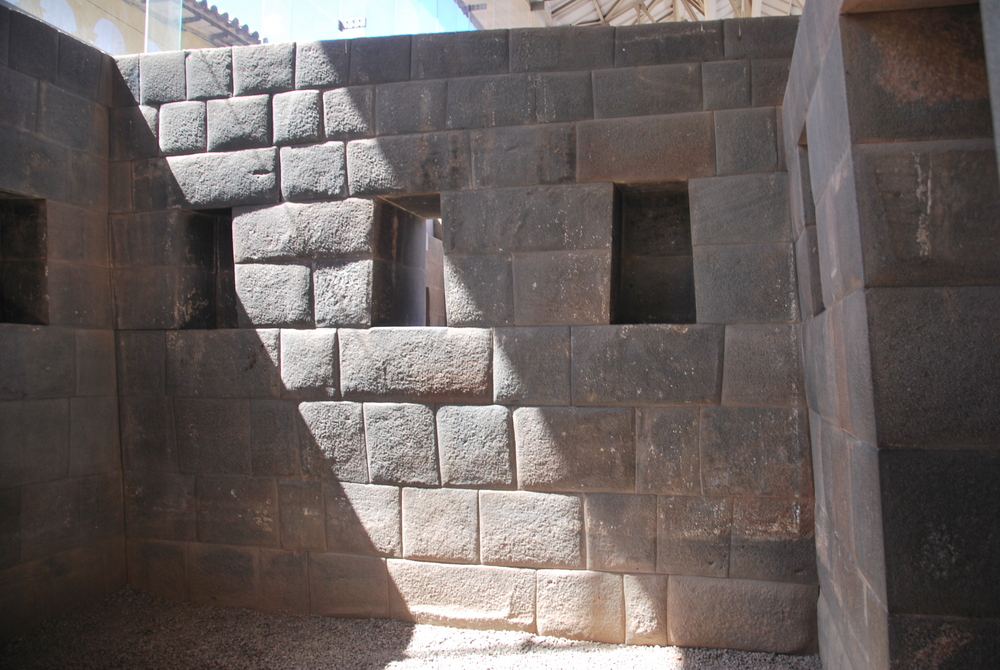
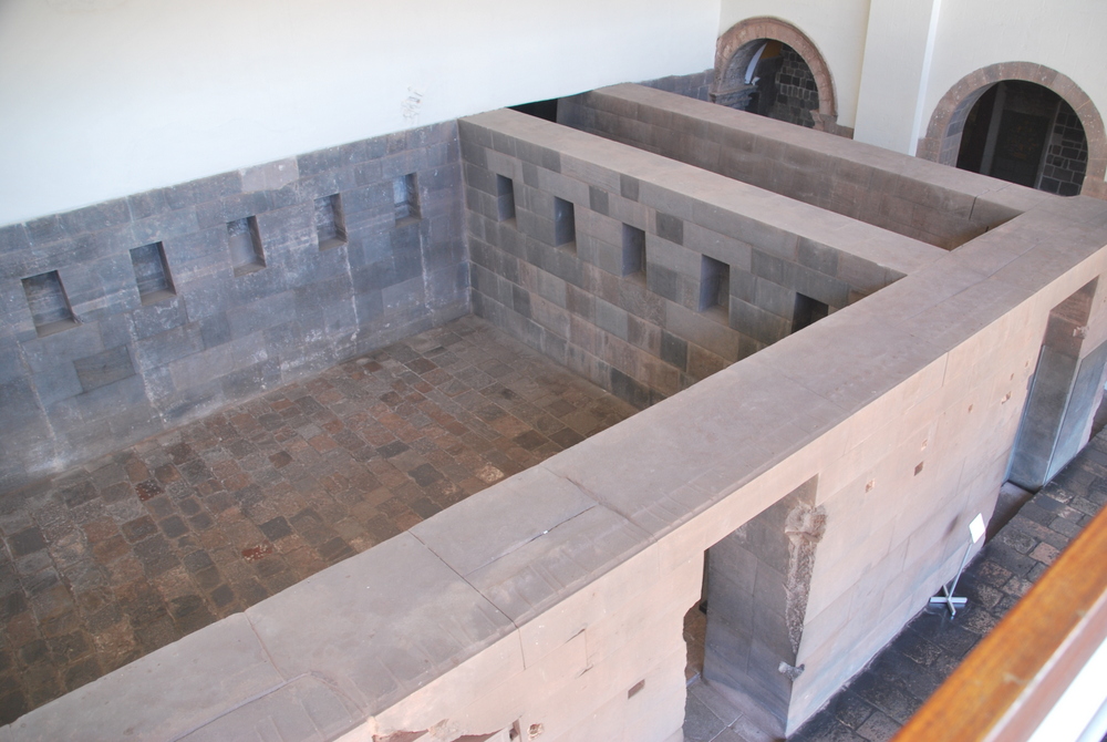
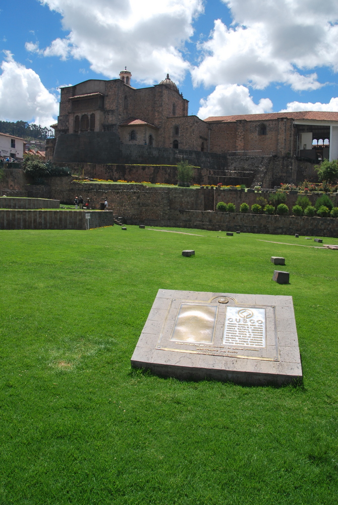
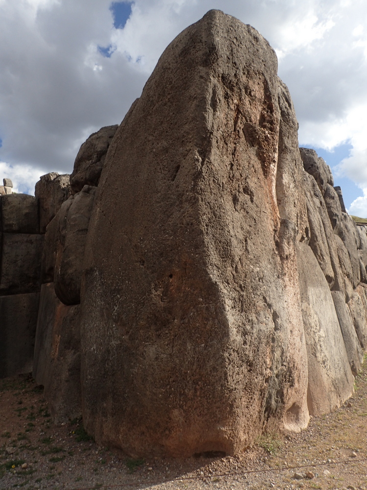
The masonry work is incredible. It’s hard to describe really, but they’re just huge blocks and perfectly perfectly placed together, with no mortar. Incredible. I think my overall feeling was one of sadness that one of the main Incan temples had been nuked to create another Cathedral. It must have been incredibly impressive in its time, as a lot of the surfaces would have been covered in gold sheets!
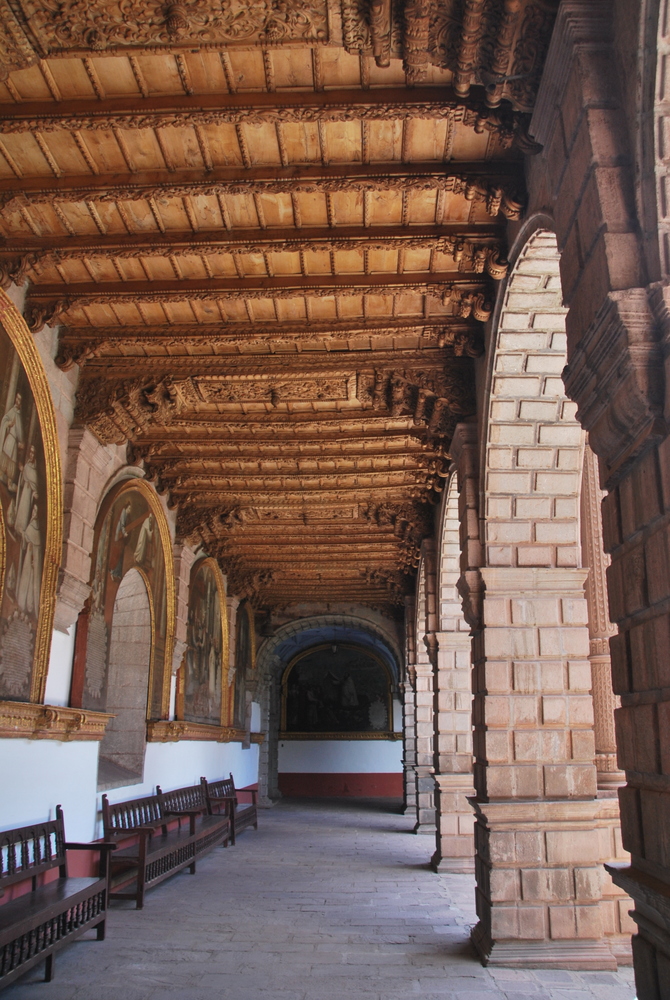
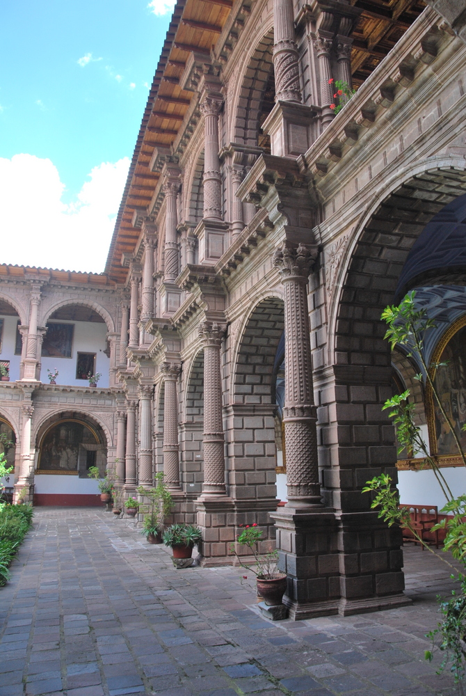
We also visited La Merced, a convent. It certainly had an attractive cloisters, and showcased a monstrance with the second largest pearl in the world and (thousands?) of diamonds, some emeralds, rubies etc. (no pictures allowed) There certainly was wealth in Cuzco that’s for sure.
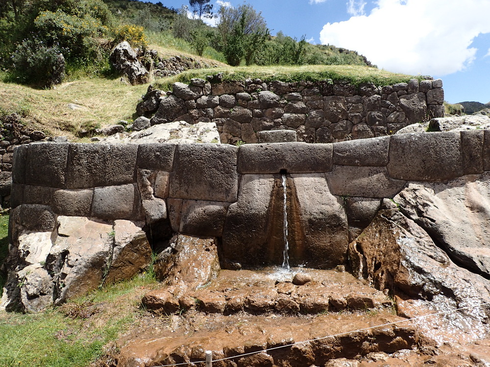
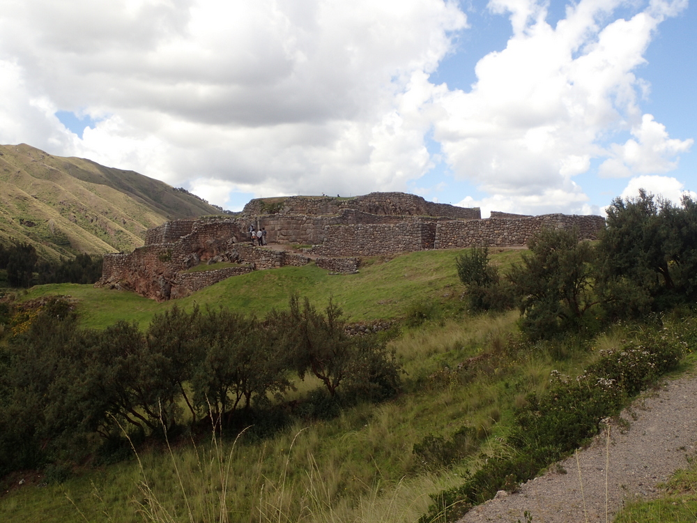
Another day we took a local bus (2 soles) to Tambomachay, another site just a few km up the hill from the city centre, and then walked back to town visiting other sites along the way. They’re not super sure of the exact use of the place, but possibly a thermal spa crossed with military outpost. Not a lot of information about the place unfortunately.

Just down the road from Tambomachay was Puca Pucará, another site overlooking the approach to Cuzco. Most likely purely used for military purposes, and they reckon built in somewhat of a rush, as the stonework isn’t as amazing as some of the other sites.
Again on down the road to the ‘Temple of the Moon’. I really wished there was more information about these sites, hey ho. Get a guide.. that’s my advice. I did find the Tupuy app which is a sort of self-guided-audio-guide, but I hadn’t found it until later on in the trip. It certainly wasn’t a great guide, but it is better than nothing.

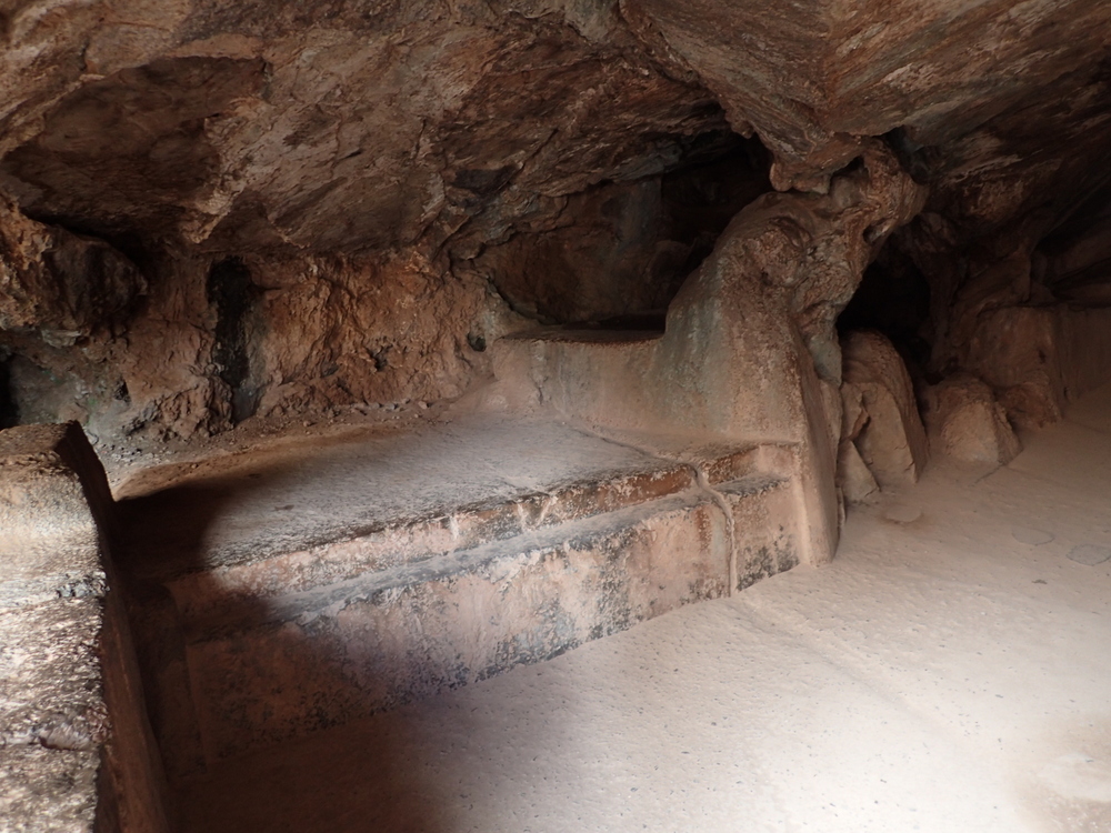
Next to Quenco. It’s believed to be a place where sacrifices and mummification took place. I thought I overheard someone talking about it in referenced to Stonehenge too.. again, get a guide (if you’re rich!) Still, one gets a feel for the place.
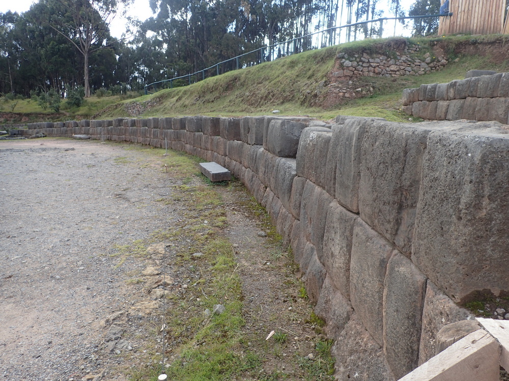
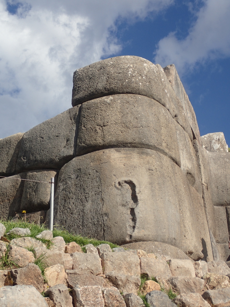
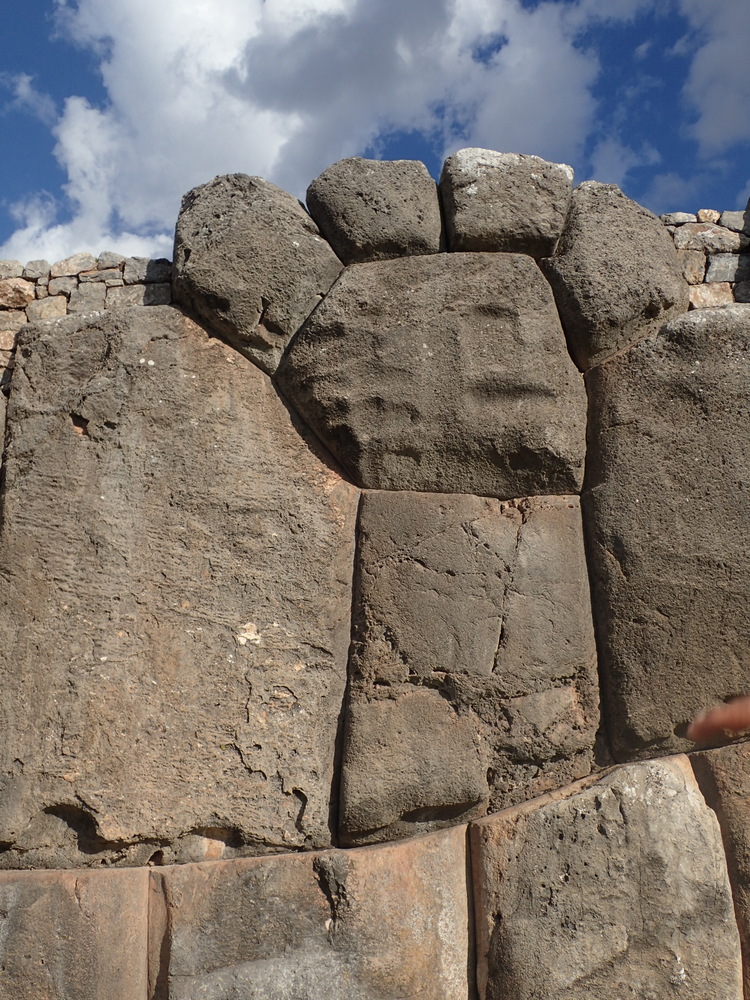
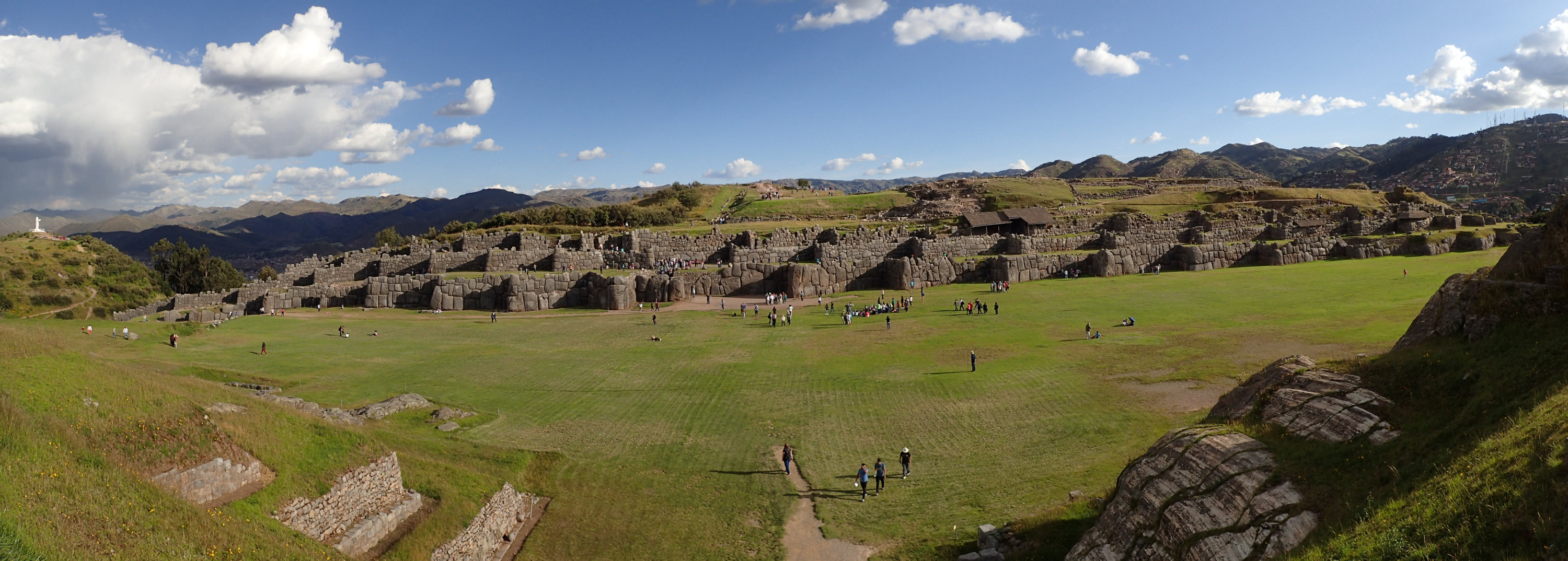
Definitely the highlight was Saksaywaman (pronounced “sexy woman”). A site dating back to 900AD (pre Inca). Certainly a fortification, and also for ceremonial activities. A huge amount of it has been destroyed by the Spanish, who used the stones in their own buildings. Again, the masonry is amazing. They reckon one technique for breaking up the stones was that they’d find a seam, drill in a small hole, put a dry stick in it, and then soak the stick. The stick would then expand and crack the rock along the seam, and then it would be carved into its final shape.
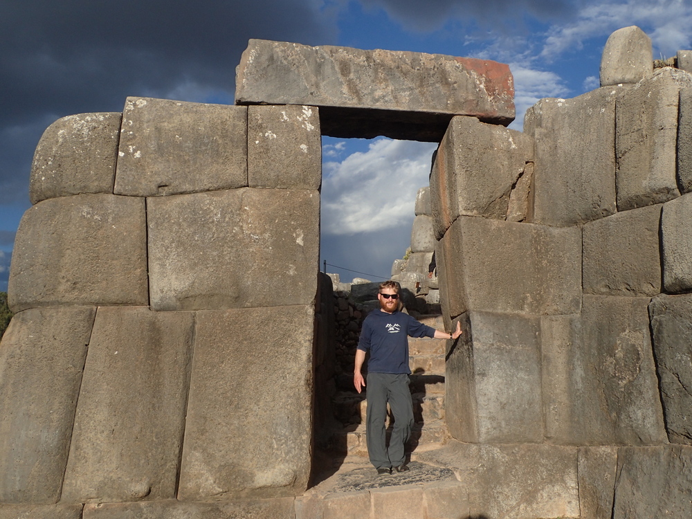
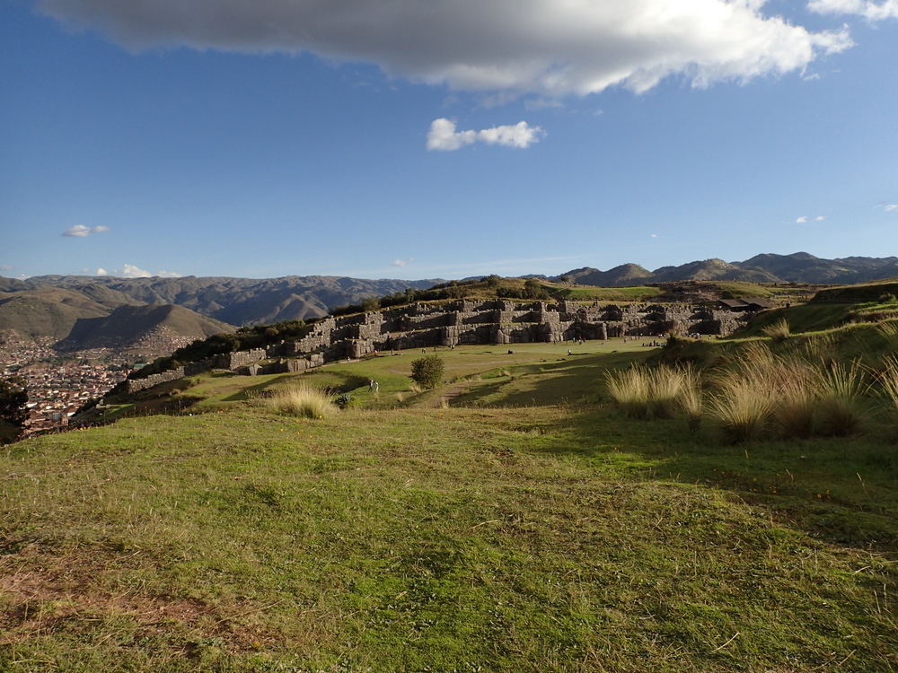


We did get a guide for Saksaywaman, well worth it. He said it had taken 20,000 people 70 years to make it. He pointed out a lot of “animal” shapes in the rocks & cracks. For example, here you can a guinea pig, a snake, and the puma’s paw! I did wonder how much was real. The ziz-zag shape of the fortification, we were told, was to represent lightning. Decent acoustics too as it was used for large gatherings.

All in all, I’d very happily recommend Cuzco. You could easily spend 2-3 weeks in the area exploring.
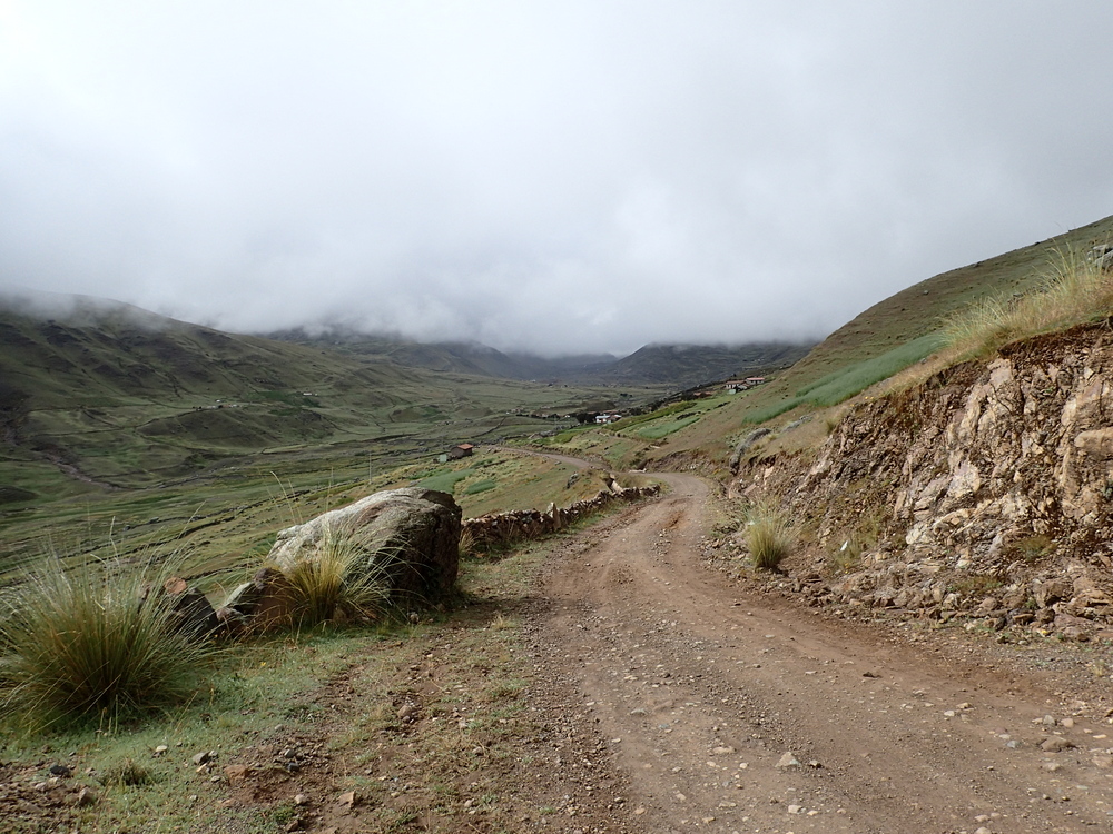
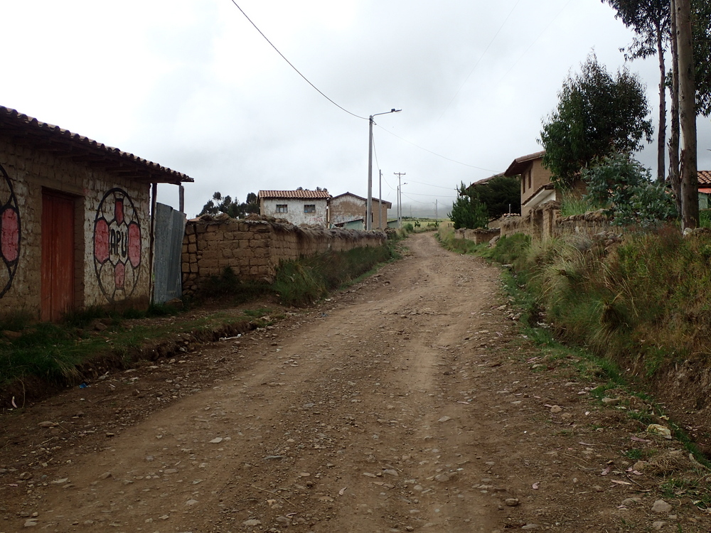
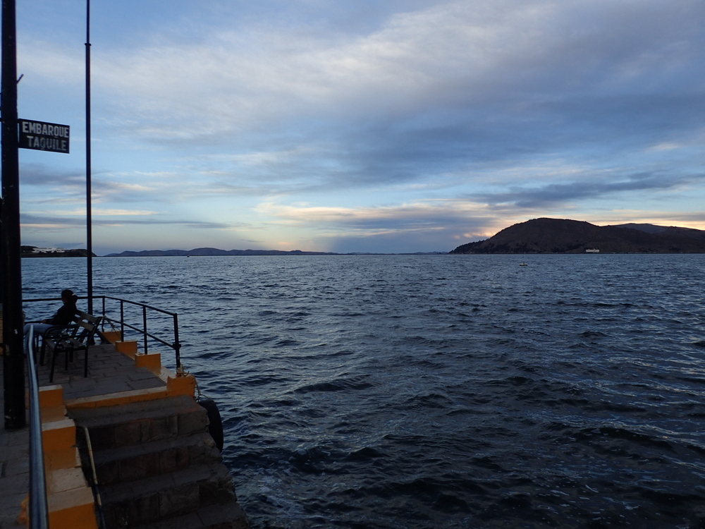
Leaving Bolivia we crossed Titicaca and entered Peru. The process was pretty painless, surprisingly, the best exchange we found for our leftover Bolivianos was actually at the border (on the Peruvian side). We elected not to take the bus all the way to Cusco opting to break the journey in Puno rather than arrive at 11pm ish.
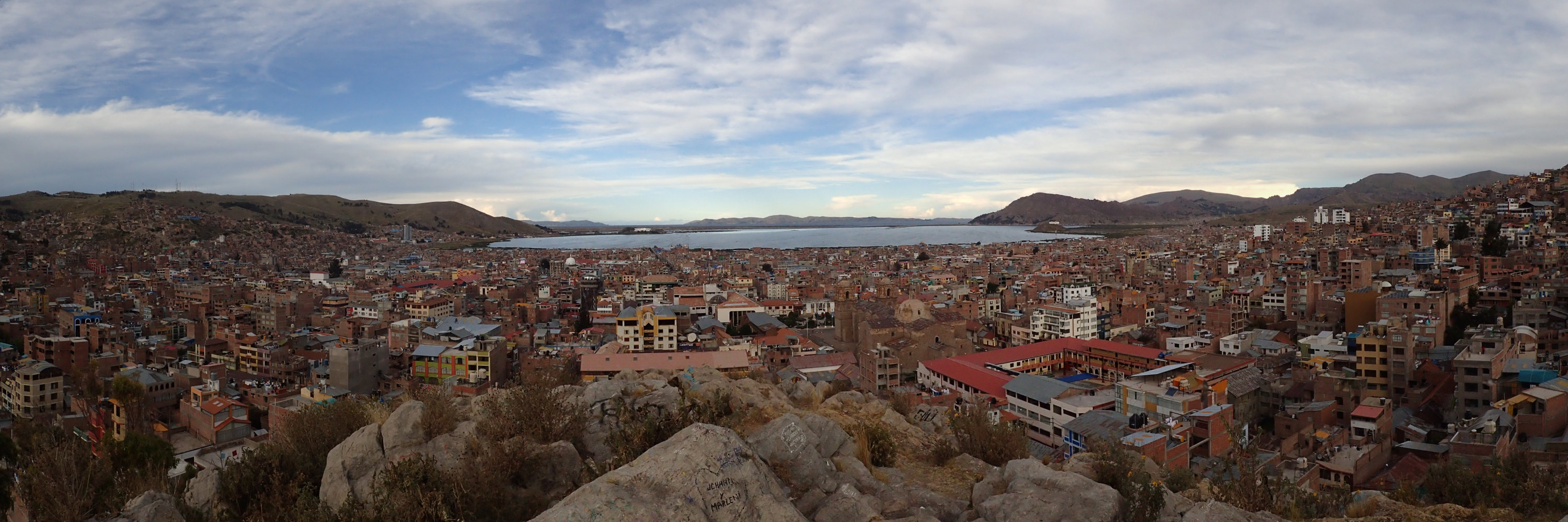
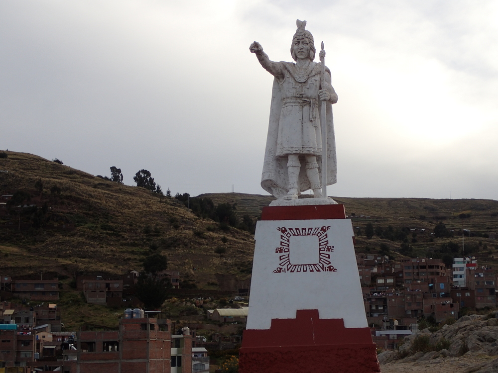
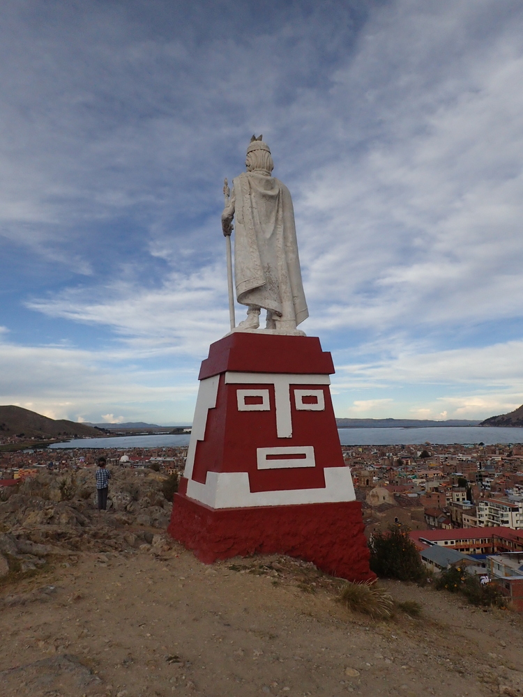
Puno was an OK place to spend the night, we had yum ceviche (trout), wandered up to a high point and that was about it.
Puno is the place you can visit floating villages from. We … didn’t. Somewhat running out of time now as there’s quite a bit left we want to do before leaving South America in mid May. It may have been a mistake to skip the floating villages, by all accounts they’re pretty groovy.
© 2026 Patricks New Zealand Weblog
Recent Comments