Archive: Month: January 2016

Torres Del Paine

  |  4 Comments

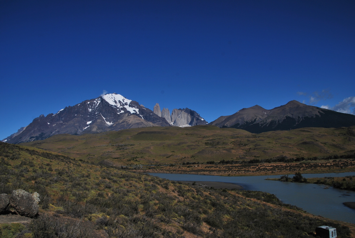
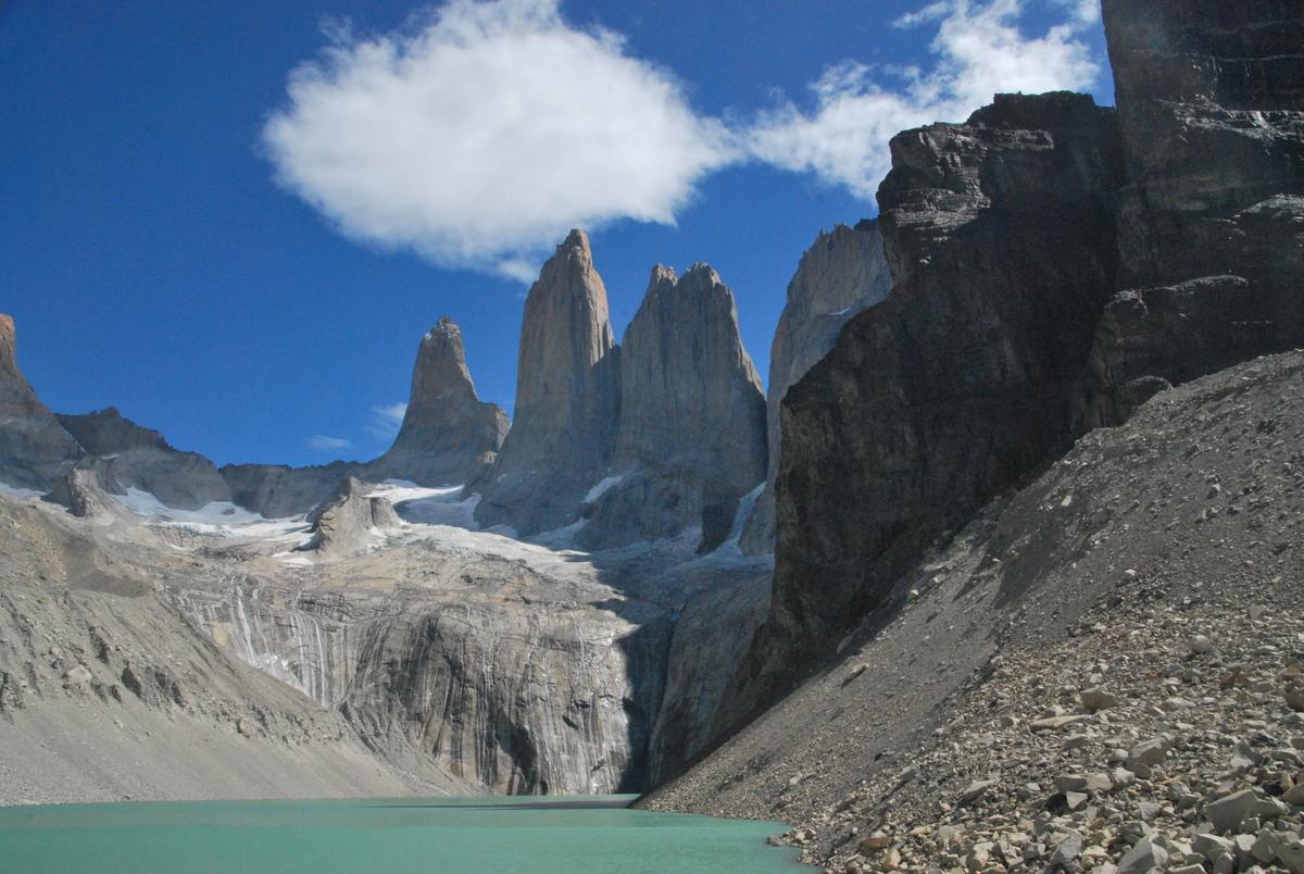
Torres Del Paine. At one time, maybe even now, voted the “best” hike in the world, by people who vote on these things. It’s a stunning place all right, no argument there. Big granite massif carved out by glaciers popping up out from the plains.

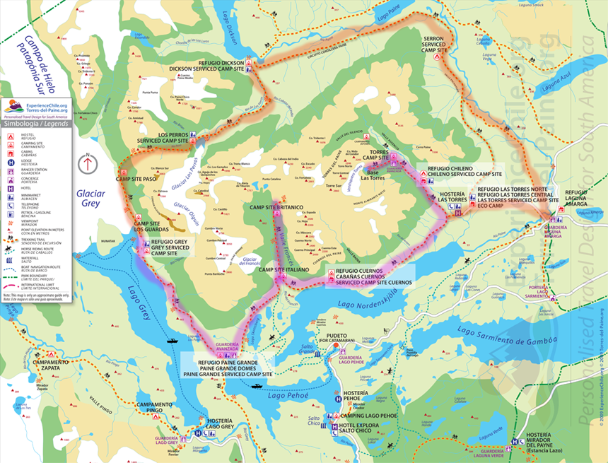
Our objective here was the circuit (called the O), opting to do it in a fairly leisurely 10 days. There’s a more popular (very busy) shorter walk called the W .. you can see here the two different tracks. The circuit turns into the W..

torres-del-paine-circuit

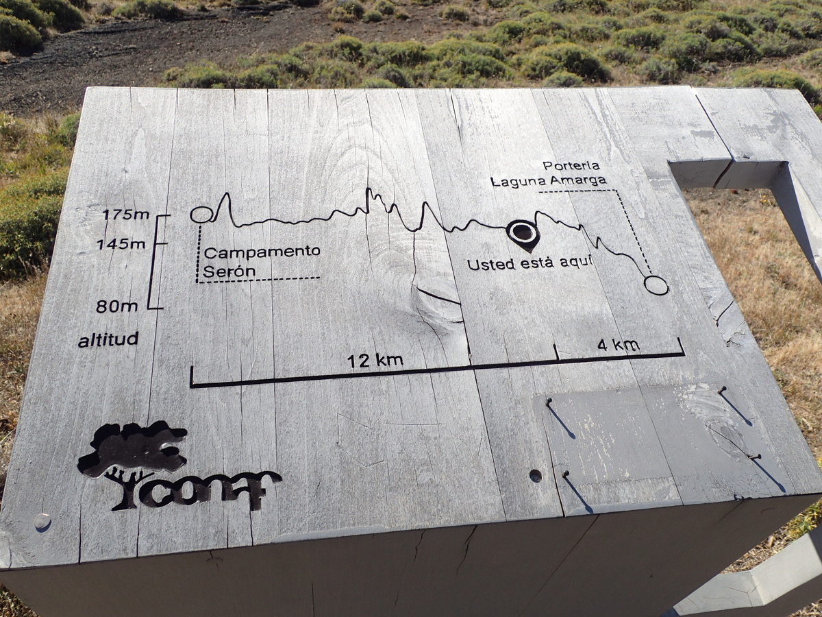
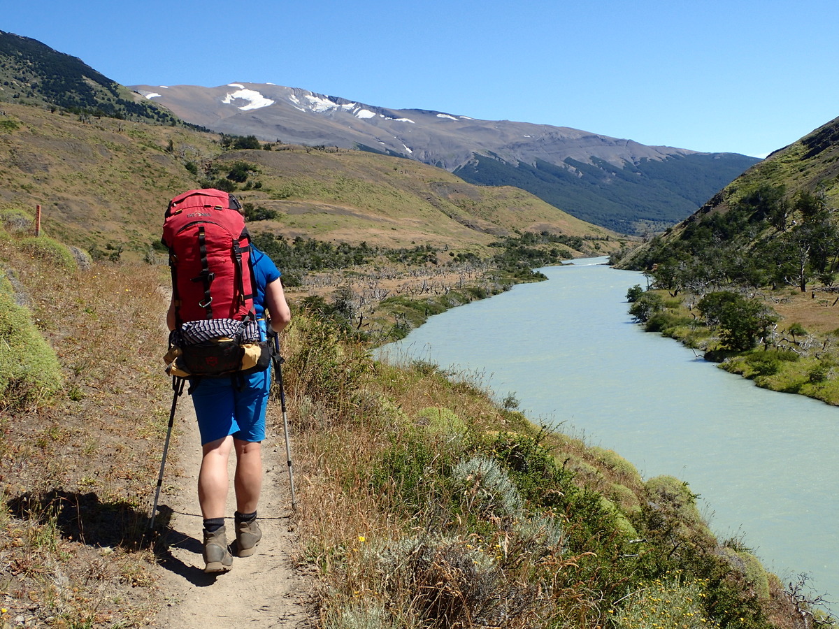
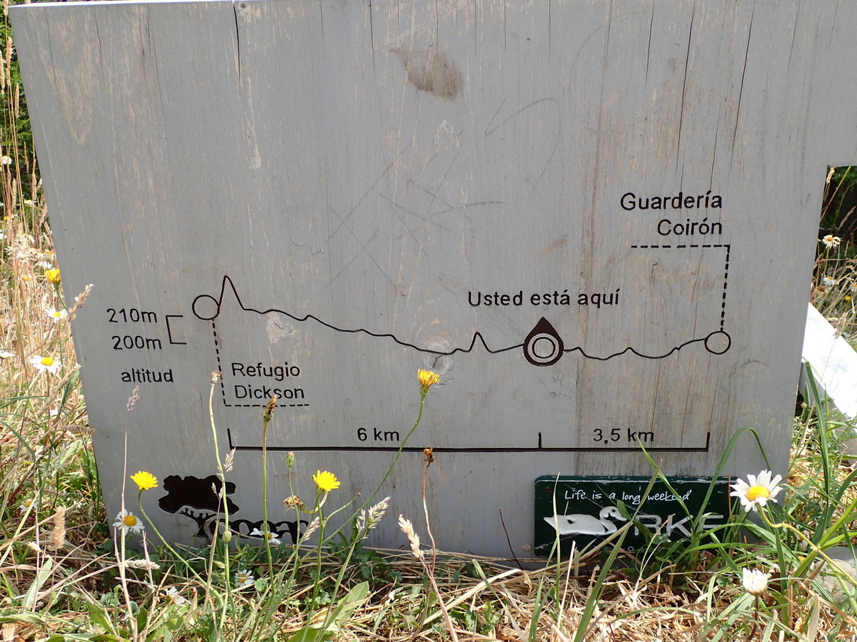
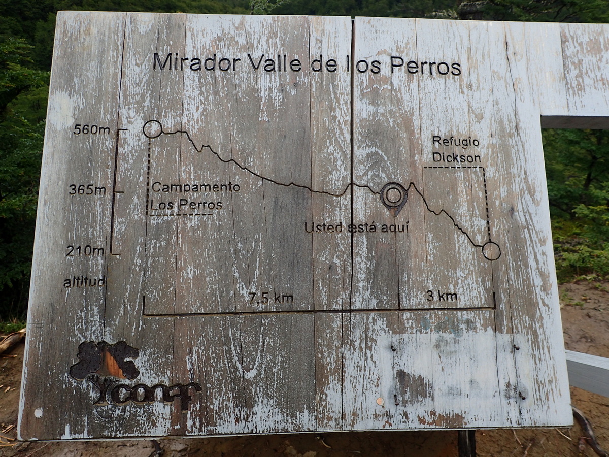
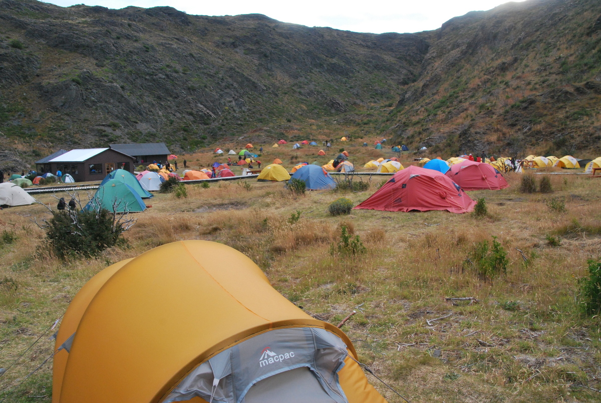
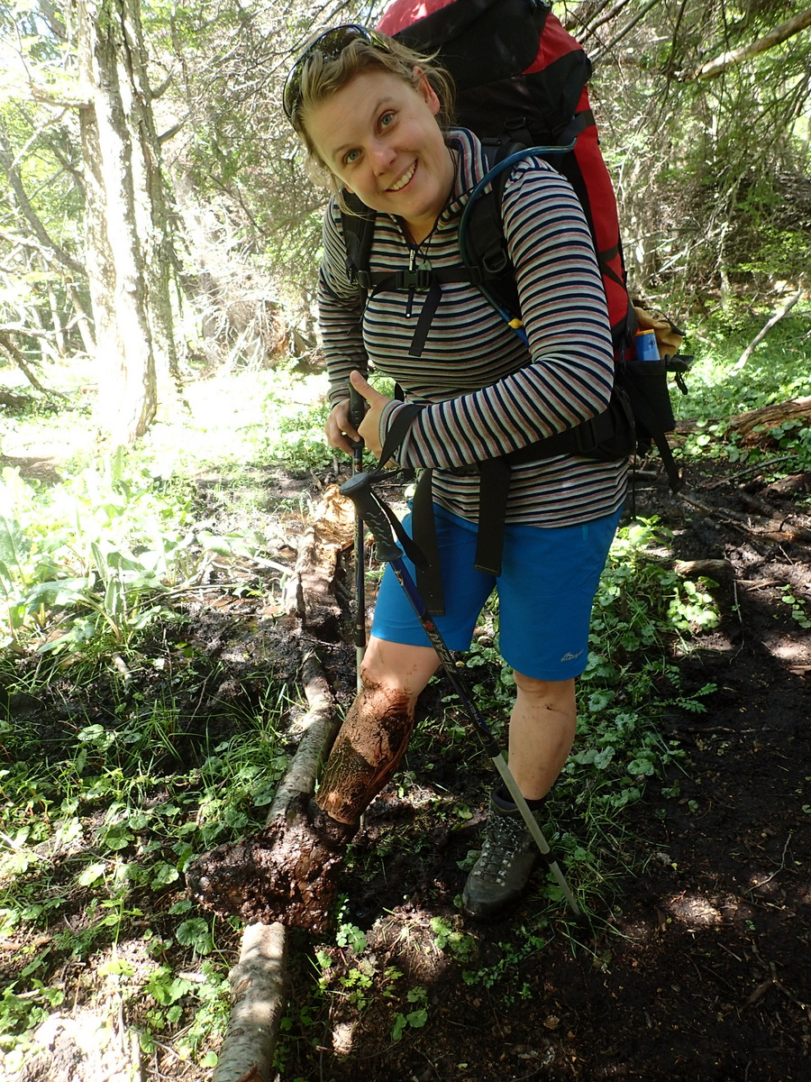
It was hard enough going for the first few days. While we did have mostly dehydrated food, 10 days is still 10 days, and I was definitely happy that we had become at least a little bit fitter after our previous few weeks hiking out of Ushuaia. We started at Laguna Amarga, then headed to Seron for the first night. Annoyingly, the dataset I’d downloaded for my GPS I hadn’t checked properly, so the route wasn’t in it. Completely unneeded as you’d have to be blind to miss the trail, but still.. one to check for next time. There were these handy little maps around the place, handy, if quite misleading. The heights and distances never seemed to be accurate, but it did give you a rough idea of where you were, and the sort of terrain you were going to be crossing, and it was always a lovely surprise when you thought you had 3km to go, but actually only had 1.

01-DSC_000104-P122001303-P1220006

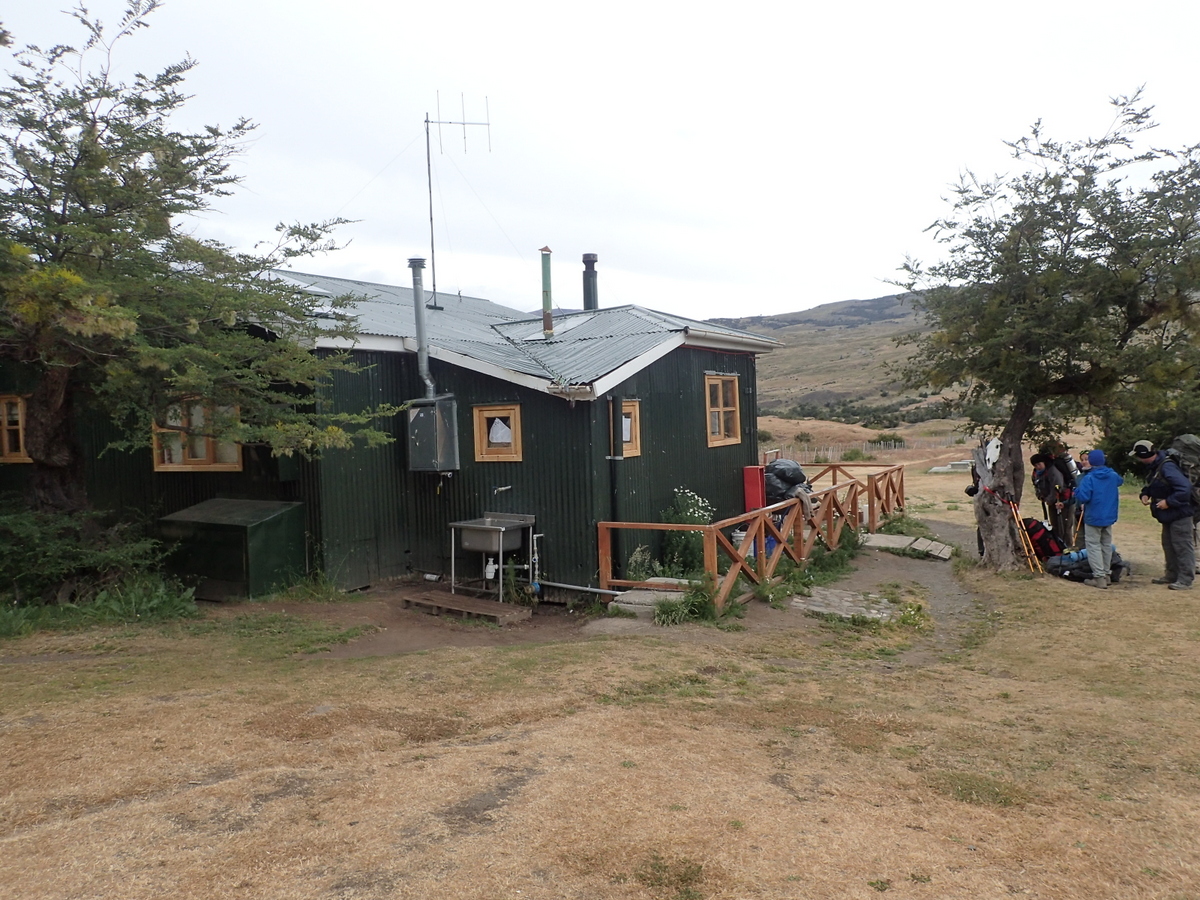
The national park is a National Park, however, there is private land ringing some of it, and they certainly make the most of the tourist dollar. The campsites on the private land (including Seron) charged more, and gave worse service than did the ones on the National Park. In fact, the best toilets we found was at the free campsite at Torres. Maaike has banned me from taking / putting up pictures of toilets. Personally I think this is a shame, feel free to comment ;)

02-DSC_000208-P1230029

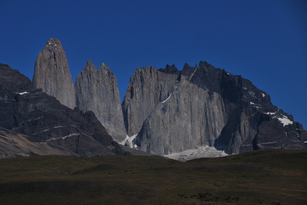
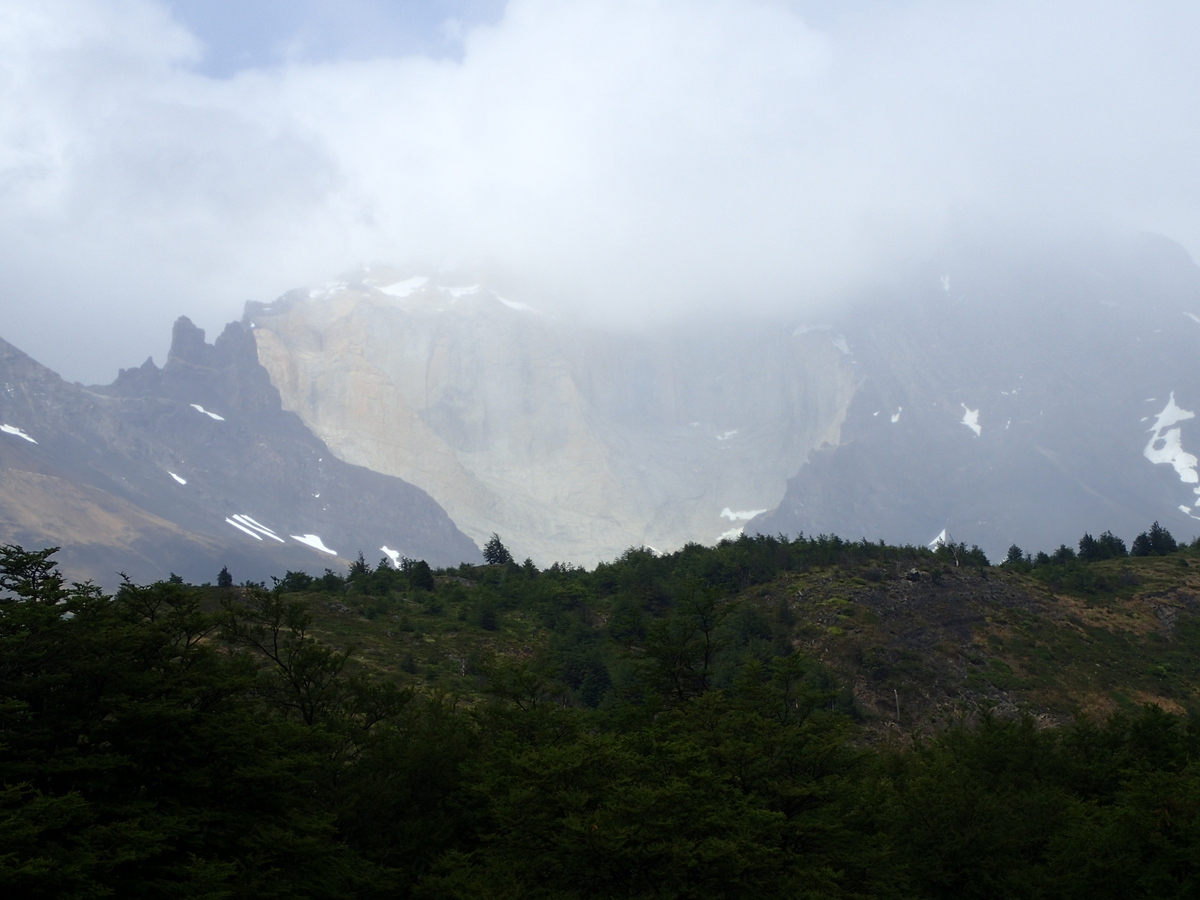
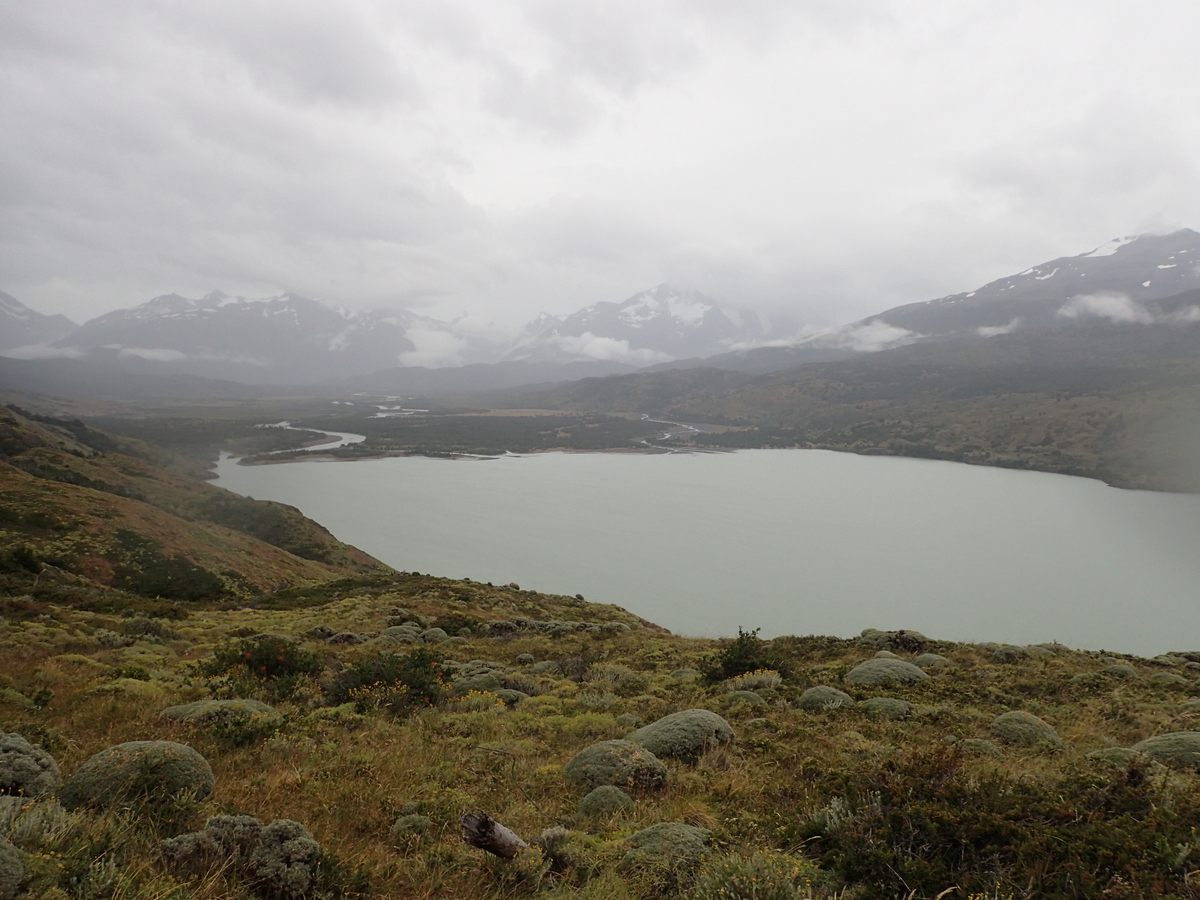
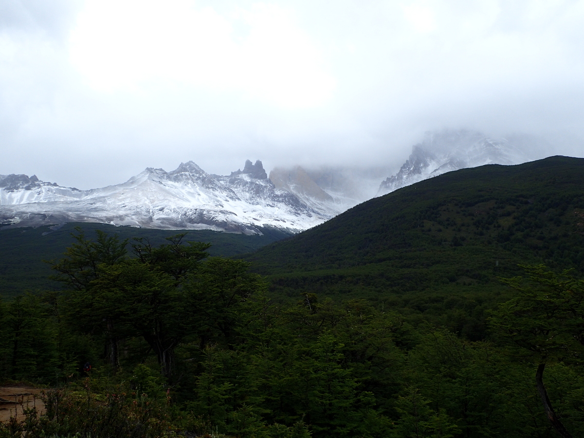
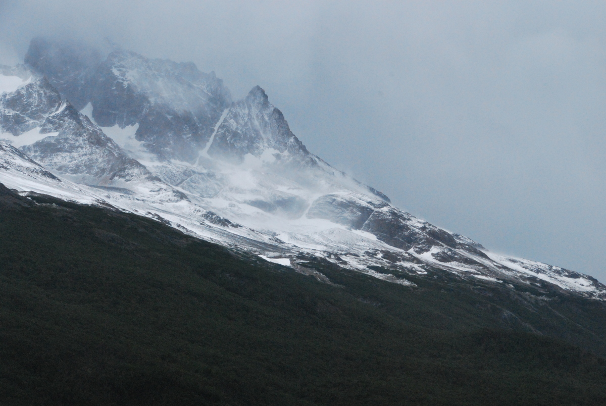
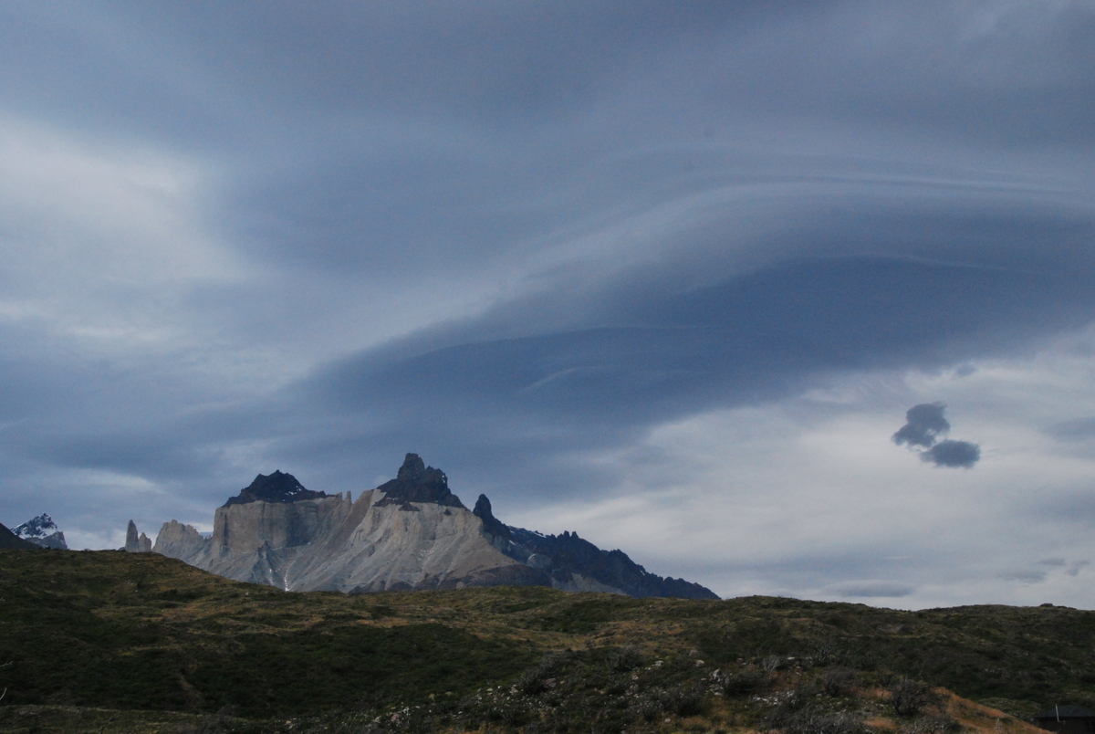
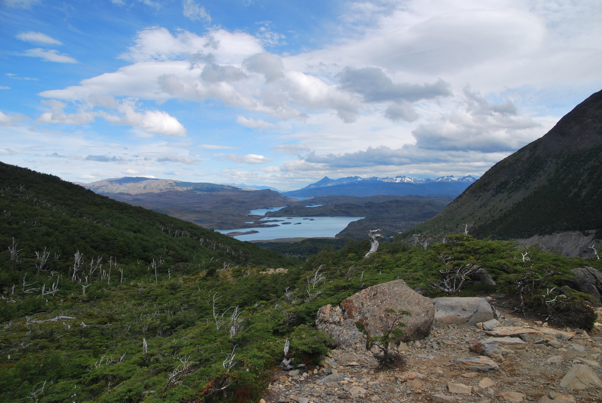
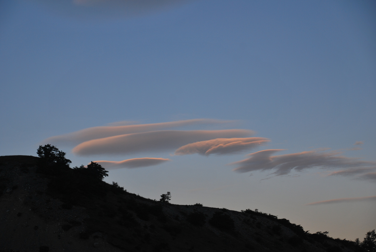
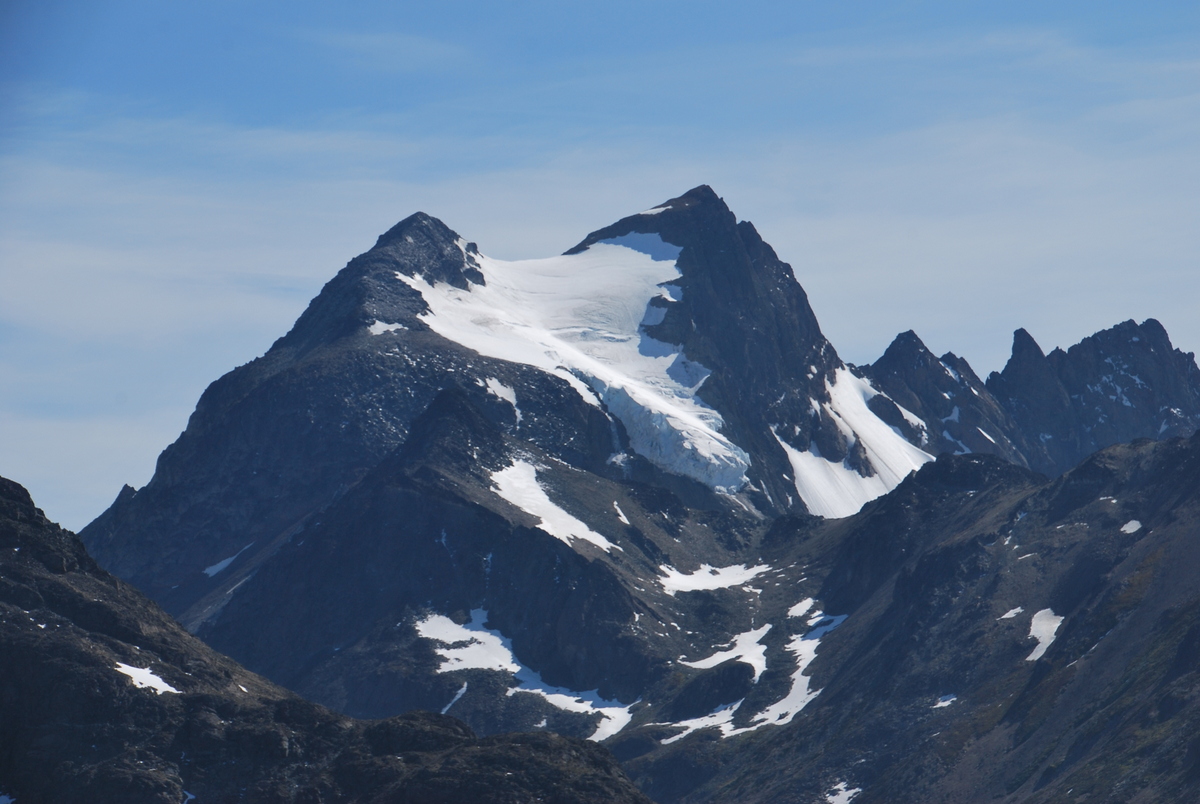
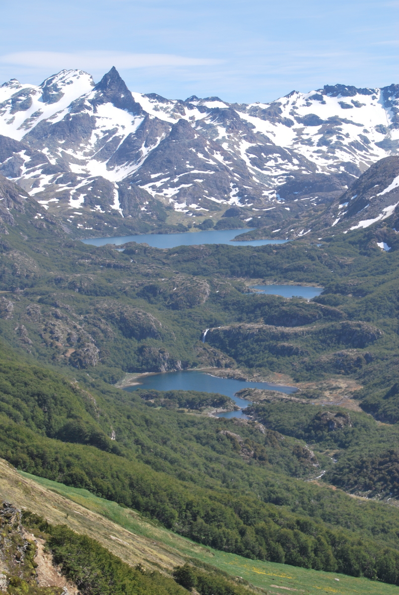
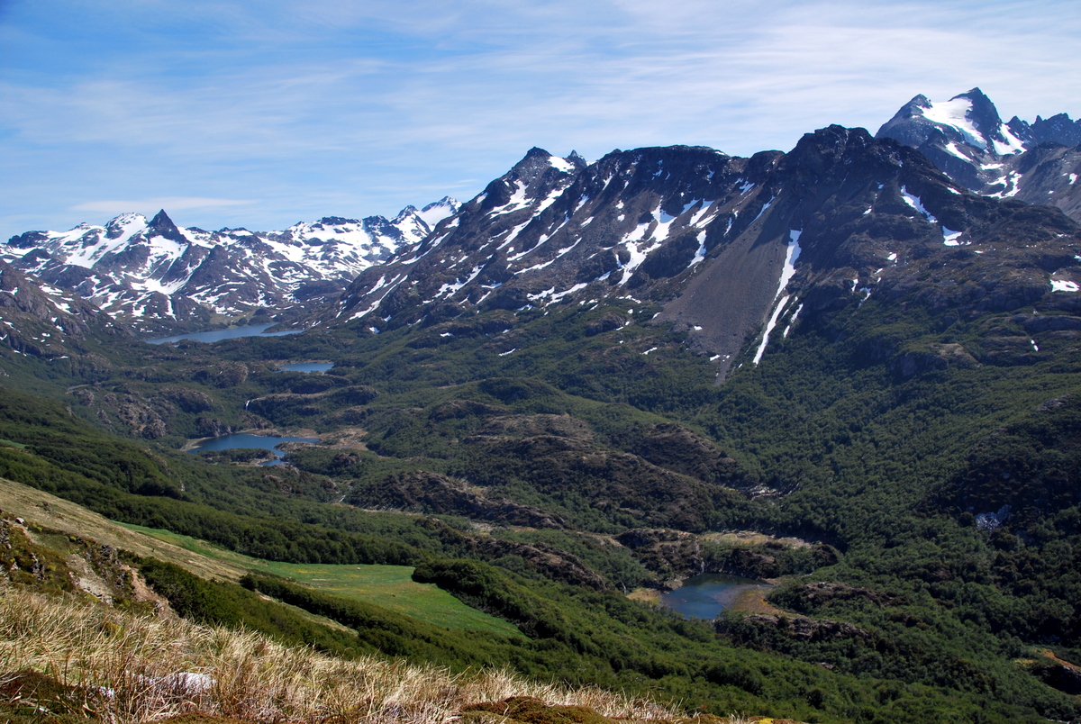
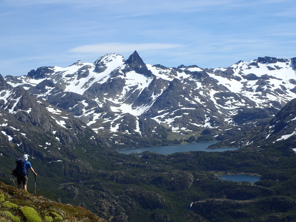
So, onwards and slowly upwards – next day to Dickson. Nice views of the back of Torres, if somewhat covered in the snow which had been falling up higher that day.

07-P122002606-P122002005-P122001712-P123007311-P123006810-P123006109-P123004015-DSC_001414-DSC_000713-P1230074

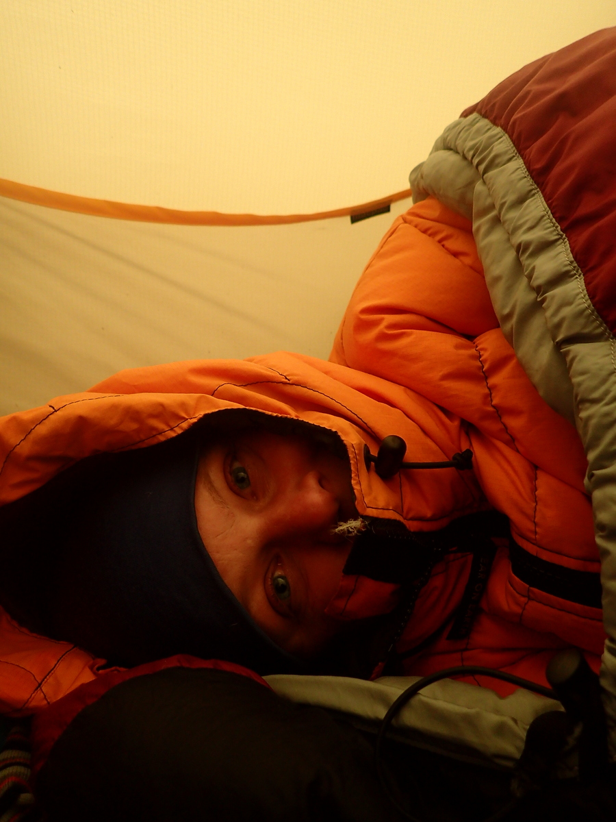
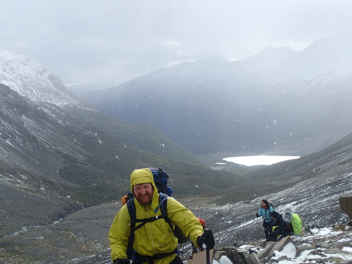
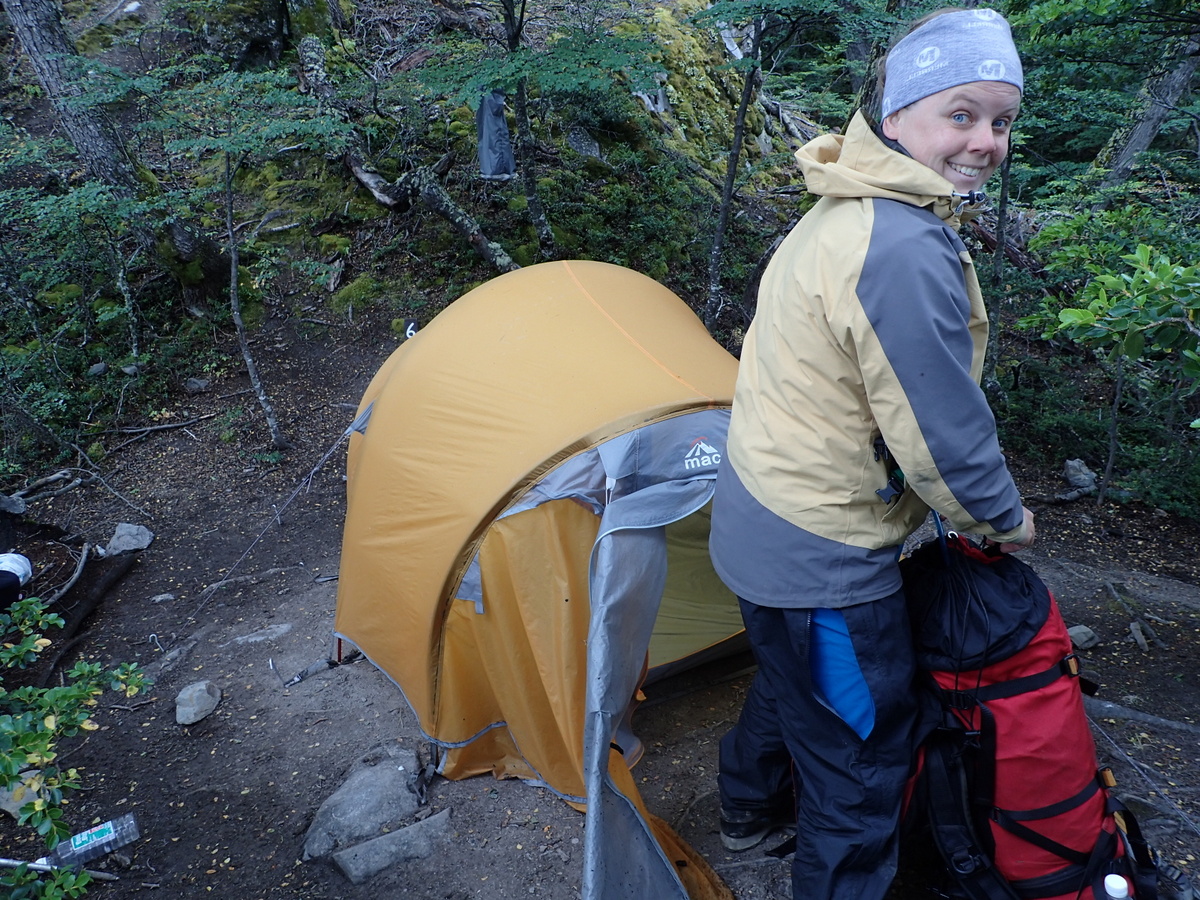
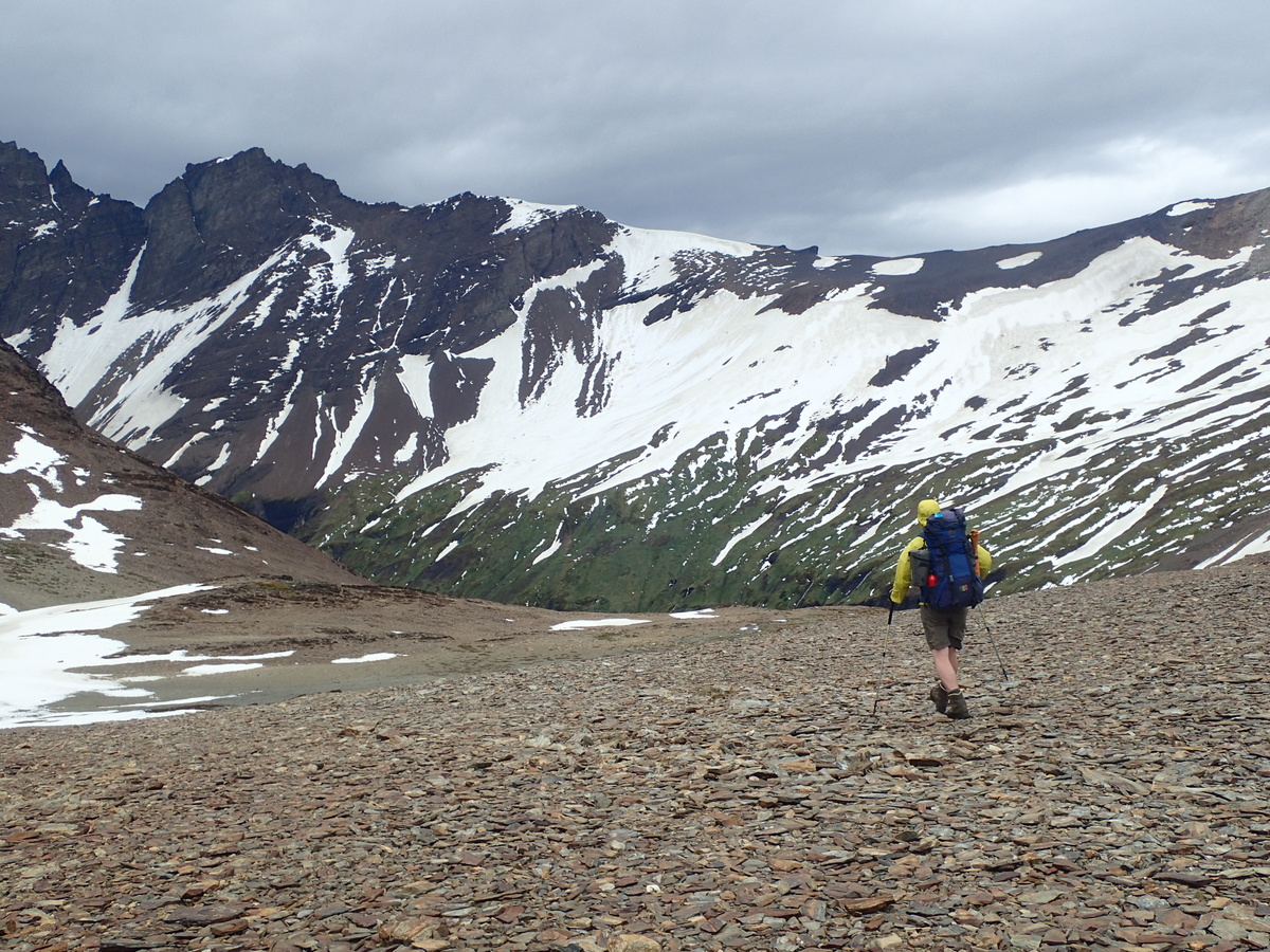
We were lucky in that the weather turned quite foul later in the evening, but after we had put up the tent. Hurrah. Not quite sure what the future was going to bring, as in 2 days time we were going over the main pass (Passo John Garner) at 1180m, and they do close the pass. Next day, up to Campamento Los Perros. We had completely terrible views on the way up… and it was very very cold, and rainy. It was bucketing down in fact. There was a shelter at the camp which everyone hung out in trying to keep warm. The pass had been closed that day, so the campsite was actually very full, as it had 2 days of people there. I congratulated myself again on choosing a tent were you put up the outer first before the inner.. so many tents get this backwards, and I simply don’t understand it. Anyway, our tent was perfectly dry and warm, but I still slept that night in my down jacket, and I wonder how many of the inexperienced / less well equipped people had a very cold night. We did see people hiking in jeans..

19-P124009618-P124009417-DSC_003416-P124008122-P124010921-P1240104

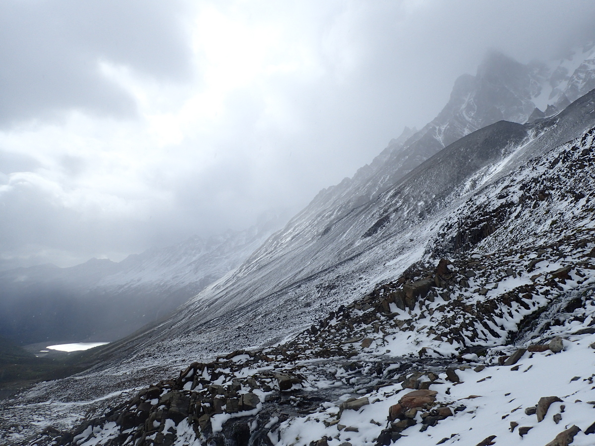
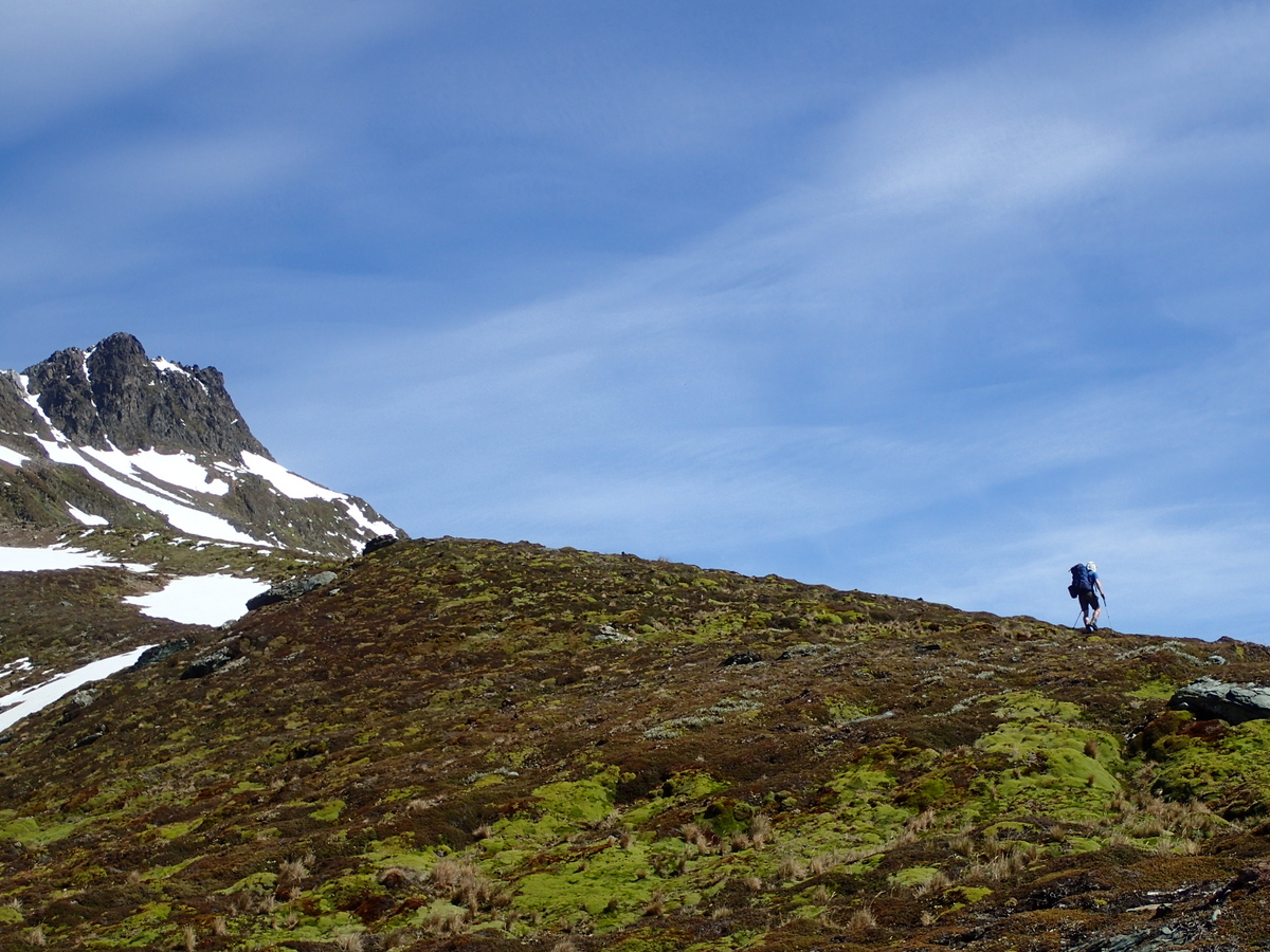
Next day, the weather had improved (wind had dropped) and the pass was open, so off up we went. It was still quite windy at the top, a lady in front of me got blown over!

20-DSC_003726-P125012025-P125011924-P125011623-P125011327-P1250125

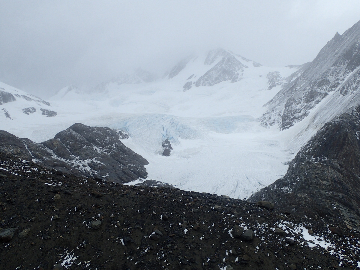
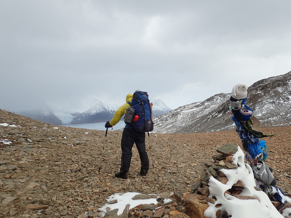
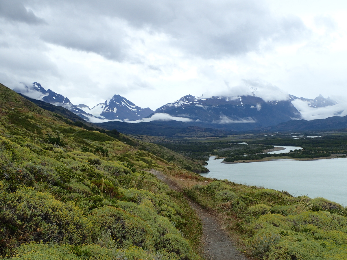
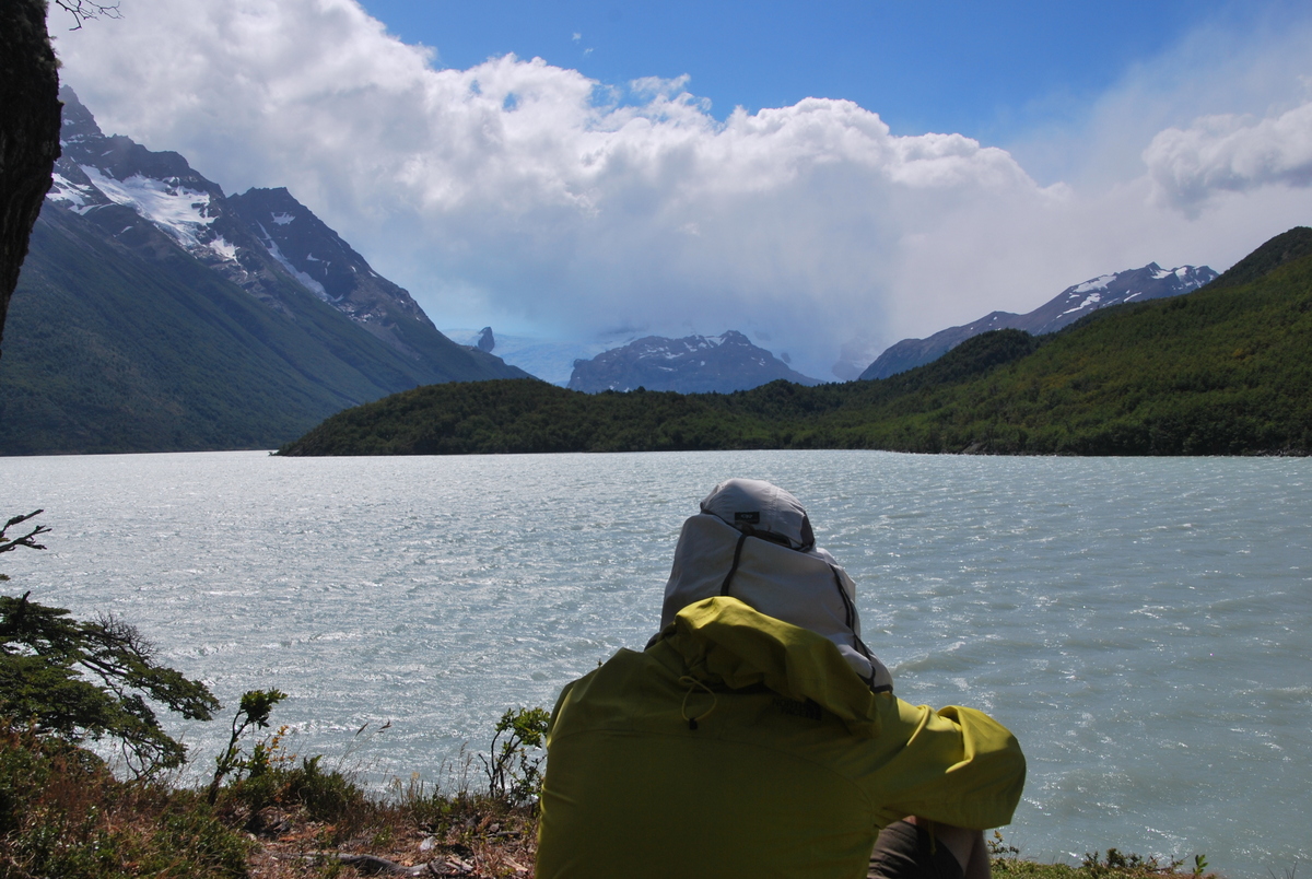
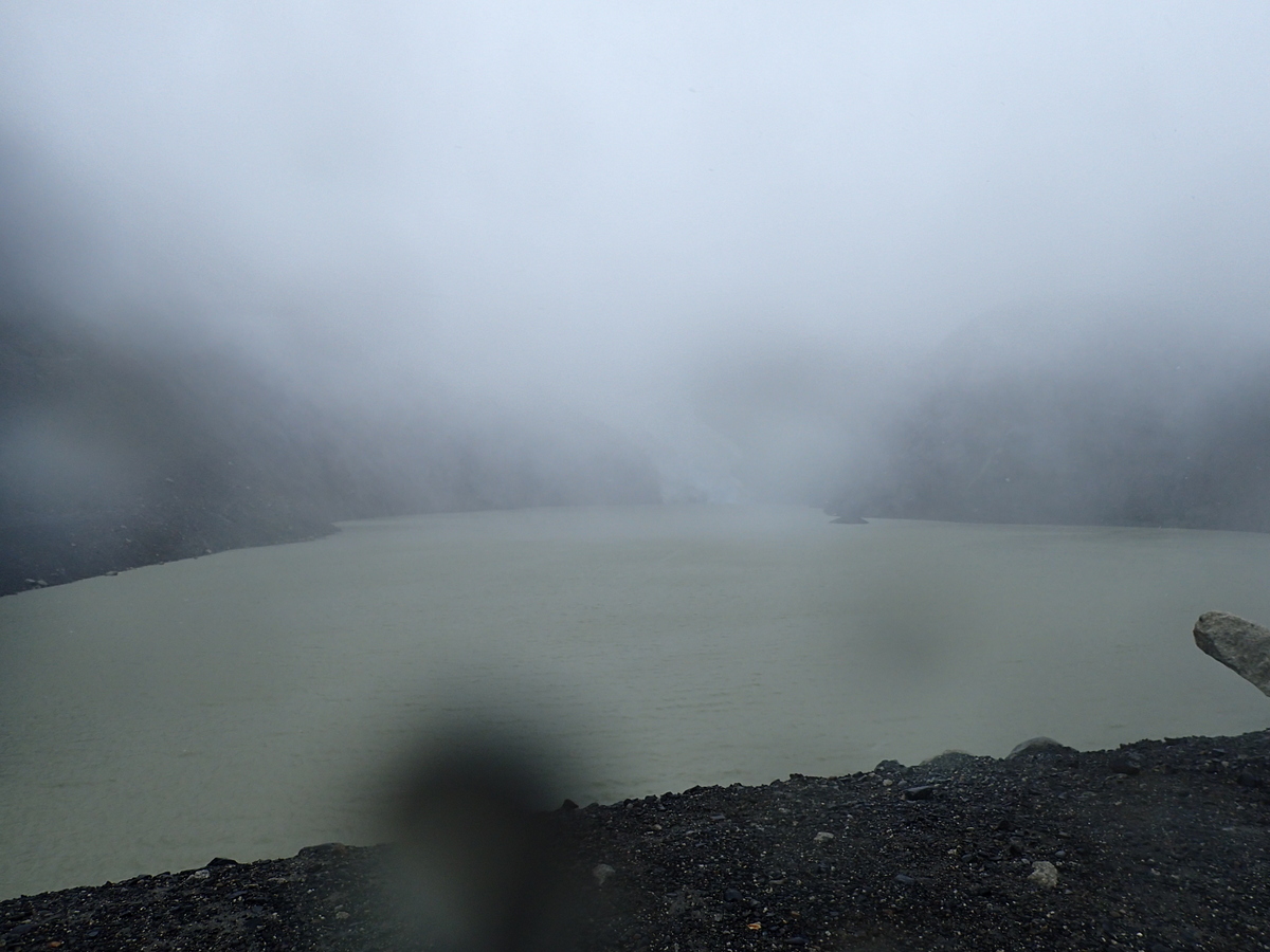
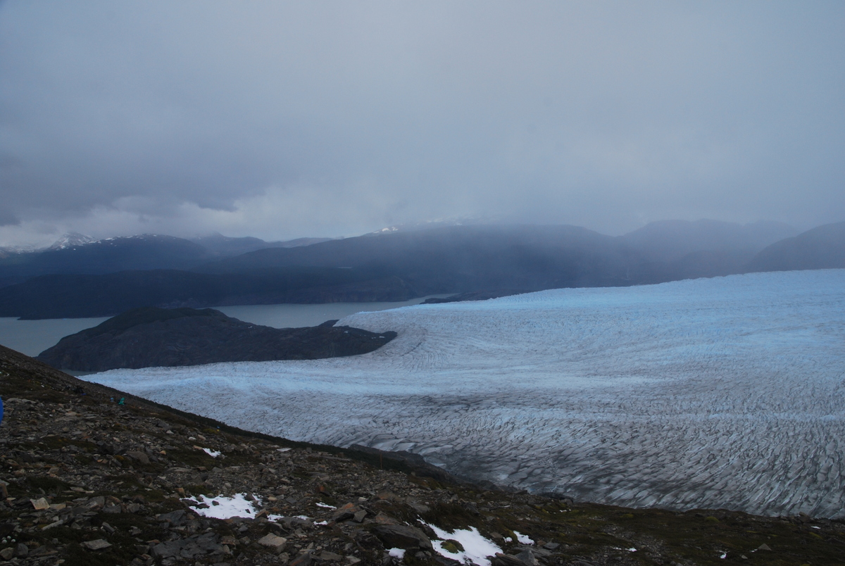
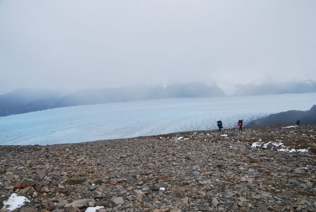
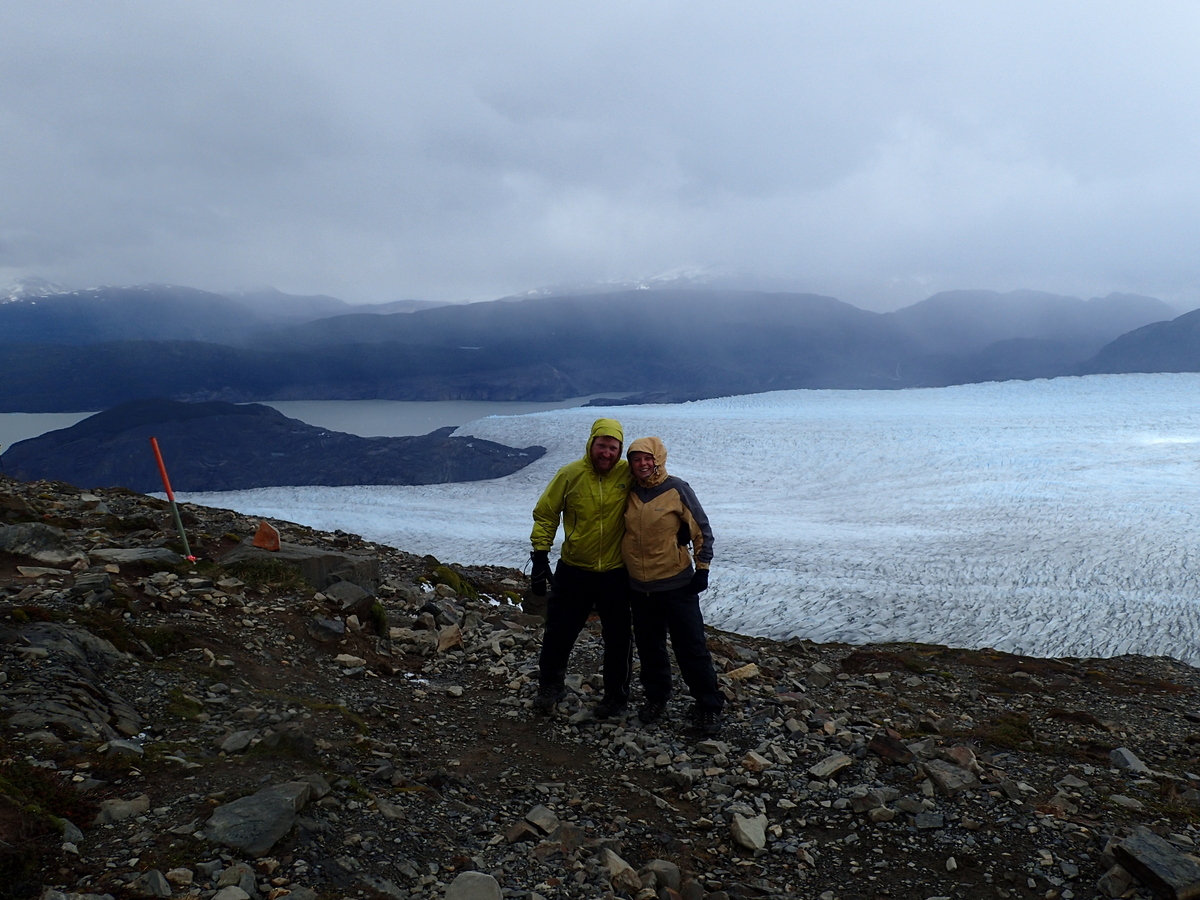
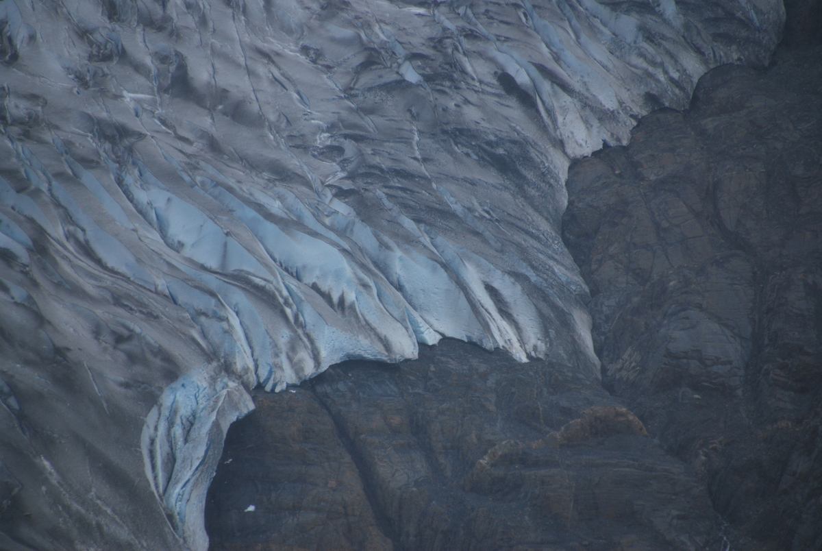
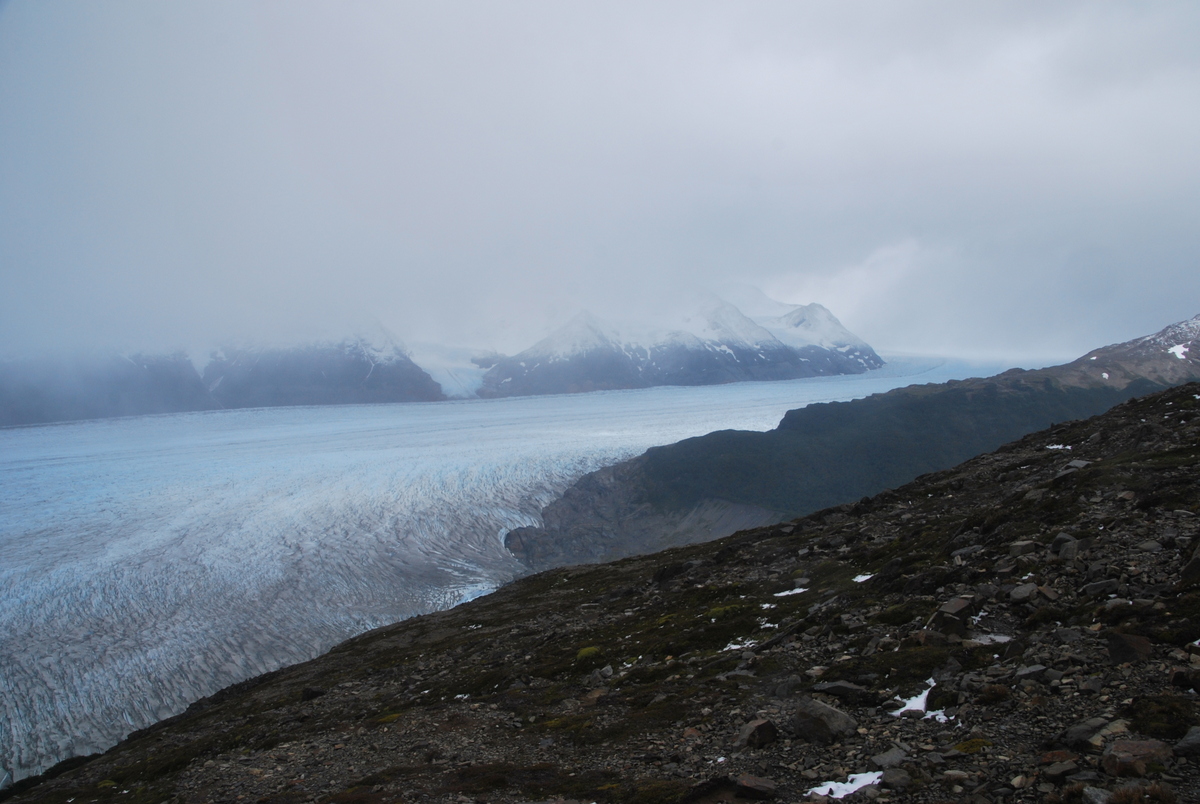
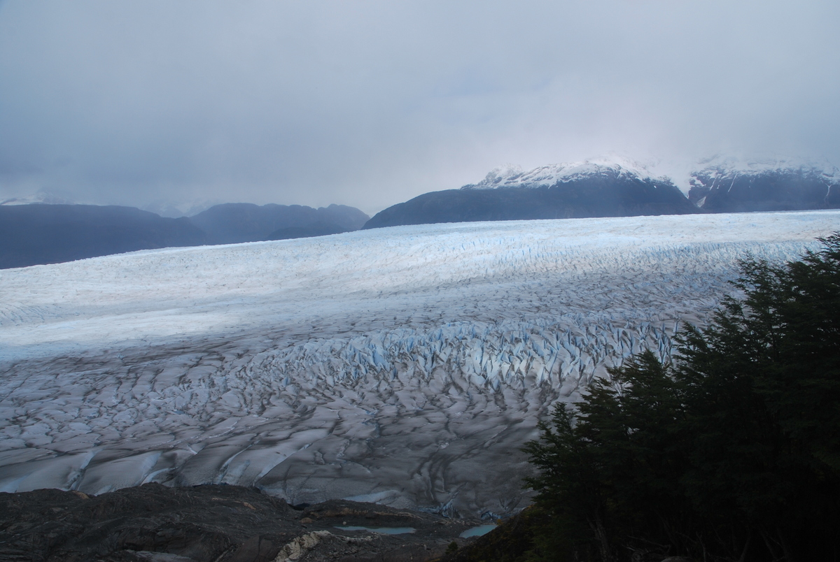
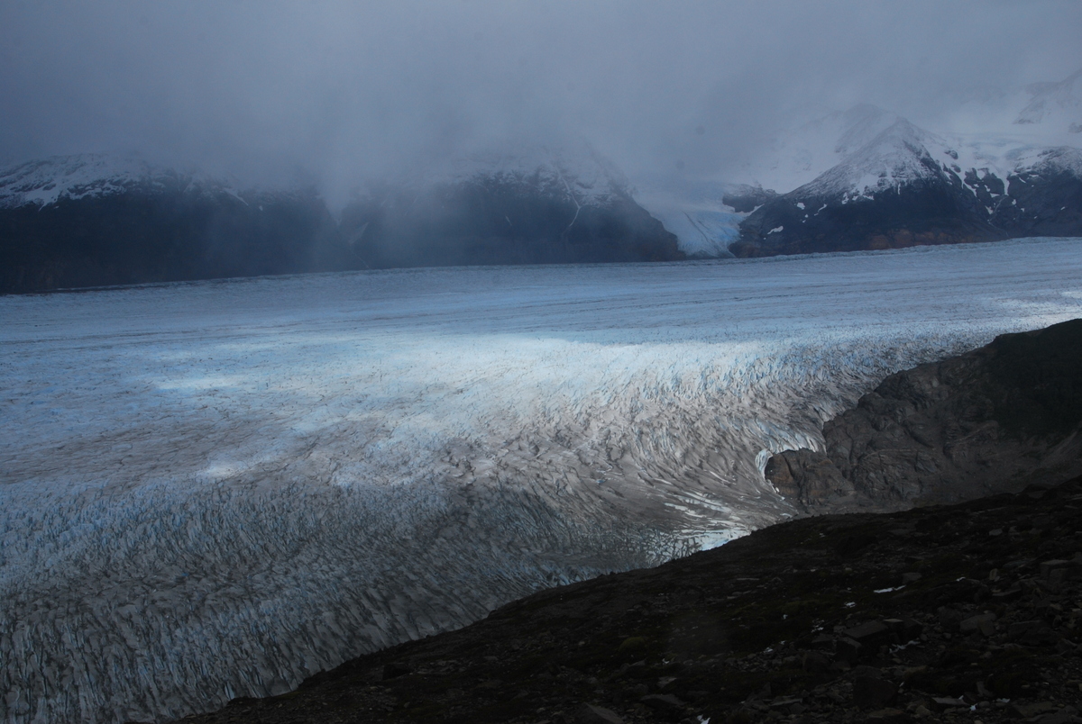
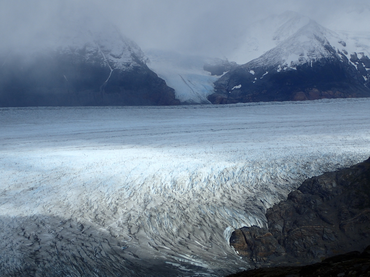
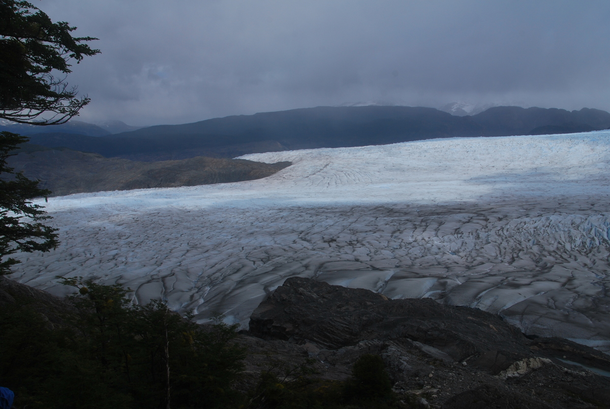
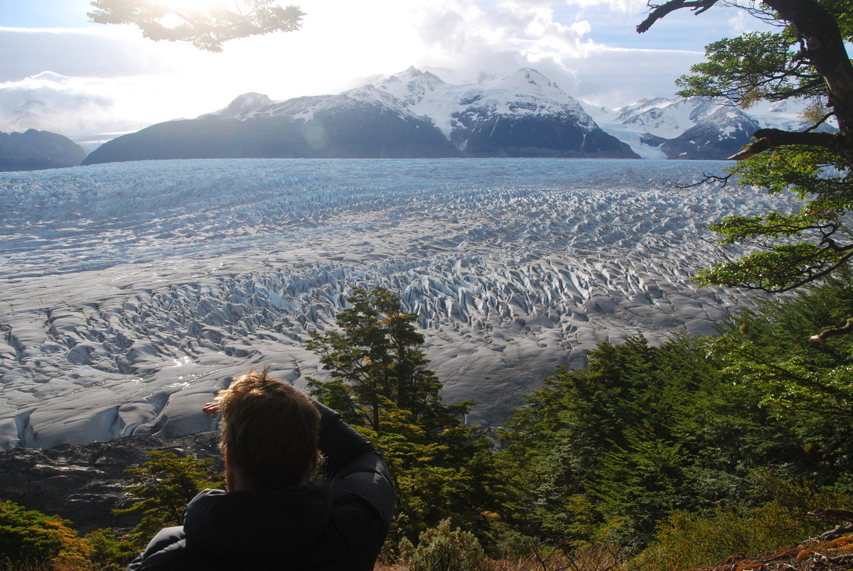
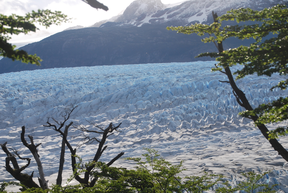
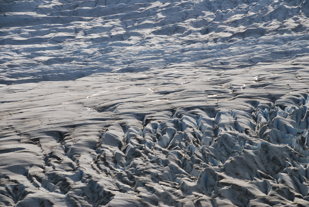
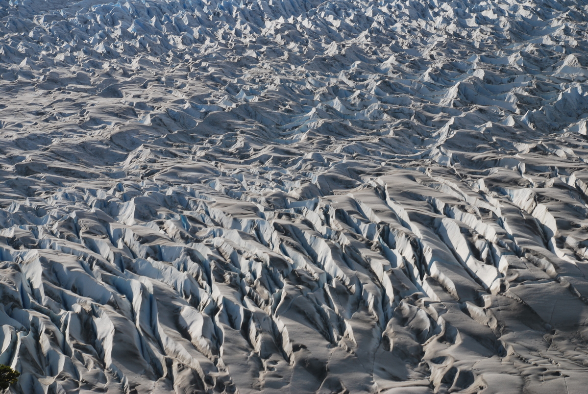
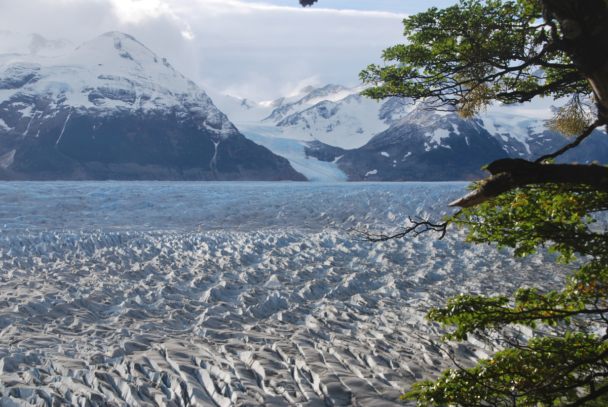
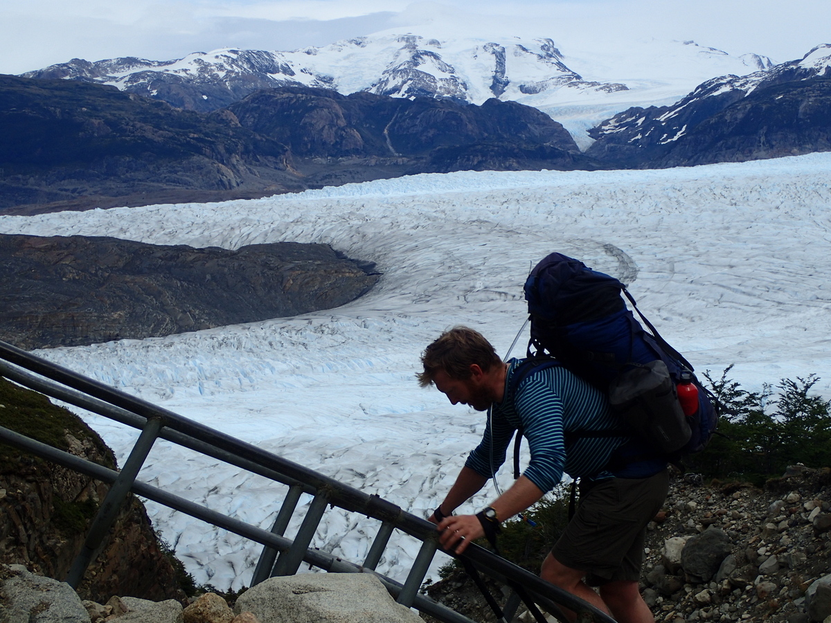
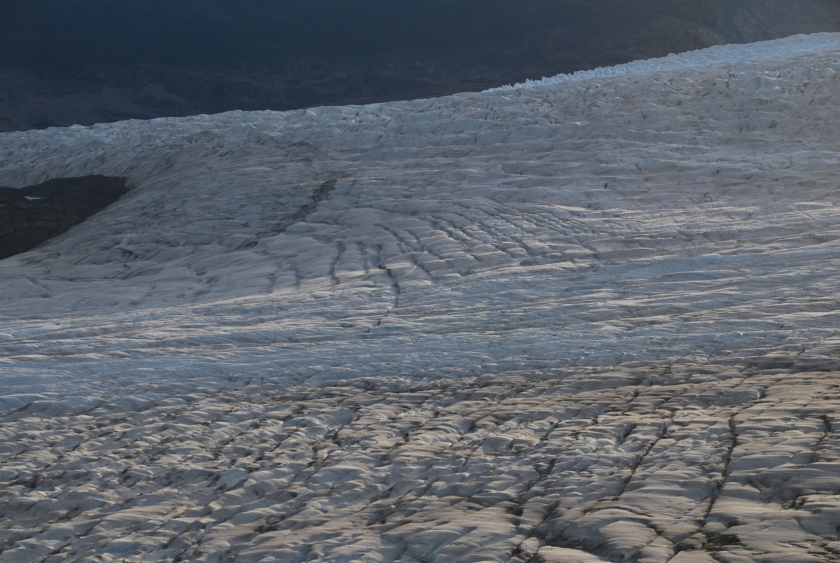
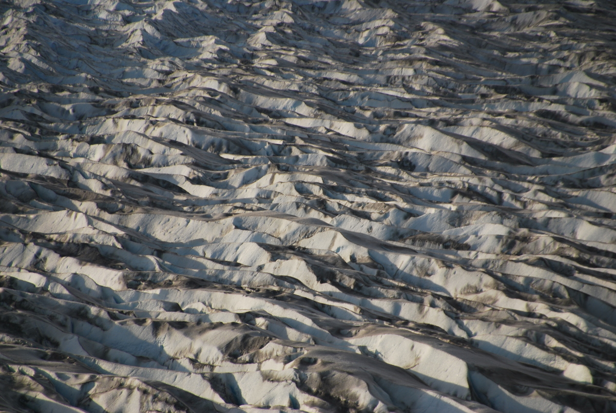
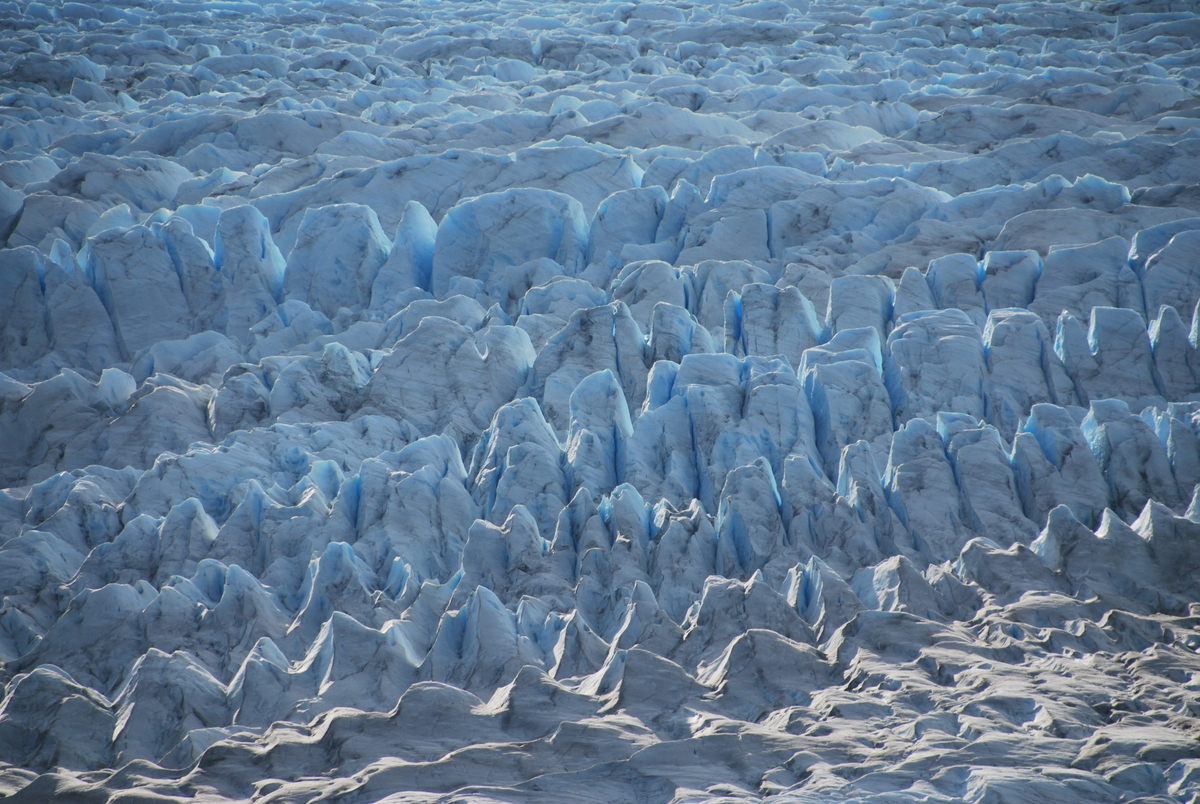
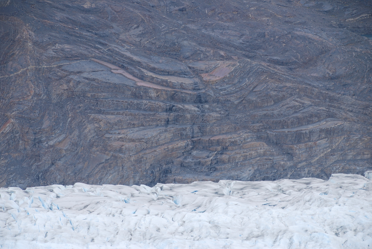
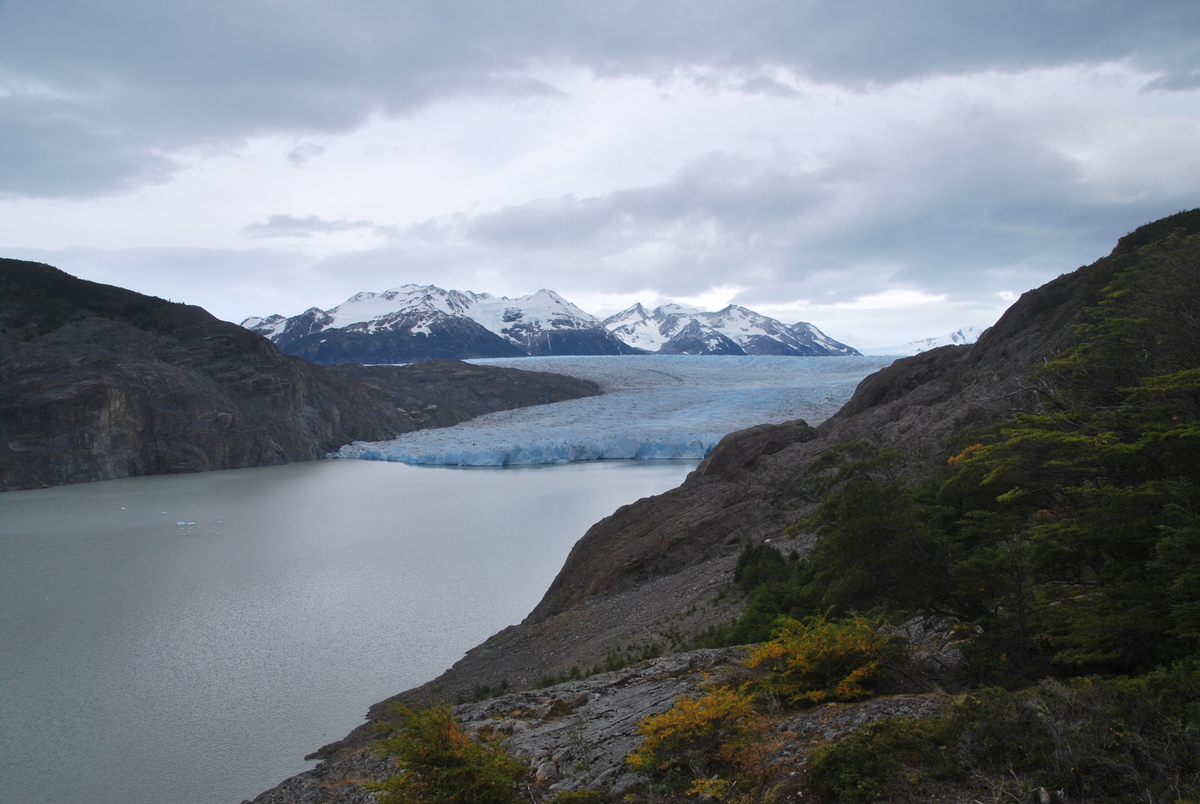
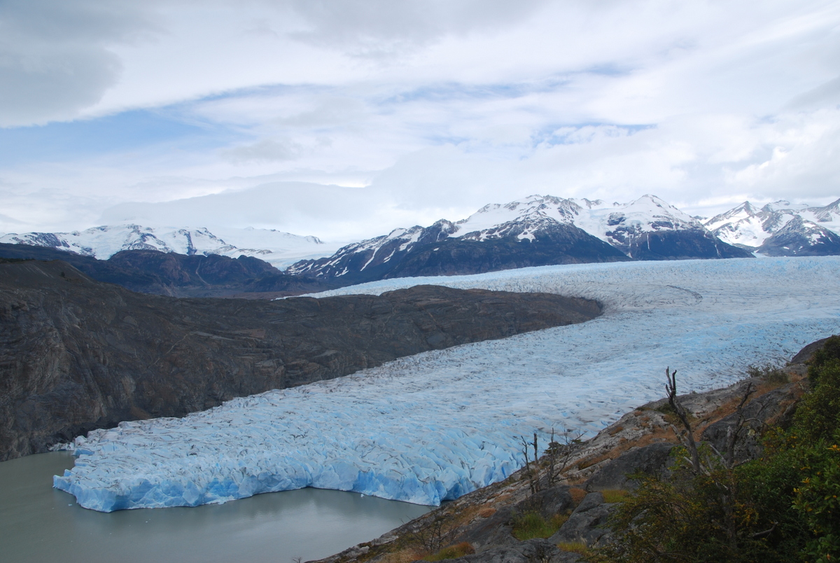
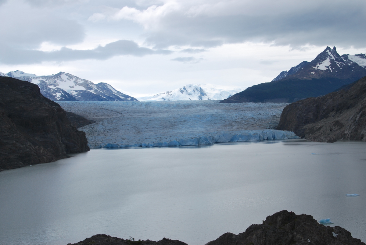
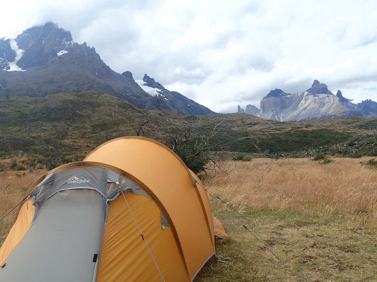
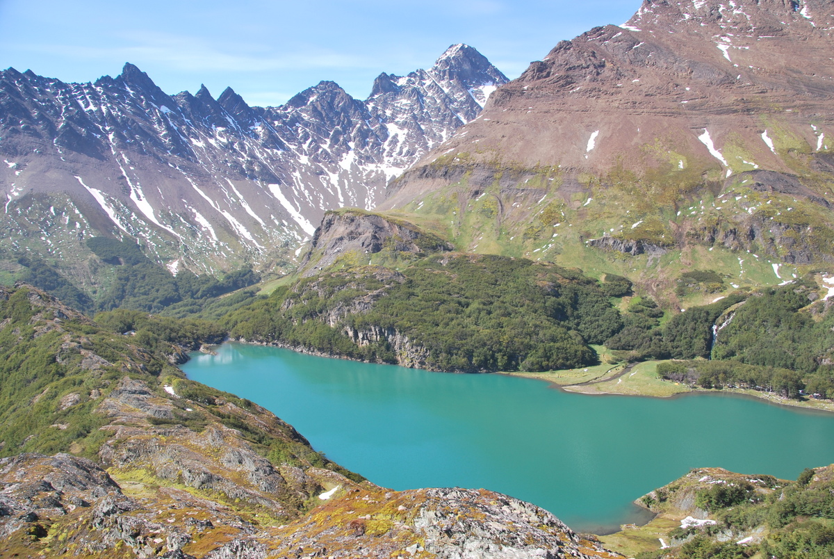
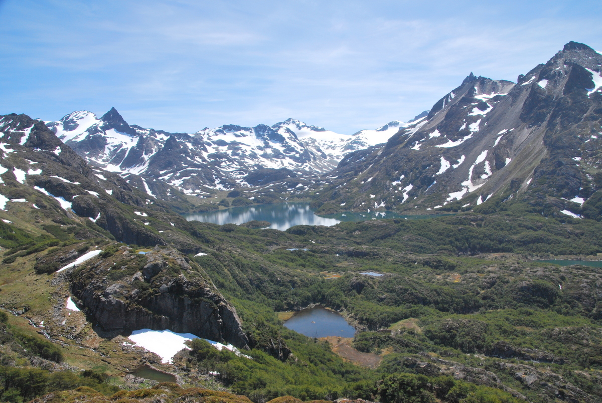
Then Glacier Gray appears, and all is forgiven. That really is a magnificent sight, and we got to enjoy it for the next two days. That night we stayed at Camp Paso, a free campsite. When the sun came out again, we went a little way from the camp and took some more pictures, it’s just stunning in the sunshine – all the colours come out, and you can see the relief better.

29-DSC_005128-DSC_004633-P125013932-DSC_005831-DSC_005530-DSC_005436-DSC_007035-DSC_006134-P125014240-P125017639-DSC_008438-DSC_007937-DSC_007644-DSC_009243-DSC_008942-DSC_008741-DSC_008647-DSC_009946-DSC_009845-DSC_0096

Then it was time to make our way to Refugio (and camp) Gray. On the way we saw an injured person being stretchered out.

51-P126018350-DSC_013749-DSC_013148-DSC_010554-P126020052-P126018653-DSC_015458-DSC_0167

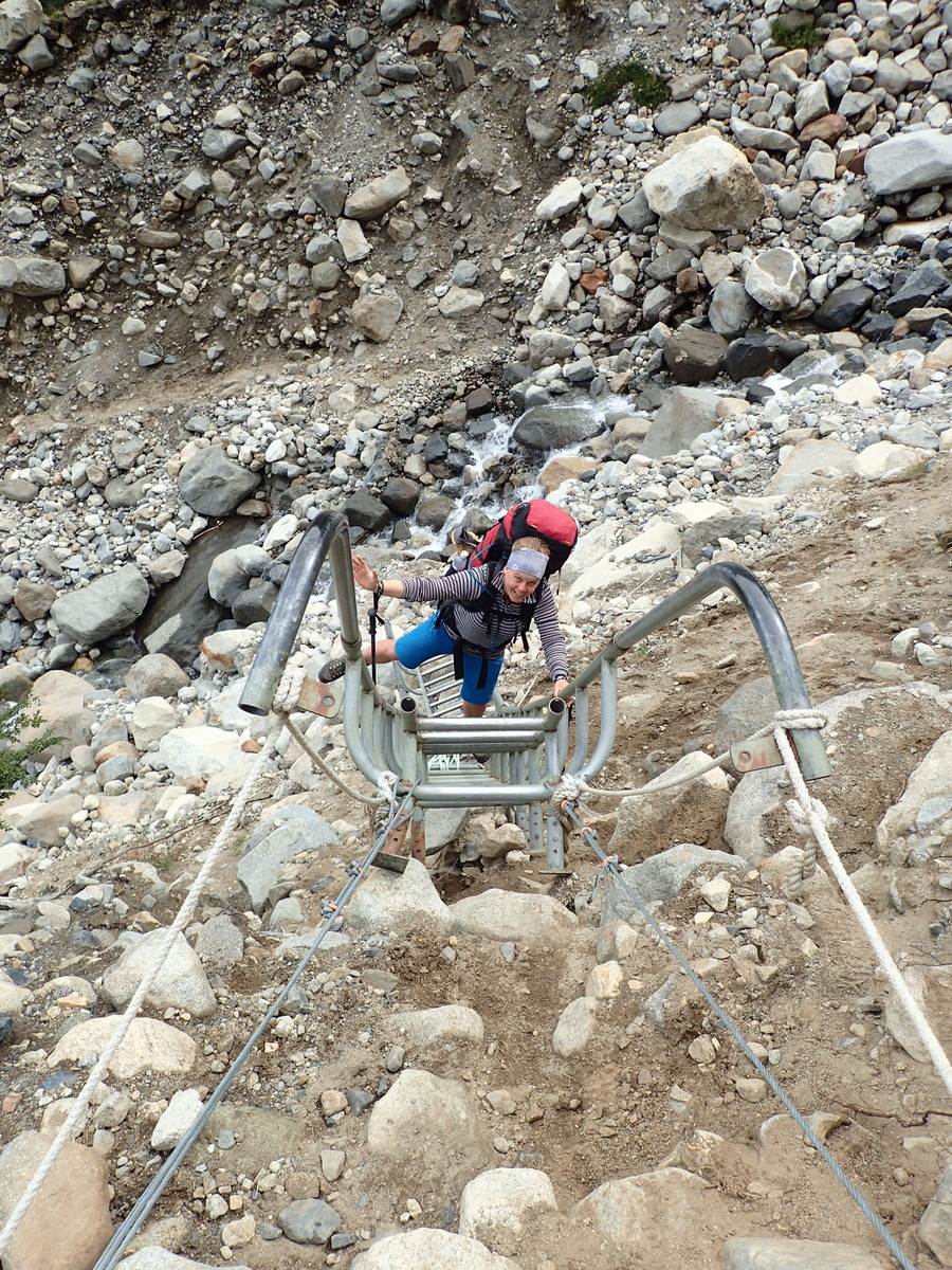
It was a stark reminder of how cushy we have things in NZ. In NZ I do take all the precautions I can while hiking, but I also take a locator beacon. If something bad happens, I pull out the beacon and a signal gets sent to a satellite and they’ll be in touch with the rescue services, generally meaning a helicopter comes and gets you. All for free, due to the wonderful thing that is ACC. I’m not sure what, if any, payment this patient would have had to make, but no helicopter for them :(

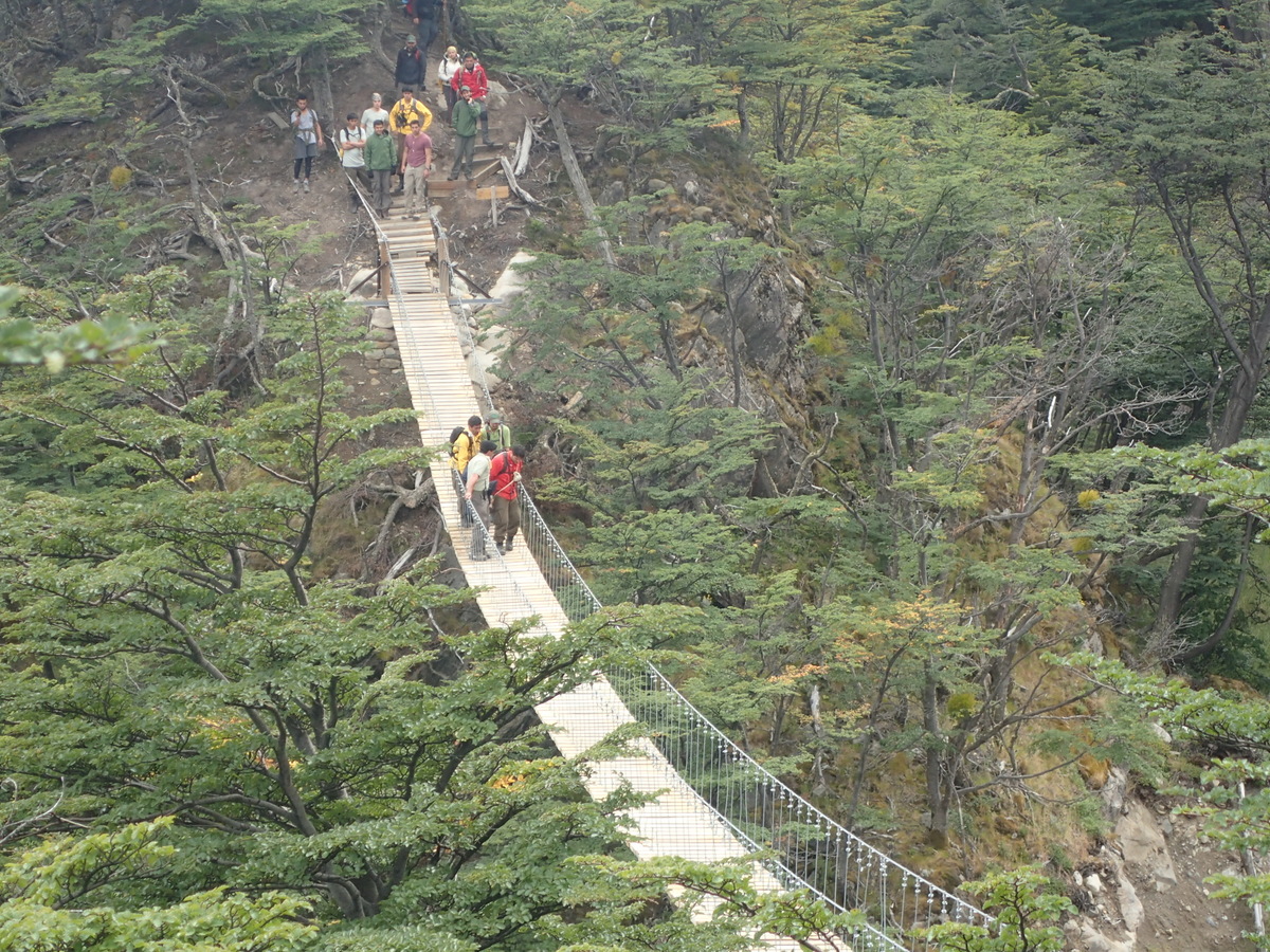
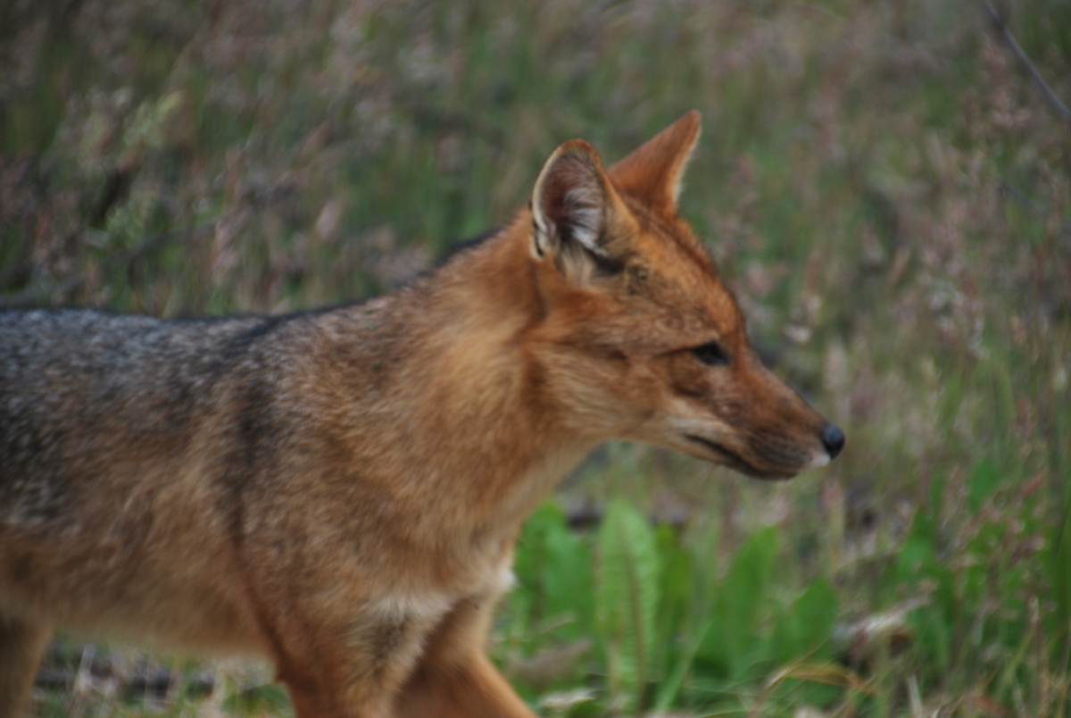
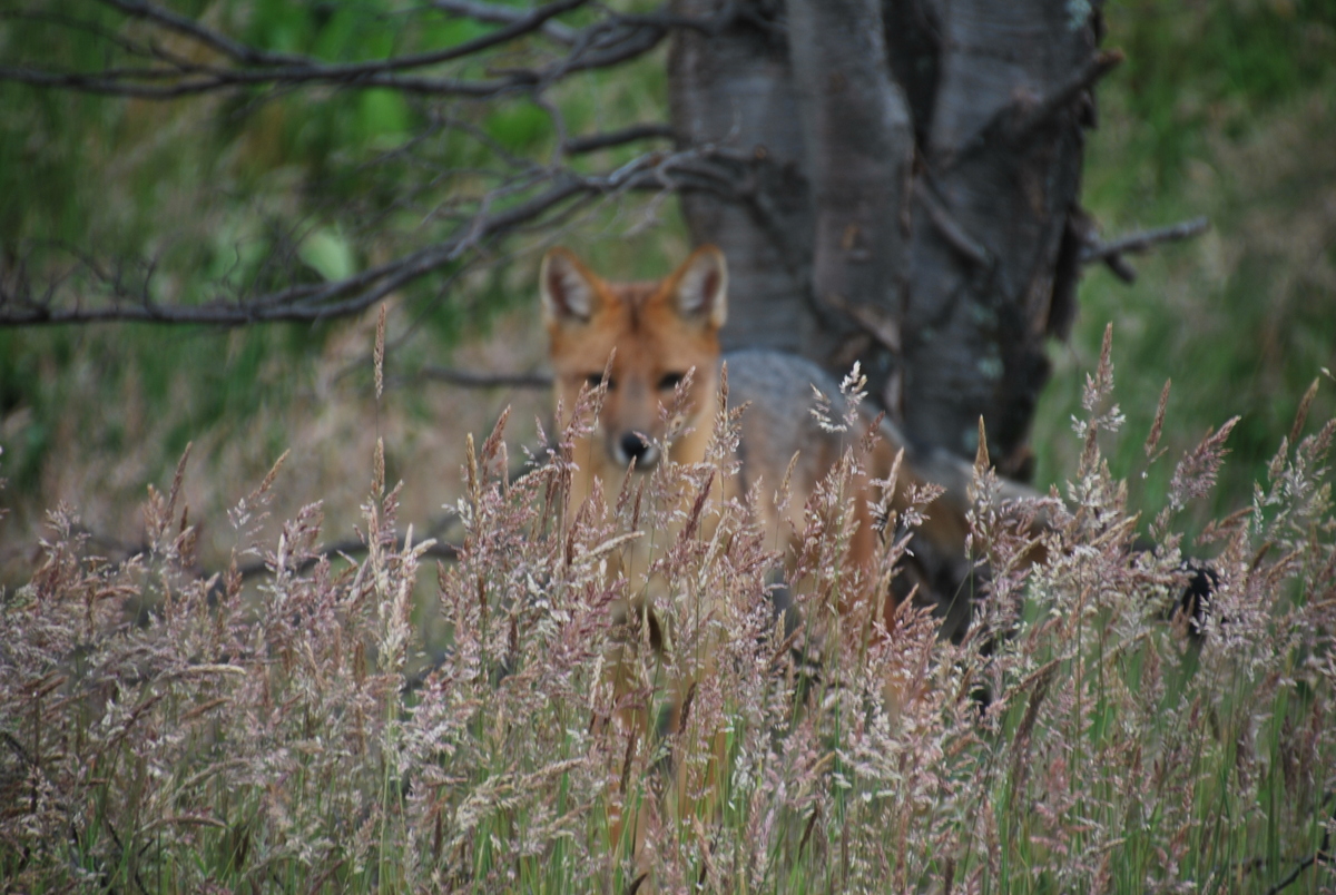
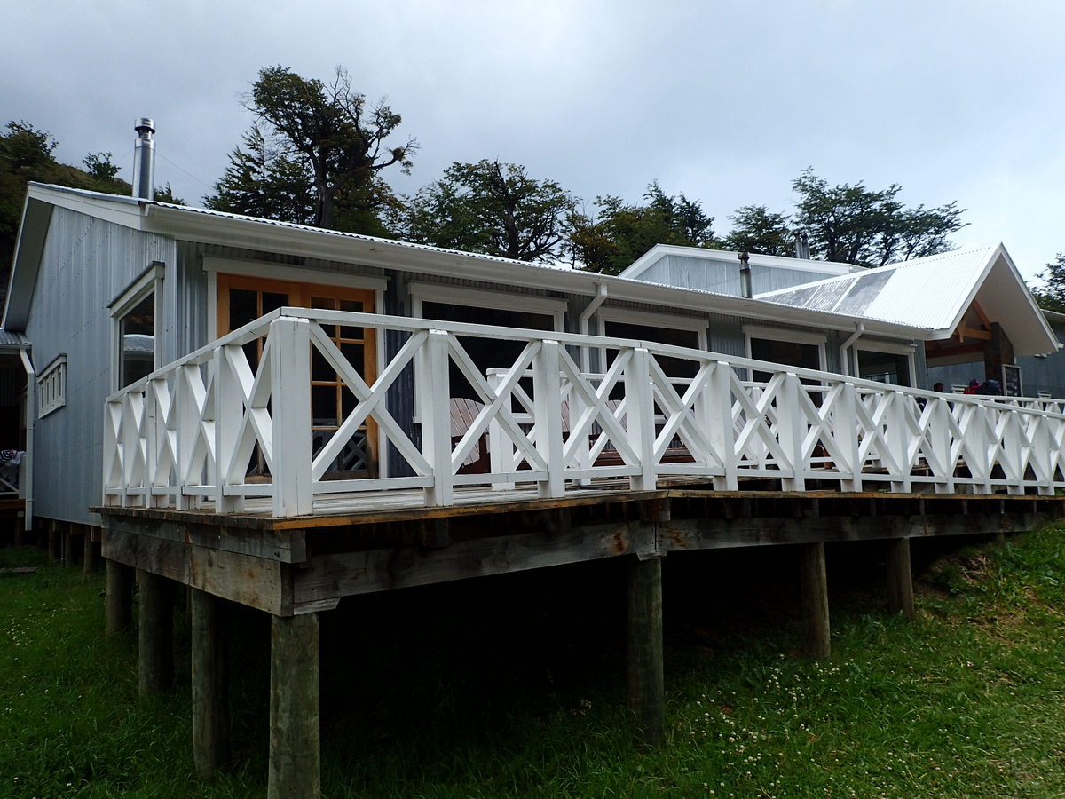
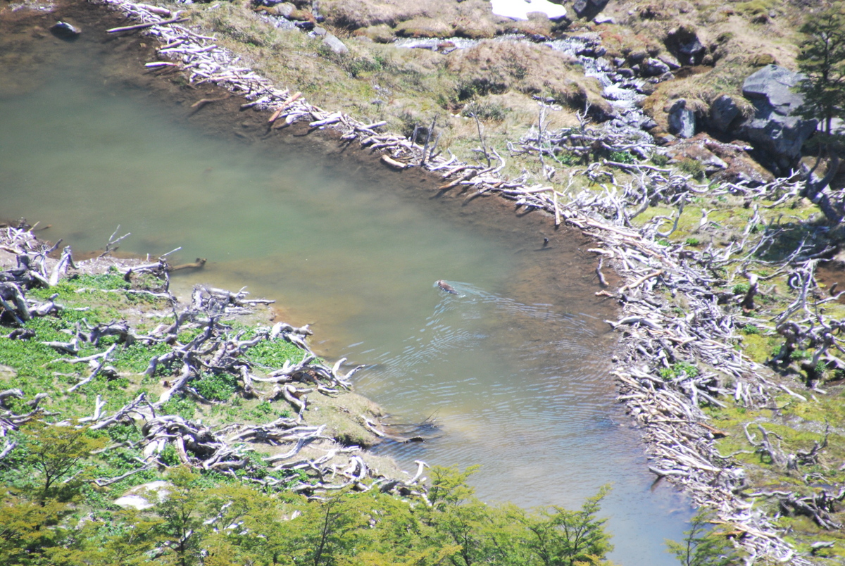
Camp Gray was where we joined the W (popular) route. Certainly the numbers of people increased hugely. Saw a fox there, seemed quite used to people. It was also the first refugio I’d seen here. Comfortable looking places I must say!

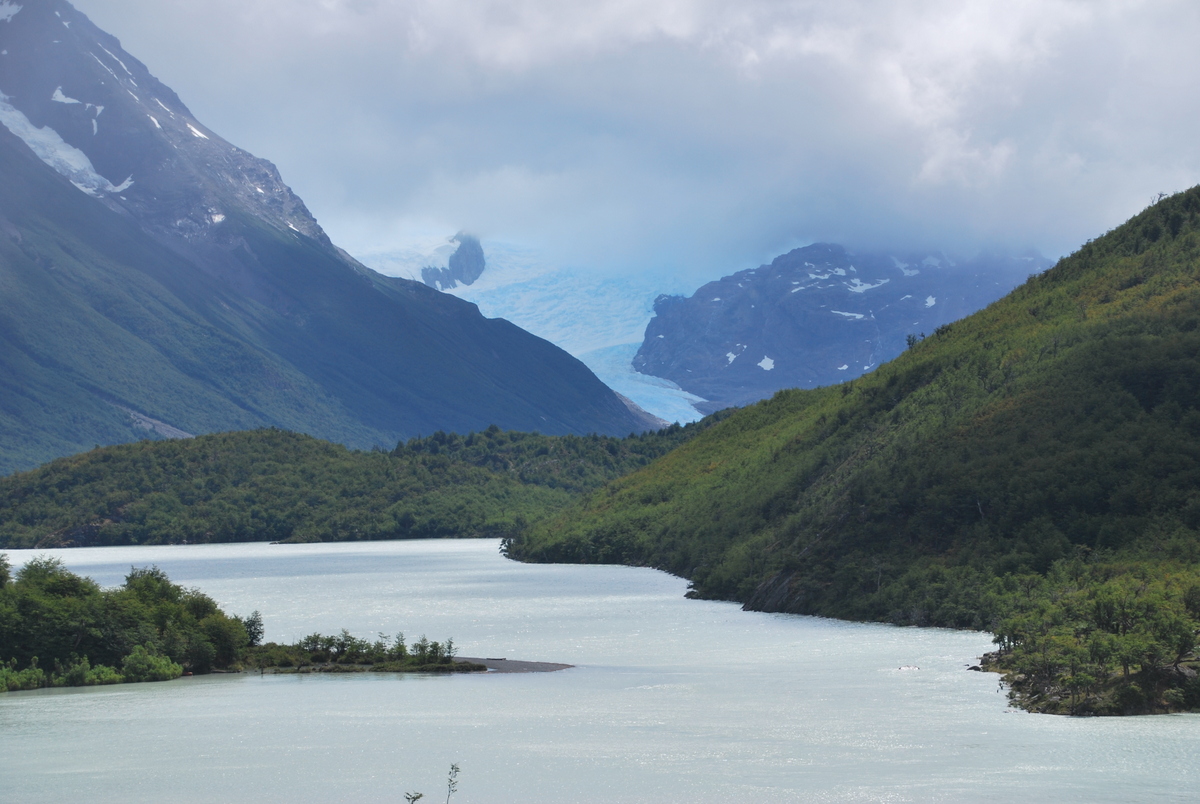
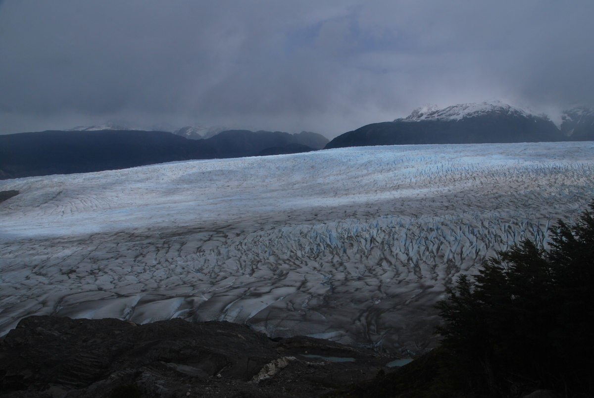
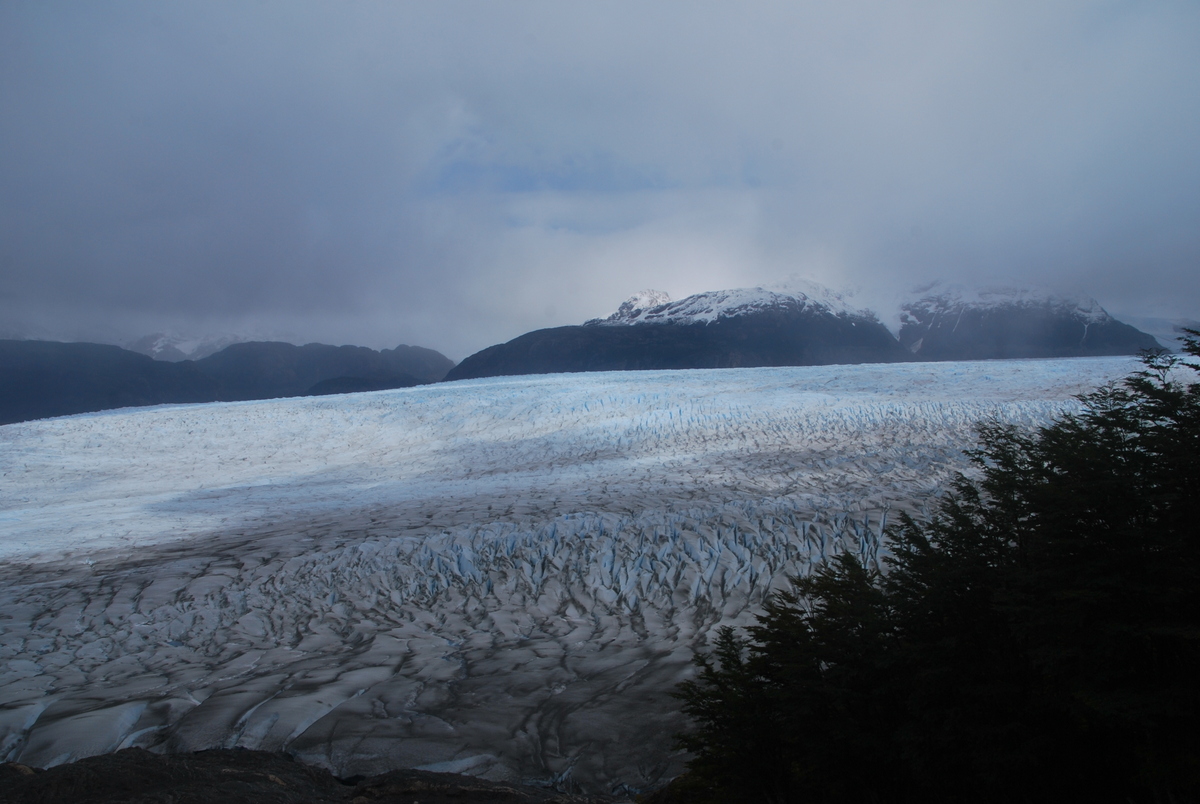
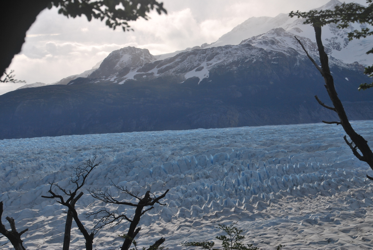
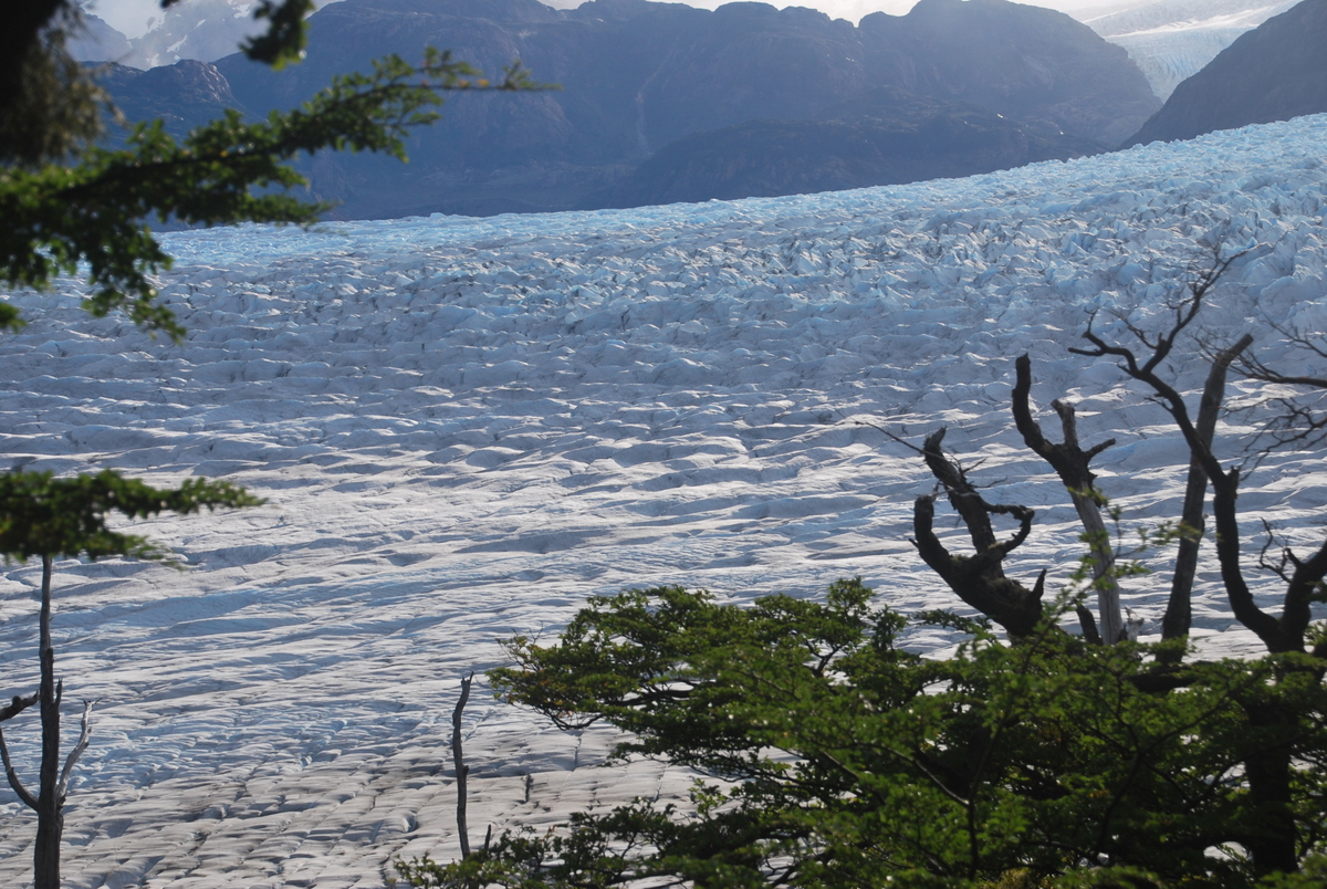
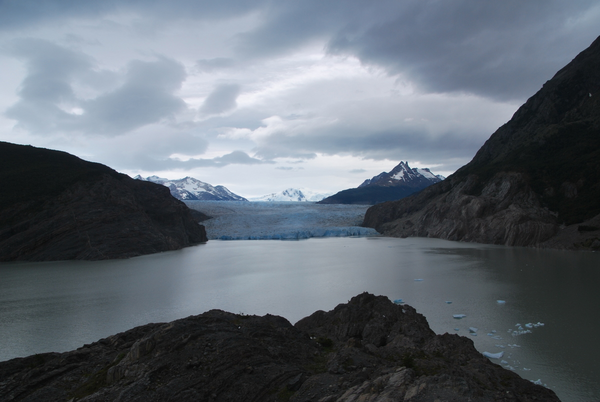
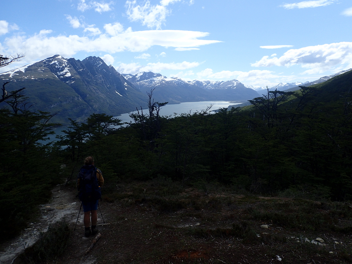
Great views back up to the glacier, it really became a much more three dimensional structure.

60-DSC_017759-DSC_017255-DSC_015961-DSC_018162-DSC_018466-DSC_022565-DSC_021364-DSC_020363-P1270213

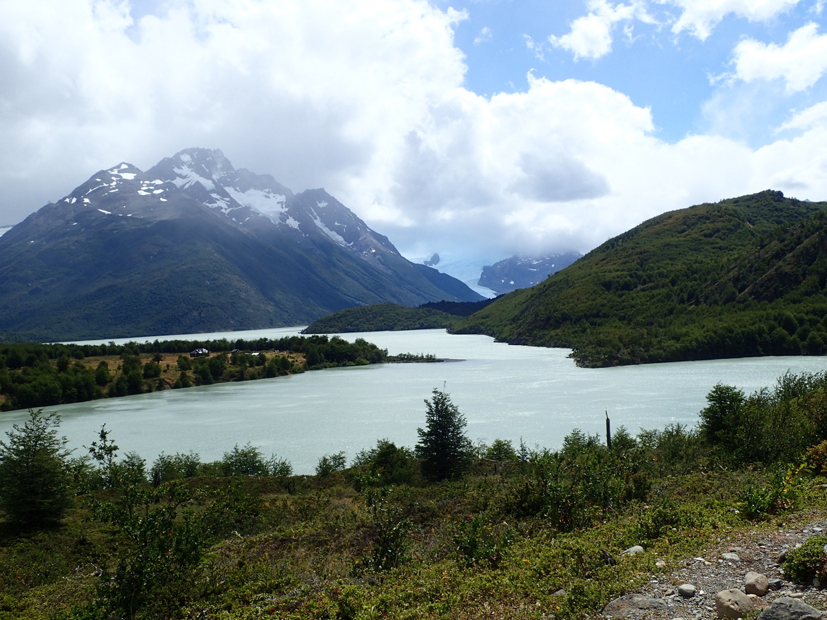
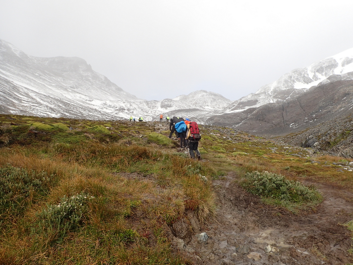
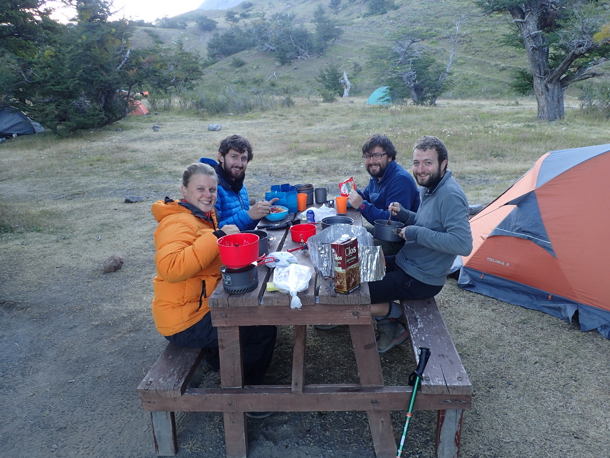
Next day it was on to Paine Grande camp, nice place, if open (hurrah for tunnel tents which are good in the wind) And a picture from the tent facing the other way… we FEASTED in the shop though. Maaike had 3, yes 3 eggs, and we shared a TIN OF PEACHES. It was a feast.

69-DSC_023468-DSC_023067-P1270225

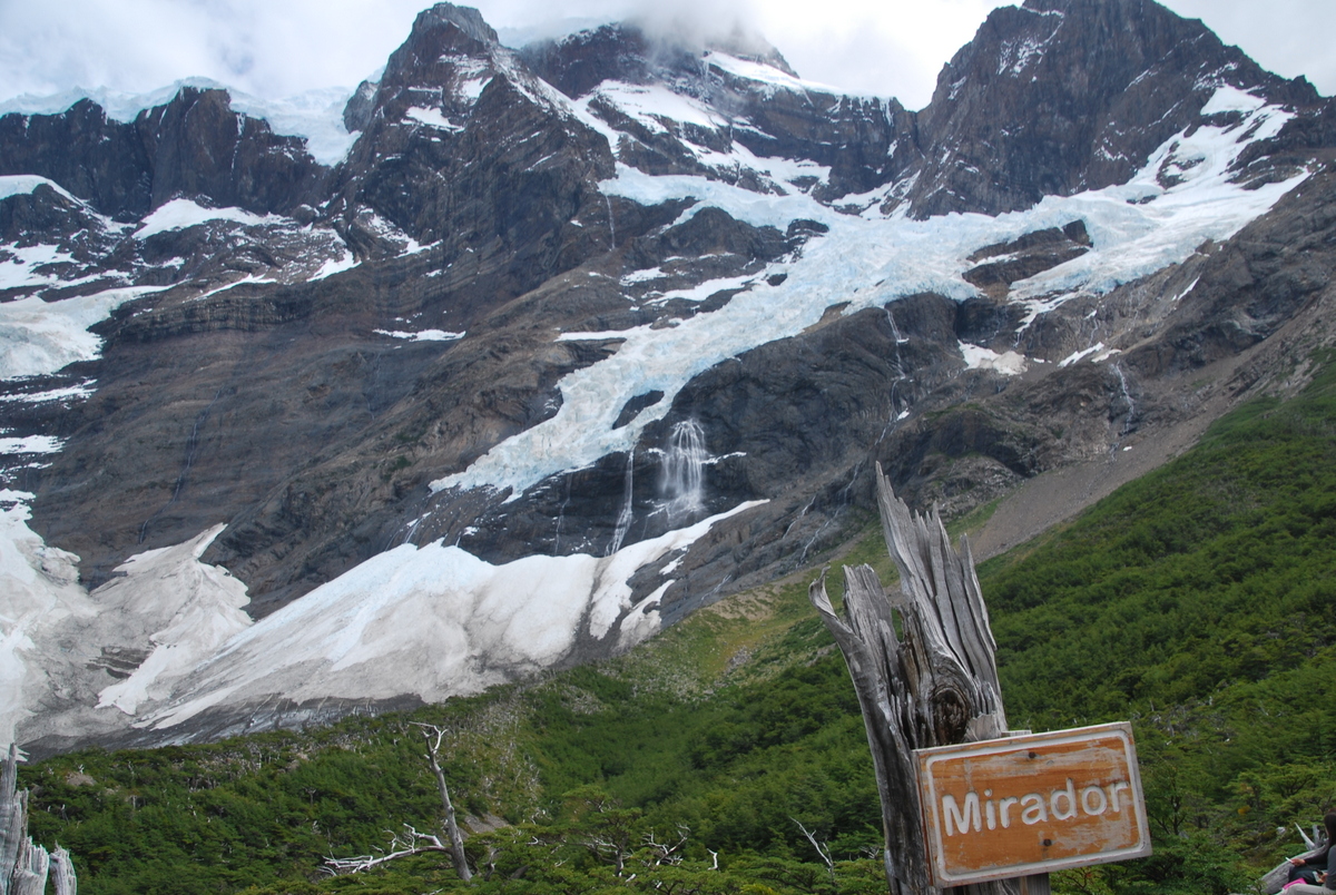
Next day up to another free campsite (Italiano) that we’d booked from Puerta Natales (thanks to Isidor for suggesting that one, as it was full otherwise). We then also did the hike up to the mirador (viewpoint)s.

70-DSC_025373-P129024872-DSC_028771-DSC_0264

Then a long, but fairly cruisey day to the main campsite – Las Torres. Another one on private land. We had a very nice dinner with some English (Rob and Chris) & Greek (Georgios) astronomers from Southampton University Supernova group we’d met on the circuit and played leapfrog with for most of the trip. They were great fun! I was most impressed with Georgius, who was doing the circuit as his first ever hike. I’m not entirely sure that he knew what he was getting himself in for, and I’m not sure how many times he thought he was going to die / wanted to go home, but he did make it – and well done him!

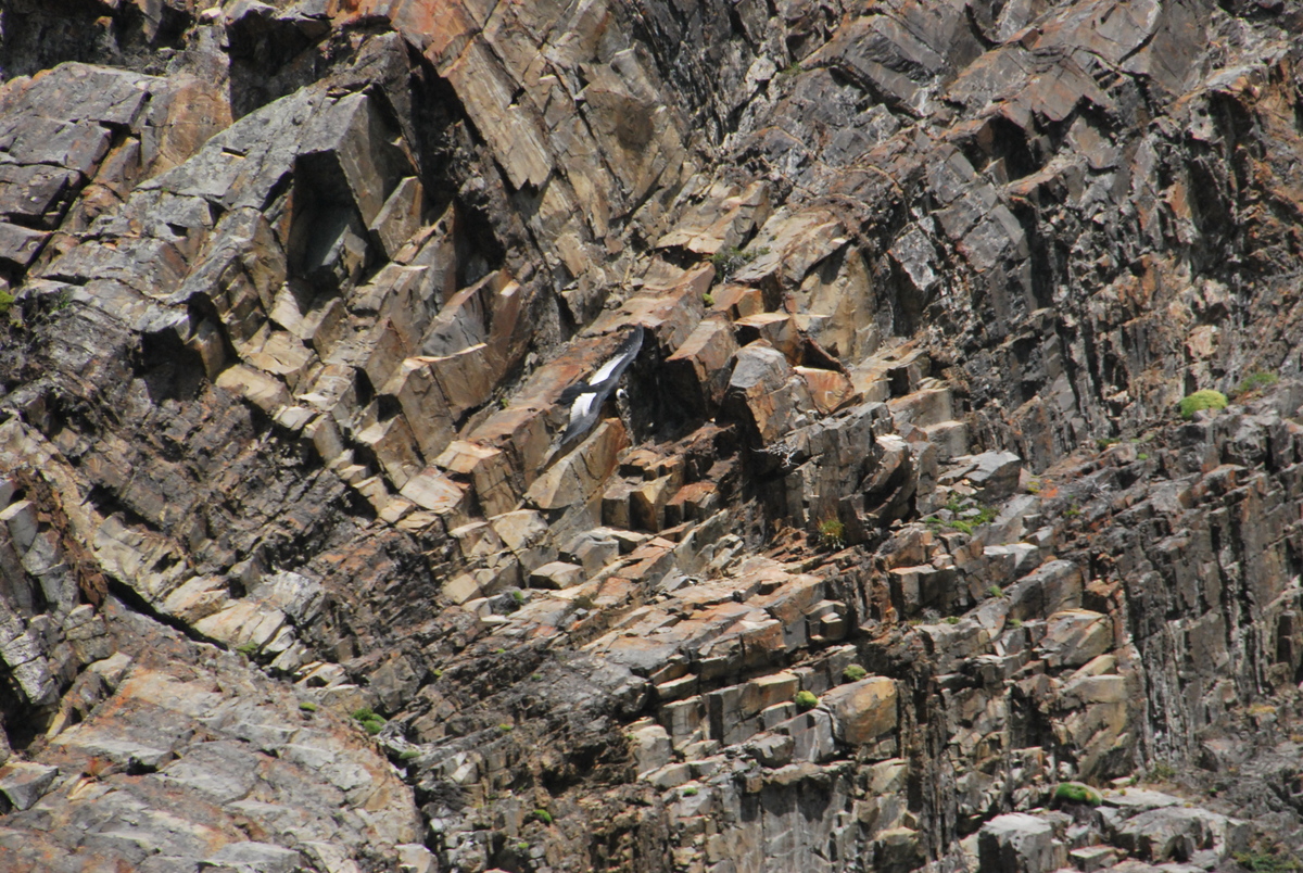
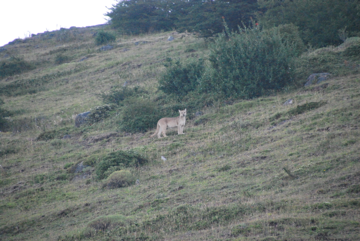
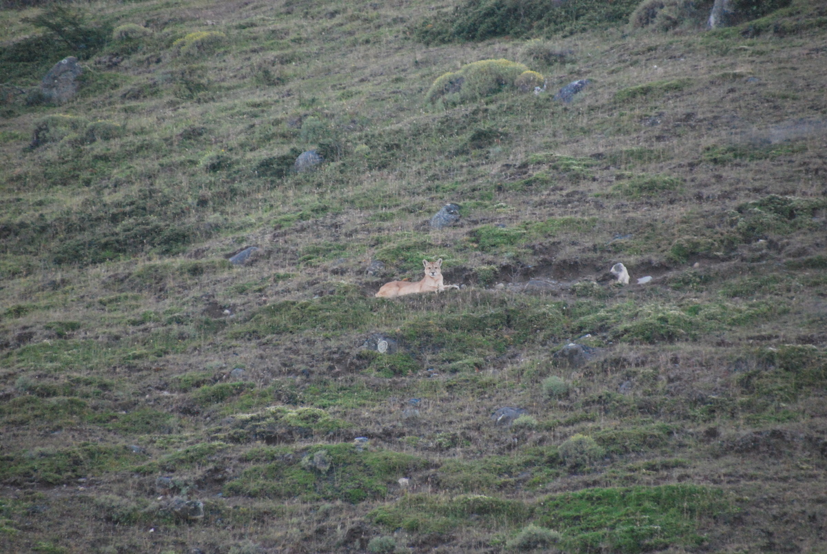
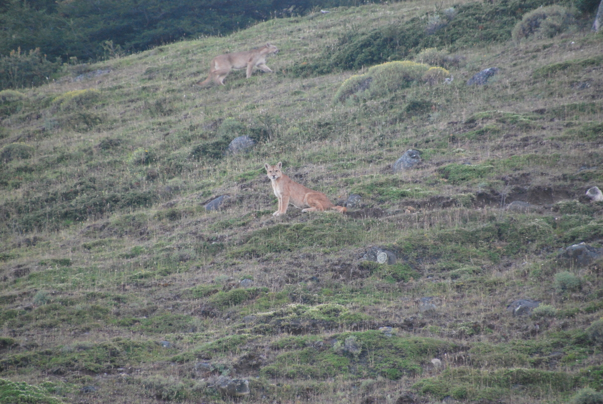
Rob spotted someone looking at the hill at twilight with a camera, and thought it was odd so went to have a look, and that meant we got to see Puma! Just hanging out.. Somewhat grainy pics, but it was low light. Someday when I’m rich I’ll get a faster lens.

77-DSC_030576-DSC_029675-DSC_029274-P129025478-DSC_0306

So, saying goodbye to the Astronomers, we headed back up the hill to the Torres campsite.

79-P1300262

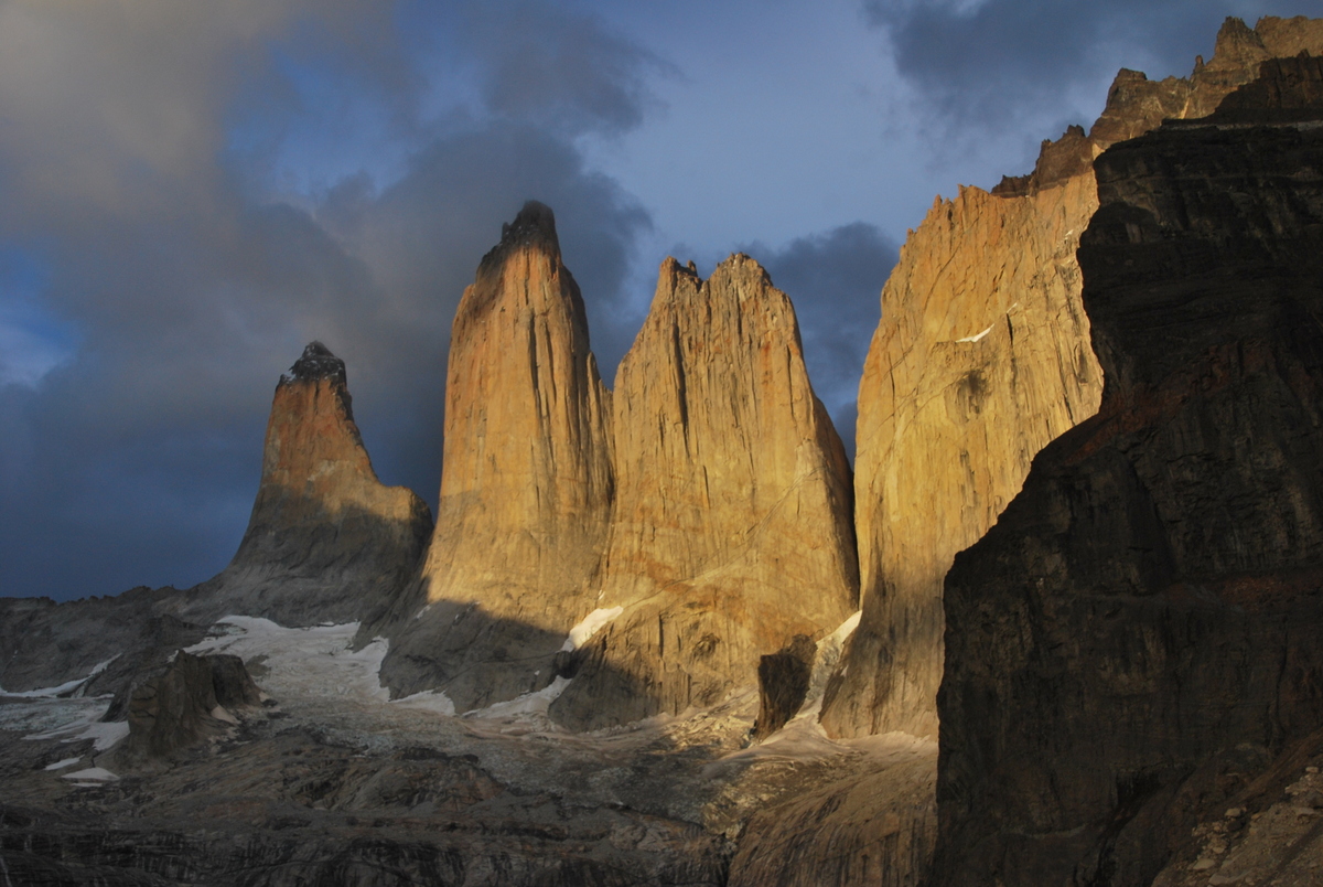
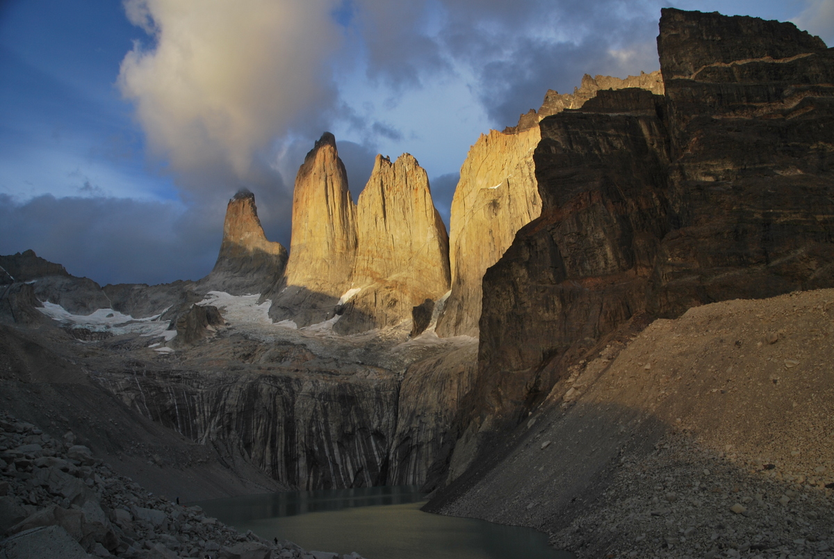
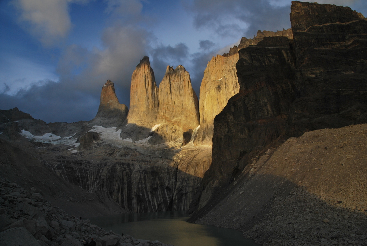
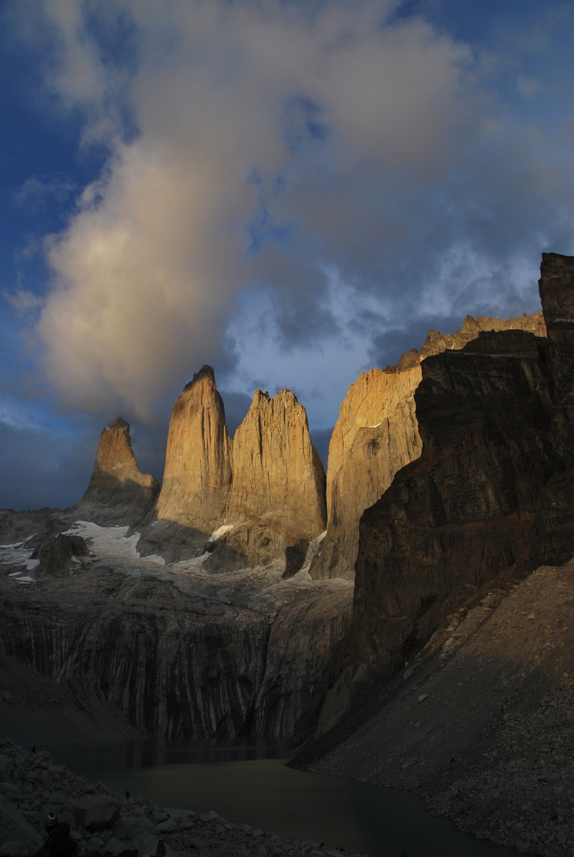
The aim here was to getup for the sunrise over the torres. The ranger told us the sunrise was at 05:15, but I should have checked the GPS which put it at 06:30… Maaike opted to go up to the lookout the same day, and then see what she felt like at 04:15. So, this pics is Maaikes.

80-DSC_0317

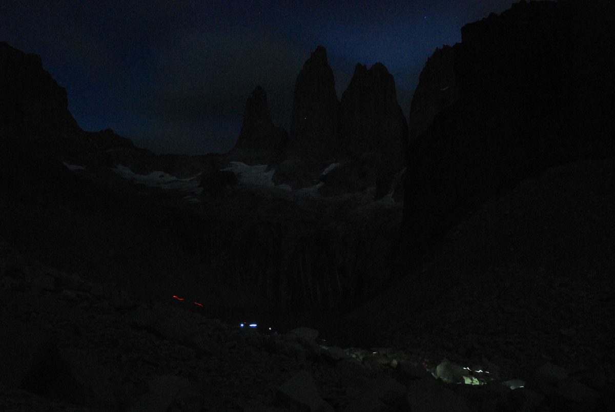
I got up at 04:15 and decided that I would head up the hill. It was dark when we got there, but you could see a light way up on the cliff, where a climber was also waking up, getting ready to tackle the rest of the route.

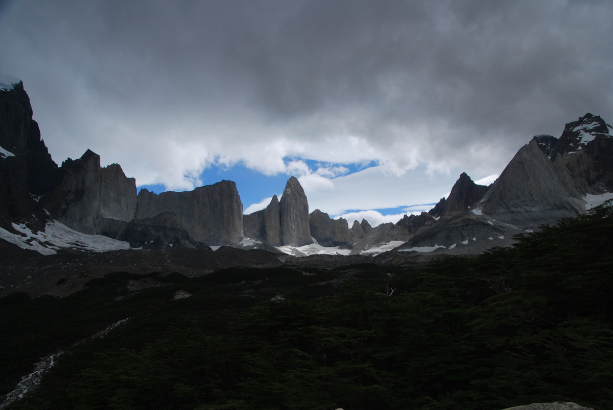
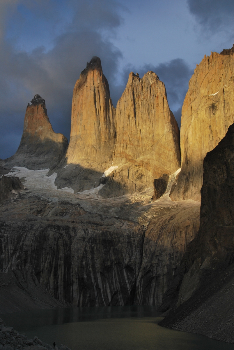
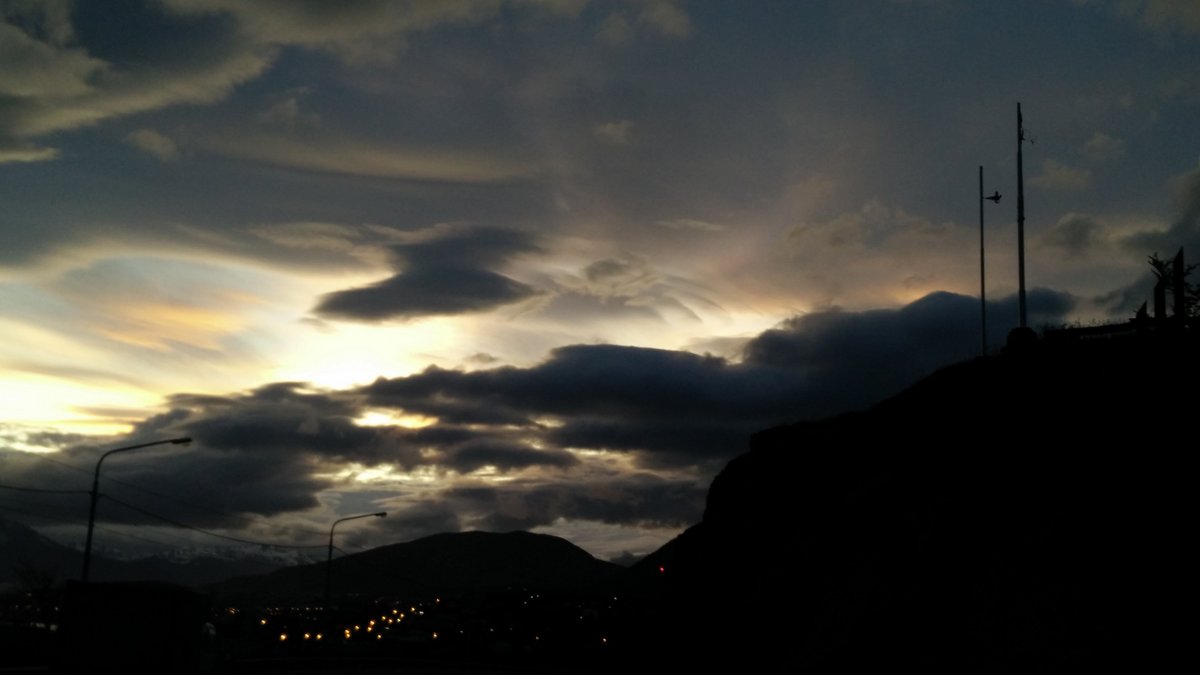
I was looking at the torres thinking about how unfortunate it was that I wasn’t seeing the sunrise, and then thought about getting up and looking back towards the East… and was rewarded by this quite nice sunrise!

81-DSC_034584-DSC_036182-DSC_0354

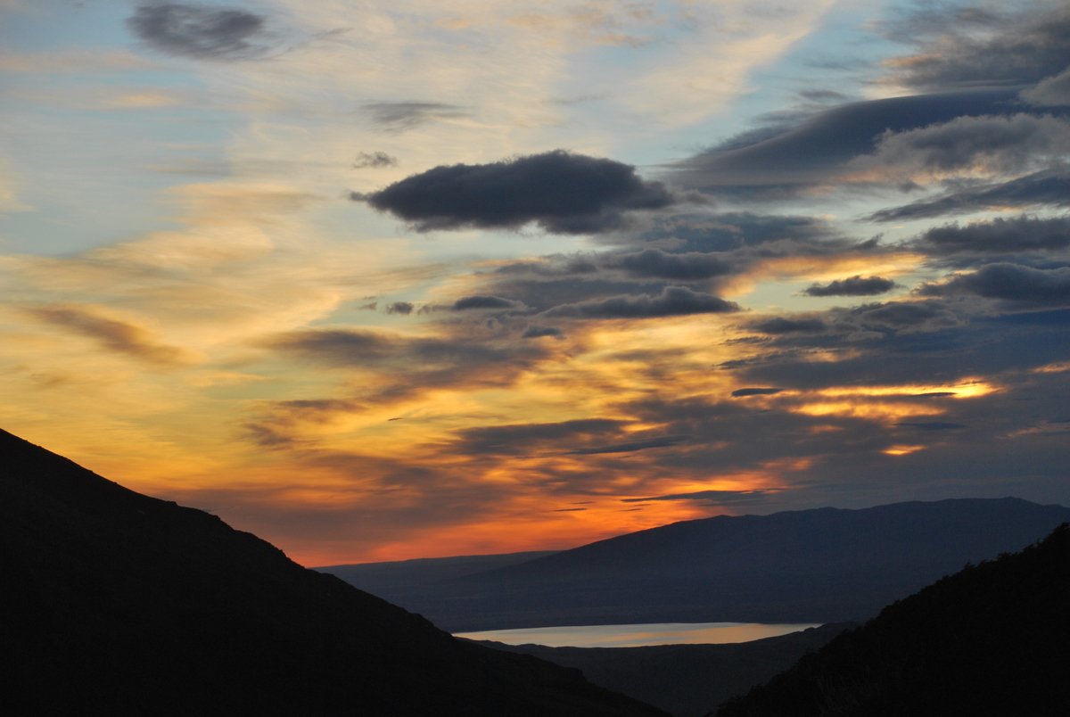
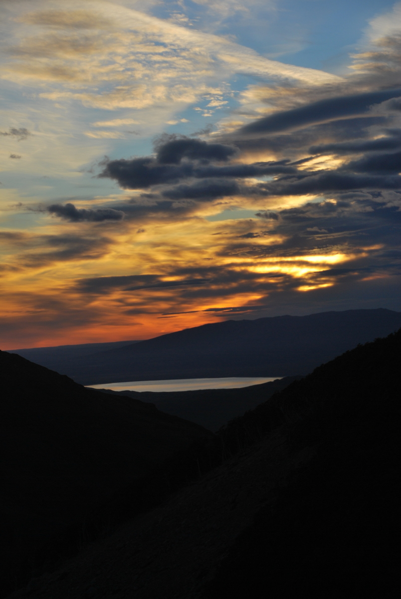
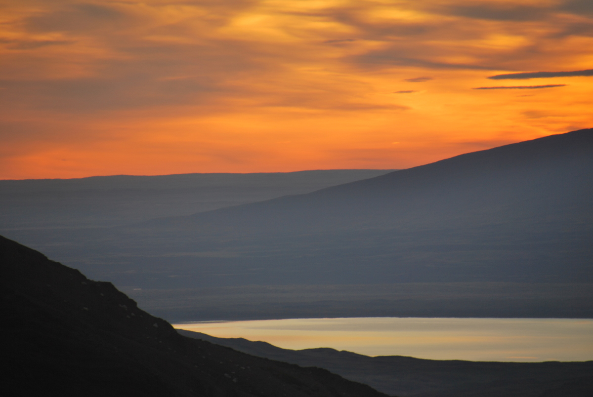
It was getting late in the morning for getting back, so I started back down the hill… promptly getting very slightly misplaced (rather than actually lost) which was a damn good thing, as it meant I delayed my descent by about 10 mins, which was the time it took for the sun to find a gap in the clouds and give us the last of a sunrise on the Torres. A lovely sight.

88-DSC_037287-DSC_037186-DSC_036790-DSC_032889-DSC_037585-DSC_0365

Finally, back down the hill, and the walk back to Laguna Amarga for the bus back to Puerta Natales. It was nice to do the hike, glacier gray a definite highlight for me, but I’m not sure I’d rush back to do it again, I think I prefer slightly less majestic places which are a little quieter. I guess that’s the curse of being the “best hike in the world” :)

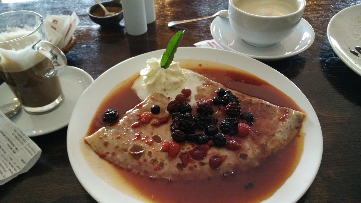
Funny, all through Torres Del Paine we’d been fantasising about the dinner we’d have to celebrate my birthday, however, upon getting back to town I was vomiting for a good 4-5 hours, and then had a somewhat upset stomach for another week. Good dieting mechanism that’s for sure.

Leaving Ushuaia – to Puerto Natales via Punta Arenas

  |  2 Comments

We left Usuhuaia by bus to Punta Arenas (Chile). Will miss those sunsets… I’m not sure what the longest border in the world is, and while I’m sure a quick Google would sort that out, I’d lay a bet that Chile and Argentina would have to be up there. Chile does have biohazard controls on entering the country, much like NZ does (so no meats, cheeses etc.) you have to get a boat to leave Tierra Del Fuego as it’s an island. Who knew? You probably, but I didn’t.

1-IMG_20160117_2206423-IMG_20160119_1710472-IMG_20160117_221417

Punta Arenas was a nice enough place actually. Wasn’t really expecting it to be, but it certainly was. We could have taken the bus all the way to where we wanted to be (Puerta Natales), but that would have meant getting it at 11pm or something, so opted instead for breaking the journey in Punta Arenas. Admittedly didn’t get up to much, except for going to an ATM and getting some cash out (a somewhat novel experience coming from Argentina). Had a nice sushi, very nice little hostel (Downtown Hostel – Hostel Del Centro), and that was that.

First impressions of Chile were certainly positive though. Seemed fractionally friendlier (Argentina already seems nice enough), definitely seemed to be more prosperous / functional. Again, super brief impressions and based on very little, but still.. good.

Very thankful for the Open Street Map app – as discussed previously – OsmAnd+, really makes finding your way around easy. Managed to find white fuel (coleman gas) – called Bezina Blanca here. Couldn’t find it in Argentina. While my stove is the MSR international, it’s happier burning the cleaner white fuel, so got 1L of that for the walk around Torres Del Paine. Also got a couple of (very expensive) dehydrated meals. If you’re coming internationally and going hiking, my advice is to bring stuff from home if you can. Also, replaced my camelbak water bladder as it had sprung a leak. Very nice being able to find good outdoors shops. Again, cheaper in Punta Arenas than in Natales, or so we were led to believe ;)

Next morning, a bus to Puerta Natales, gateway to the Torres Del Paine massif, our ultimate destination in Chile. Puerta Natales is another nice little town. Definitely catering to the tourists, which it could do a little more for I think, at least food wise. I reckon you’d make $$$$ if you bulk imported freeze dried meals from NZ and sold them there.. not sure how easy it’d be to get setup.. but there’s definitely a market!! Great little hostel in Little Patagonicos… well, the rooms were a little noisey, but the internet worked well enough, the kitchen was well supplied, very clean, and the staff was extremely helpful. Nice place, would recommend. If there was one disappointment, it was that our room looked out onto a beautiful brick wall, rather than the absolutely stunning landscape which the raspberry pi would have done justice to in terms of a timelapse ;) And yes, I searched for available wall sockets, buffink. In fact, annoyingly the Americanish style wall sockets they have here, have a very slightly smaller diameter than the adapter I bought in the airport… seeing as we’re only going to be in Chile for the one hike, I didn’t bother getting a new one. I still love love love my multiplug adapter though, that worked fine. If you can find one of these, get one… best thing ever.

Went out for a crepe and a coffee for my birthday, opting to wait for a meal until after we get back from the 10 day hike.. Maaike also smashed me at Tantrix (the day before my birthday luckily, so the day wasn’t completely ruined ;) … she has the beautiful green loop.

6-IMG_20160121_1631585-IMG_20160121_1631374-IMG_20160120_195937

A very quick note on some hiking & app tips

  |  0 Comments

I have really made use (too much use?) of our Garmin 62. Apparently discontinued now, but I’m sure things like it are still around. On our friend Hamish’s excellent advice, we subscribed to the satellite imagery. It’s only $30 USD for a year, and you can get it worldwide. Very handy when trying to navigate.

I also found this site which has all the open street map data available for download in Garmin format. Very handy as then you can just upload it all into the GPS and you have all the contours, tracks etc. Very useful – at least so far in Argentina, remains to be seen what the other countries are like.

Still on hiking, our friends recommended getting an MSR whisperlite international. The international version, as then you can burn unleaded as well as kerosene (rather than just white gas). I slightly wish I’d got the dragonfly as it allows for better simmering. I haven’t been able to find white gas here (did find a nice datasheet with different countries translations of fuel types in it). I’m not sure if it makes a difference, shortens life / will lead to blockages to use unleaded. Need to do research! That said, filling up the bottle with unleaded costs $2 . $2 for about 10 nights cooking (if you’re careful and just firing it up to boil water). Very impressive.

26-P1150112

Also, on friends Neil & Frances’ suggestion, bought Primus Eta pots from telemark pyrenees online. I got the 1L and the 1.7L pots (doesn’t look like they have the 1.7L in stock at the moment). These are great. They stack together, they have a heat exchange system so use significantly less fuel, boil in minutes on the MSR, are non-stick and have a built in strainer (should you need it). Very happy we bought them.


Apps

Osmand – open street maps for android
Bought the OSMAnd app. It’s a nice interface for open street maps, and I can download all the countries for offline storage (and navigation, does not require internet)

AirBnB
Simple decent app for AirBnB

Google Translate
This thing is amazing. You can download the languages for offline use again (godsend!). It has this wonderful feature where you simply hold up the app with the camera on to some text, and it translates it on the fly. I must take a video, it’s really really beautiful and impressive tech.

XE.com – currency exchange
Again, very handy app this one, for knowing what you’re actually paying

hostelworld (tentative)
Have downloaded this one on a friends recommendation, will see how it goes.

Well, I think that’s about it for the moment, it’s amazing how far things have progressed so quickly. Does feel a bit cheaty at times, but still, very handy.

Laguna del Caminante y Paso de la Oveja

  |  3 Comments

Final hike out of Ushuaia, this was to Laguna del Caminante and up over Paso de la Oveja. Nice walk this one, not has hard as the first one, much more interesting than the National Park. A goldilocks kind of walk.

Map above courtesy of wikiloc.

We did the walk from East to West, seemed like the best way to do it. Nice enough walk up the valley, track easy to follow and mostly clear of barriers (the odd beaver lake..). Nice hanging glaciers to look at on the way up.


03-P113001107-DSC_003301-DSC_000702-P113000505-P113001704-P113001501-P1130004

We walked all the way in to the lake, found about 5? other tents there (it is popular ish). There had been snow on the ground, and the best spots were taken, so it was a cold enough night. Yes, our tent has a decent groundsheet, but still, we got wet through it a bit, or there was condensation, whatever, it was a little damp that night.

03-DSC_002006-P1130018


The next day it was still snowing on and off a bit, so, we opted for a lazy day!!! WOOOOOOOHOOOOO, Maaike doesn’t seem to believe in relaxing half as much as I do. It was a glorious day, full of eating biscuits, reading books, eating more biscuits, playing cards… and… moving the tent to the best place on the lake!


02-DSC_001704-DSC_002606-DSC_003205-DSC_0028


The following day, Friday 15th, it was (as forcast) a beautiful day, and we went for a walk on the far side of the lake and up an along the ridgeish / contouring . Very nice walk, stunning lunch spot. Beavers swimming in the lake below (little *******s!)…


08-DSC_003609-DSC_003812-DSC_004413-DSC_004713-P115005214-P115005315-DSC_005914-DSC_005616-DSC_0068


Maaike took a lot of pictures of flowers (quite happy with our TG-3 camera – thanks Steve & Michelle for the suggestion). The TG-3 is waterproof, shockproof and has a very nice macro lens on it. It’s perfect for us hiking as we can just put it in a pocket and forget about it. Very happy so far.

10-P115003809-P115003508-P115002812-P115004711-P115004016-P115006515-P115006220-P115008519-P115007818-P115007317-P115006723-P115009622-P115009421-P115009125-P115010731-P116013924-P115010030-P116013533-P116014529-P1160132

Then the next day we walked out. It was an easy enough walk, do keep to the true left of the valley at the saddle, the cairns seem to lead you astray (just look at the map!)

28-P116012327-P1160114

Easy at least, until about 3km from the end where there was a good bit of tree fall.

32-P1160143

Anyway, a great hike, would definitely recommend it, even just up to the lake is nice, though I did enjoy our traverse a lot :)

This may very well be the last post with lots of pictures.. I’ve been writing these (and Antarctica) up at our AirBnB in Ushuaia which has really great internet. I suspect the upcoming posts will have a lot less pictures!

Tierra Del Fuego National Park

  |  4 Comments

Of all the places we visited out of Ushuaia (and it was only 4 hikes we’ve done to be fair), the national park was my least favourite. A good thing if you’re reading this and contemplating coming, as it was the only place that we had to pay for.. It’s on the border with Chile, and, well, there are more than a few flags flying around the place.

01-P1080073

We did some walks at a few different places. I admit, I was again disappointed in the track state. I get that NZ is wonderful, and I know Maaike will hate me for bashing Argentina at all, however, they take $15 USD per person entry into the park, and have only a few marked trails. Incidentally, the fee is cash only… most convenient, would be interesting to trace it!. So yes, I would expect the tracks to be at least fairly clear of fallen trees, and I’d expect that the areas that are getting destroyed (turned to mud) through wet ground and people making ever wider circles to get around; would have boardwalk. They did have boardwalk in places, but it never seemed to be anywhere that needed it. While I am saying this, our AirBnB hosts have said exactly the same, so I don’t think I’m being unfair.

02-P108007414-P1100116Looking up towards Guanaco04-P108008005-P1080081

The hill above, Guanaco, was one we climbed in the following days.

The next day, we walked along the coast to the next campground. There was a paid one with toilets and showers, and two free ones which we thought looked way way nicer, so, opted for the free one. Maaike did a walk to the border, while I chilled out by a lake, ate biscuits and did a little bit of Spanish practice.

06-P109008207-P109008510-P109009312-P110010309-P1090092

Then the next day we did a walk up Guanaco, which was definitely the highlight and did have very nice views out over the Beagle channel.

13-P110011111-P109010108-P1090090

Then back to Ushuaia.